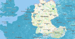
googlestreetview

Android Users Can Now Shoot and Share Google Street View Photos

Google Street View was created using an army of iconic camera cars driving up and down all the streets of mapped areas. Starting today, though, anyone with an Android camera can effectively become a Street View car and contribute to the massive trove of explorable location photos.

Taking ‘Travel Photos’ Through Google Maps During Lockdown

Creative Director Yousuke Ozawa—whose 'Satellite Fonts' project went viral back in 2014—is at it again. In order to keep his sanity during lockdown, he started taking "digital vacations" through Google Maps, and capturing Street View travel photography.

I Took a Virtual Photography Road Trip Using Google Street View

During the COVID-19 pandemic, we have been asked to stay home and shelter in place. This restriction has only increased my desire to explore and road trip. I still need to create and think critically throughout this time, but if I can’t go to new places, how can I make new work?

Sheep View 360: An Island Country’s Makeshift Street View

Faroe Islands is an island country halfway between Norway and Iceland. It features some of the world's most beautiful roads, but those routes haven't been traversed by Google's Street View camera cars. So, the country decided to take matters into its own hands by mapping the island with sheep-mounted 360-degree cameras. It's called Sheep View 360.

Google Uses Tiny Camera Cars to Shoot Tiny Street View of Tiny World

Google's Street View cameras have gone to the ends of the Earth, from under the sea to desolate deserts, in order to document the world in photos. The project is grand, but its latest effort is on a much smaller scale -- literally.

The company just announced Street View for the famous Miniatur Wunderland in Hamburg, Germany, the world's largest model railway. To shoot the images, Google mounted tiny cameras to tiny vehicles (they also had a tiny Street View car look-alike drive around).

Google Street View Offers a Glimpse at the Incredible Rate of Gentrification in Brooklyn

We told you to expect a wave of interesting "then and now" series when Google first integrated the 'time-machine' feature into Street View, and that prophesy is starting to come true.

A couple of weeks ago we showed you GooBing Detroit, a Tumblog that tracked the demise of Detroit in Street View images. And today, Gizmodo published a fascinating look at the rapid pace of gentrification that has transformed several areas of Brooklyn.

New Technology is Making it More Difficult to Conceptualize Photography

A few weeks ago, I found myself wandering around a local career fair -- the type of event I normally find pretty loathsome, or at least overcrowded an unhelpful. This time though, a fun surprise: representatives from Snapchat and Shutterfly stood at booths right next to each other.

Oh boy! I couldn't turn down the chance to chat with some folks more or less connected to the photo industry.

Tour CERN and the Large Hadron Collider with Google Street View

Few people without PhDs ever set foot inside CERN's (The European Organization for Nuclear Research) lab in Geneva, Switzerland, home of the Large Hadron Collider. And although we have had the opportunity to share some stunning pics of the world's largest particle accelerator before, Google is one-upping us (go figure) by letting you take a virtual stroll with Street View.

Google Business Photographer Explains How He Shoots Street View Indoors

It's obvious that Google is interested in mapping just about everything that is mappable via Street View, but even our future overlords they need some help on occasion. Although the company is willing to send employees with trekker backpacks to many an exotic location, when it comes to taking a virtual tour of local businesses, the search giant hires on "trusted photographers."

One such photographer recently sat down with Tested and told them all about the process of becoming a Google Business Trusted Photographer and taking Street View indoors.

Tour Some of the World’s Most Famous Zoos, Now on Google Street View

Google has made sure that the couch potato in all of us has ample opportunity to see the world by adding everything from the world's tallest peaks to an extensive tour of the Grand Canyon to its Street View repertoire. But of course, that's not to say the search giant is anywhere near done.

The company's most recent update, which went live yesterday, added a long list of world-renowned zoos to the list, allowing users to skip the lines and see some lions, giraffes and pandas in their not-so-natural habitats.

Thai Villagers Arrest a Google Street View Driver, Thought He Was a Spy Photog

On your own mental list of "most perilous jobs," chances are Google Street View driver doesn't make it very close to the top. But one of Google's own wound up in a strange situation recently when a group of villagers in Thailand put him under citizen's arrest, believing him to be a spy for a government dam project they oppose.

Explore Japan’s Abandoned ‘Battleship Island’ Courtesy of Google Street View

In the most recent James Bond movie, Daniel Craig spent some time in the eerie emptiness of an abandoned island that the villain Silva had claimed as his lair. What many don't realize is that this setting was actually based on a real place.

It's called Hashima, but it's better known by its nickname Gunkanjima (or "Battleship Island"), and thanks to Google Street View we can now tour the deserted, crumbling island as well.

Google is Loaning Out Its Trekker Street View Camera Backpacks

Google has had no issues expanding street view to some pretty amazing places. Thanks in large part to the company's trekker backpacks, we can now visit the Grand Canyon, explore Central Park and check out the view from the world's tallest peaks.

But the company isn't above asking others to help expand the "off-road" street view repertoire, and so Google is announcing plans to loan out those expensive Trekkers to worthy third party organizations.

Stunning Views Atop the World’s Tallest Building Come to Google Street View

Rising from the desert in the Middle East are mind-blowing structures and formations. One of those just happens to be the Burj Khalifa. It's the tallest man-made structure in the world, coming in at over a whopping 2,700 feet.

Wandering to the highest levels of this building is undoubtedly on the to-do list of many photographers. Magnificent views, beautiful architecture. But for those folks who don't foresee a trip to Dubai on the cards in the near future, Google has you covered.

Google Expands Street View to Let Users Visit Three Historic NYC Locations

In partnership with Historypin and the Central Park Conservancy, Google has decided to expand its Street View repertoire once again, this time letting out-of-towners experience three of The Big Apple's most historically significant locations: Central Park, The 9/11 Memorial and places affected by Hurricane Sandy.

Create a Gorgeous Hyperlapse Video with Google Street View Photographs

Hyperlapse photography involves shooting a series of photographs over large distances and then stringing the photos together into a time-lapse video that zooms the viewer through the locations. Creating a real hyperlapse involves quite a bit of work, so the folks over at Teehan+Lax Labs decided to go virtual by turning to Google Street View to source the necessary photos.

The gorgeous hyperlapse video above was created entirely using Google Street View photos, and shows the locations visited by the Street View camera van in a way that's very different from what you see through your browser.

Explore 75 Miles of Grand Canyon Trails and Roads With Google Street View

Back in October, Google took several Trekker Street View backpacks into the Grand Canyon to capture the majestic beauty of the national park for those who can't actually go there. Several months have gone by since that point, but finally, the cubicle-bound and financially unable among us can now visit the Grand Canyon from the comfort of our own desktops.

The Emperor’s New Photographs: Are Appropriated Street View Shots Art?

The debate rages on: should appropriated Google Street View photographs be considered art? There are quite a few artists and photographers out there who think it should be. Photographer Michael Wolf was awarded Honorable Mention for his curated screenshots at the World Press Photo 2011. Photographer Aaron Hobson takes screenshots and turns them into gorgeous panoramic photos. Jon Rafman's screenshots were picked for an exhibition at London's Saatchi Gallery.

Now here's another case that might cause a lot more head-scratching: photographer Doug Rickard's Street View screenshots have been selected for the permanent collection at the San Francisco Museum of Modern Art.

Google Street View Now Has Underwater Panoramas of the Great Barrier Reef

If you've always wanted to go scuba diving at the Great Barrier Reef but haven't had a chance to, this might be one of the next best things: Google has added gorgeous underwater panoramic photographs to Street View, allowing to swim around at the world's largest coral system as if it were a street in your neighborhood.

Artist Pasting Google Street View Photos of People Back Into the Real World

Google's Street View imagery features plenty of photographs of people, but they're often distorted and almost always feature blurred faces. Street Ghosts is a project by artist Paolo Cirio that reintroduces these distinctive portraits back into the real world. After choosing a particular photo containing a person in Street View, Cirio prints it out as a life-sized print on thin paper, cuts out the person, and then uses wheat-paste to affix the giant person photo onto the exact location where the photo appeared in the virtual world.