You Can Spell Your Name is Aerial Images Thanks to NASA

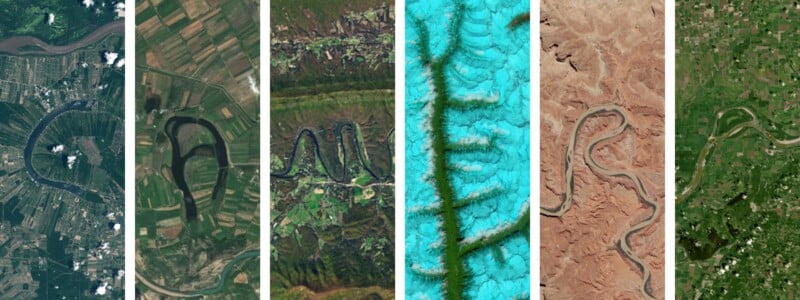
Following on from Earth Day (April 22), NASA has publicized a tool that allows people to spell out their name or any word they want using Landsat satellite images.
“Your Name in Landsat” was promoted by NASA’s Kennedy Space Center this past Earth Day. “This planet can spell your name — literally,” writes the Florida-based spaceport.
The planet can spell your name – literally. 🔤🌍
This Earth Day, see your name written in landscapes captured by Landsat: https://t.co/kcP12dhsI2 pic.twitter.com/z2Ubn42iY1
— NASA's Kennedy Space Center (@NASAKennedy) April 22, 2026
The Landsat program is a long-running series of Earth-observing satellites jointly operated by NASA and the United States Geological Survey (USGS). Its primary purpose is to systematically monitor the Earth’s surface over time, supporting research and decision-making in areas like agriculture, climate change, urban development, and natural resource management.
According to Wikipedia, the Landsat program has captured millions of images — more than enough to spot letters etched into the Earth.
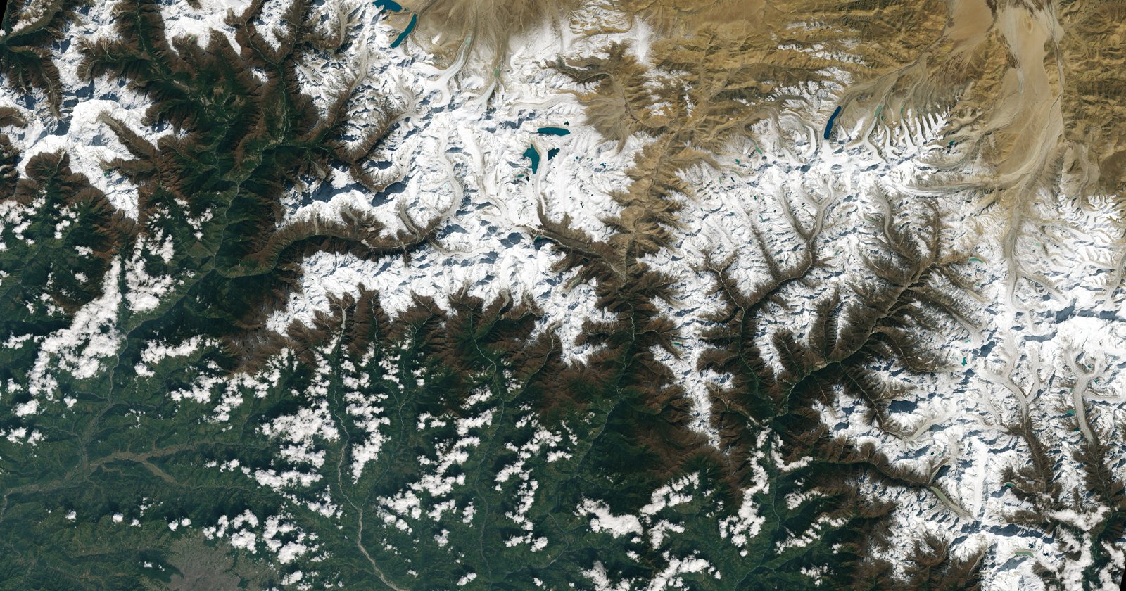
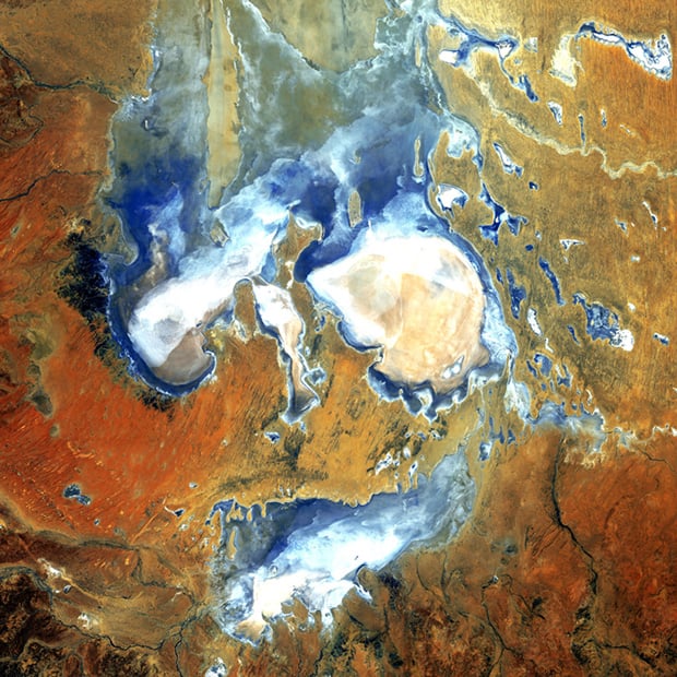
While the satellites capture data across multiple wavelengths, scientists often process that data into false-color images — assigning visible colors to infrared or thermal bands — to highlight features that wouldn’t normally be seen by the human eye.
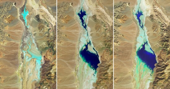
The result is a collection of vivid, graphic images: deserts appear in deep reds, vegetation glows bright green, and rivers and coastlines cut through landscapes in sharp blues. These images can resemble modern art, but they’re grounded in real environmental data, revealing patterns like crop health, mineral deposits, glacial movement, and water flow.
According to Fast Company, NASA first revealed the spelling tool in August 2024 as part of its Camp Landsat, a virtual summer camp run by the space agency.
The Landsat satellites have been photographing Earth since the summer of 1972, and while there are plenty of “A” options (five in total), there is only one “G” (and it’s lowercase).
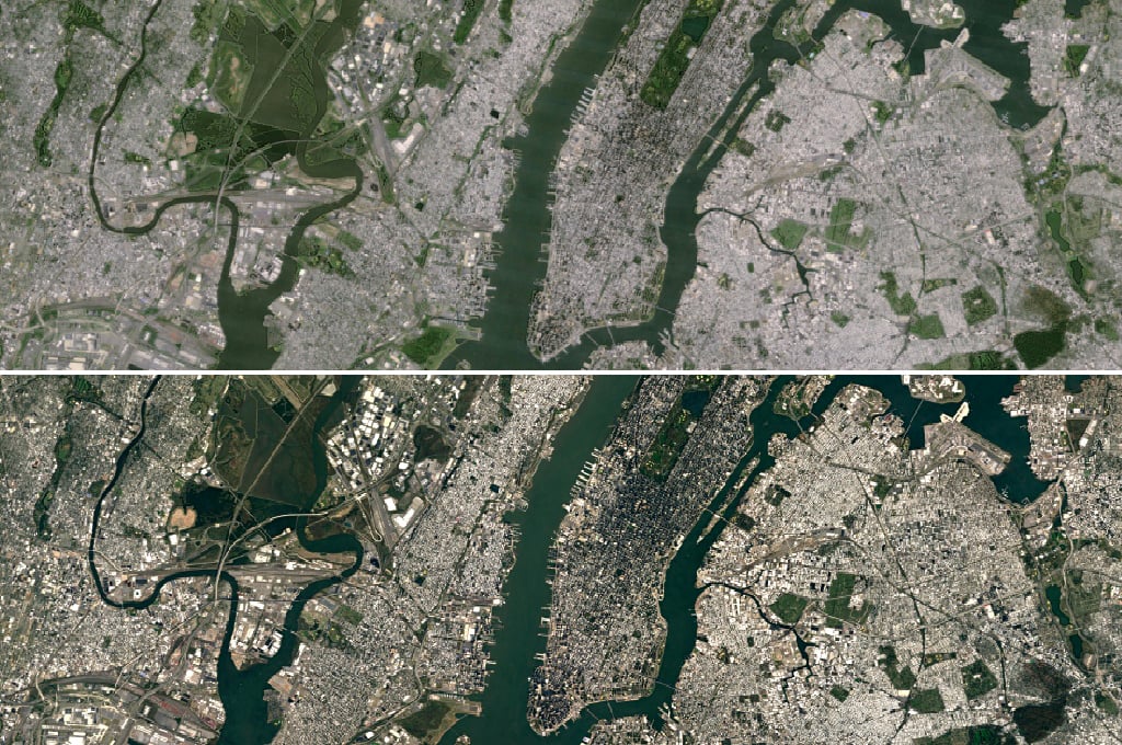
Landsat is also excellent at showing changes over time, such as Landsat 7’s final image, which showed that Las Vegas has almost doubled in size since 1999.
You can try the Landsat spelling tool here.
Affiliate Disclosure PetaPixel articles may include affiliate links; we may earn a commission if you buy through one.