Satellite Photos and AI Combine to Reveal Secret Roads Damaging Rainforests
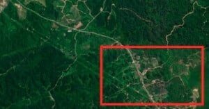
Scientists used AI to analyze satellite images and find the secret, unmapped roads that are destroying rainforests.
Scientists used AI to analyze satellite images and find the secret, unmapped roads that are destroying rainforests.
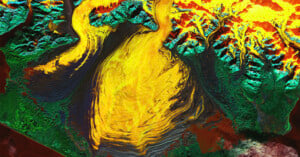
A new satellite image released by NASA reveals a psychedelic look at a hidden lagoon in a massive Alaskan glacier. However, the incredible photo also paints a worrying picture.
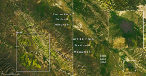
Southern California’s superblooms look absolutely stunning from space right now, and it's likely to get even more spectacular in the coming weeks.
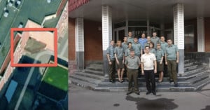
As the war in Ukraine rages on, an investigative team geolocated a Russian cruise missile program from a single group photo.
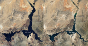
NASA has revealed dramatic photos that show water levels retreating in Lake Mead which is critical to both the supply of water and electricity across the southwestern United States. The startling images of the largest reservoir in the U.S. demonstrate clearly how much it has shrunk over the past 20 years.
Taken on February 19th (and available in high-resolution here) the satellite image above …
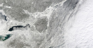
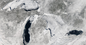
The last couple of days have seen the east coast battered by a huge blizzard known as winter storm Hercules. Thousands of flights have been grounded and many schools were closed yesterday as entire cities began digging themselves out of snowfall that ranged from just a few inches to almost two feet in some areas.
Of course, being there is the only way to truly experience and understand the magnitude of the storm, but this satellite image gives us a small inkling by capturing the blanket of white Hercules left in its wake.
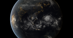
This unbelievable satellite photograph shows the sheer horrifying magnitude of Typhoon Haiyan, the terrible tropical cyclone that caused unimaginable damage to the Philippines yesterday (you can see the full resolution image here).