Here’s a Map with Up-to-Date Drone Laws For Every Country
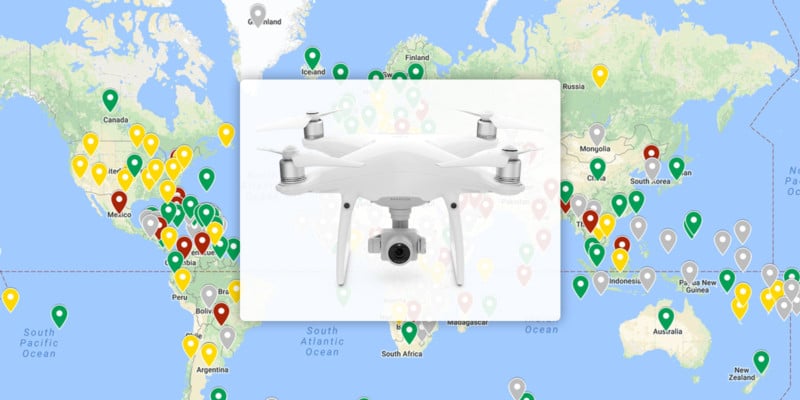
Obeying local law when flying your drone is paramount, but those laws vary from country to country – with some not allowing drones in at all. To help with planning, blogger and frequent traveler Anil Polat has created a map of the world with the laws of each country.
Because laws can vary from state-to-state in the U.S., Anil has also included separate state laws, along with any area-specific laws found in other countries.
The map is split into color-coded categories:
- Green: means that “drone use is generally allowed”
- Yellow: Drone use is limited or may require cumbersome registration processes
- Red: Drone import or use is prohibited or otherwise heavily restricted
- Grey: No data or there are no defined or applicable UAV laws
The full map is hosted on Google My Maps. Anil has also released smartphone apps containing the same data, which can be found for Android and for iOS.
Related Articles

Discussion