New NASA Satellite Image is a Technicolor Portrait of Climate Crisis
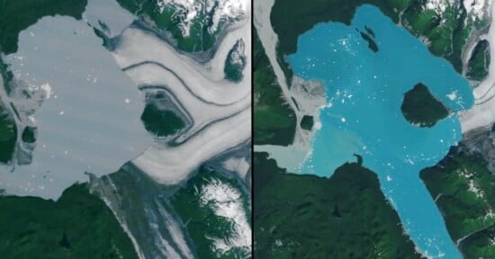
A new satellite image released by NASA reveals a psychedelic look at a hidden lagoon in a massive Alaskan glacier. However, the incredible photo also paints a worrying picture.
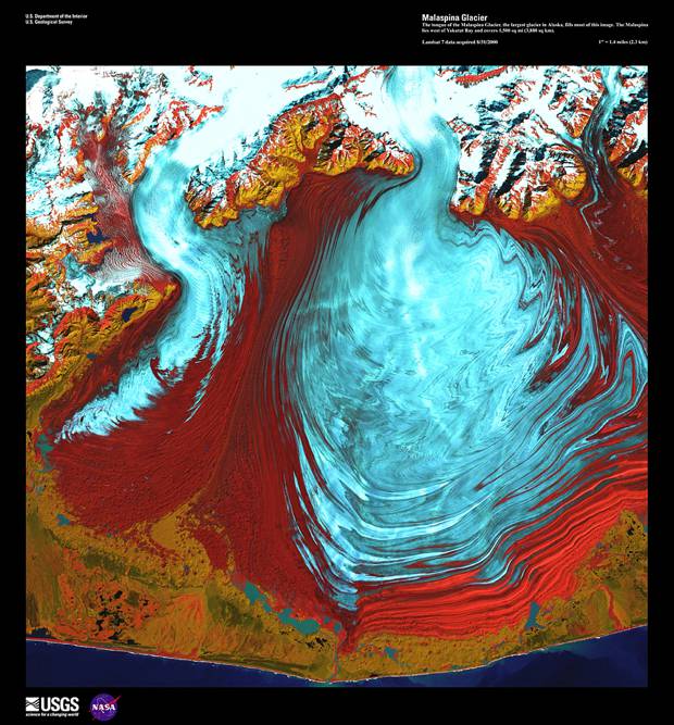
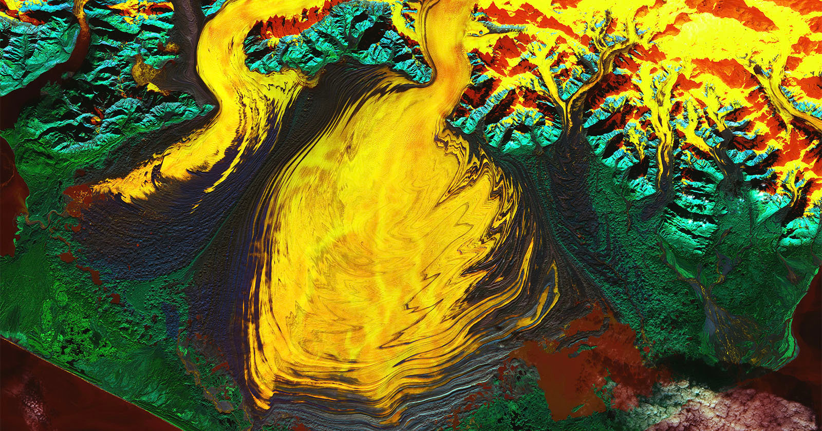
An image of the Malaspina Glacier, located on the southeastern coast of Alaska, was captured in October using the OLI-2 (Operational Land Imager-2) on NASA’s Landsat 9 satellite. The imager creates bands of color where “watery features,” as NASA describes, show up in red, orange, and yellow. Vegetation appears green and rocks are blue.
“To human eyes, glacial ice typically looks white tinged with blue. But in this false-color satellite image, the rippled ice of Alaska’s Malaspina Glacier appears more fiery than frosty,” a release from NASA’s Earth Observatory reads.
The image, along with other satellite captures over time, shows the formation of a lagoon that has taken shape. The development has taken decades, according to NASA. But this lagoon isn’t a secret oasis to revel in. It could speed up the glacier melting away.
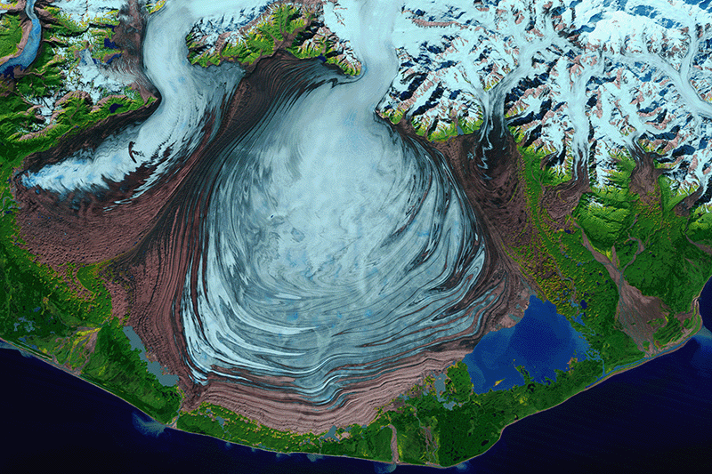
“Small patches of open water are visible here in a rusty red color,” the release continues. “Some of this water is nearly as salty as the ocean, according to recent research, meaning that comparatively warm ocean water is making contact with the ice. This could lead to large-scale calving and hasten the glacier’s retreat.”
The volume of the Malaspina Glacier’s ice was overestimated by around 30 percent, according to a study published in the Journal of Geophysical Research: Earth Surface in February, as Space reports. The publication added that if the entire ice mass were to melt, it could raise the global average sea level by 0.06 inch.
The Malaspina Glacier itself is a behemoth, spanning approximately 1,680 square miles. It is even known in Tlingit, the language of the indigenous Łingít people, as Sít’ Tlein, which literally means “big glacier.” It is the world’s largest piedmont glacier, a large ice lobe spread out over surrounding terrain, and covers an area larger than the state of Rhode Island, NASA explains. Piedmont glaciers like this one are typically associated with the end point of a large mountain valley glacier, according to the National Snow and Ice Data Center. The Malaspina Glacier gets most of its ice from the Seward Glacier along with others.
Image credits: NASA Earth Observatory