NASA Satellite Photos Reveal the Dramatic Decline of Lake Mead
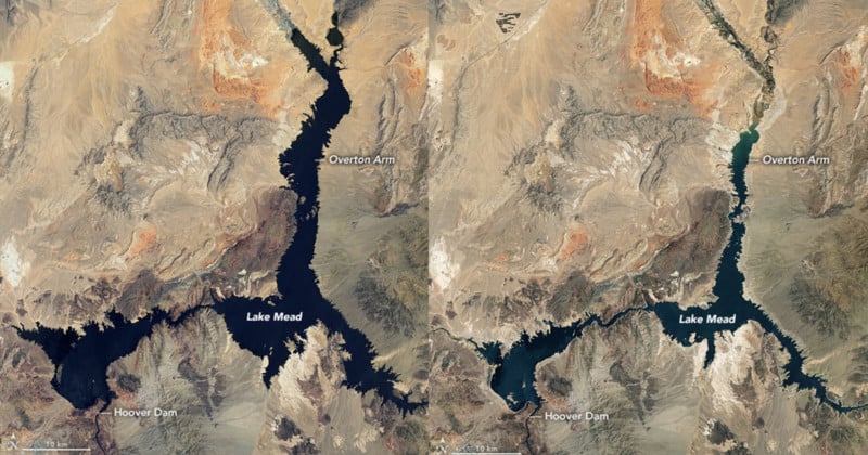
NASA has revealed dramatic photos that show water levels retreating in Lake Mead which is critical to both the supply of water and electricity across the southwestern United States. The startling images of the largest reservoir in the U.S. demonstrate clearly how much it has shrunk over the past 20 years.
Lake Mead, located near Las Vegas, Nevada, has been subject to one of the worst droughts in U.S. history resulting in its lowest level since the Dust Bowl that devastated the American Great Plains in April 1937.
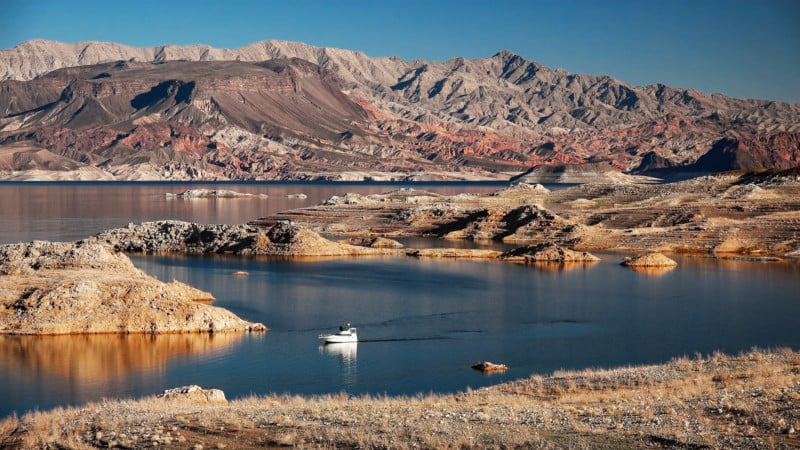
NASA’s natural-color images were taken on July 6, 2000, and July 3, 2022, by Landsat 7 and Landsat 8. The space agency also included a picture from 2021 where the viewer is able to see the mineralized areas of the lakeshore that were formerly underwater when the reservoir was filled closer to capacity. The phenomenon is often referred to as a “bathtub ring.”
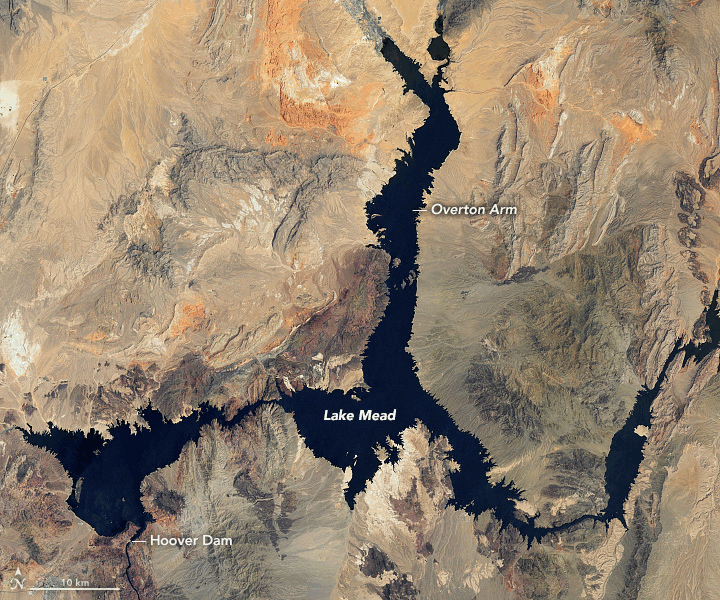
In July 2000 the water level was at 1,199.97 feet above sea level. As of July 18, the lake was just 1,041.30 feet at the Hoover Dam, where the water level must stay above 1,000 feet to maintain consistent electrical generation.
There’s a noticeable color difference between the two images. When Lake Mead was pictured in 2000 it was a deep blue color, now the vast reservoir is a much lighter shade of blue.
The massive body of water provides hydration to tens of millions of people living across California, Arizona, Colorado, Utah, New Mexico, Nevada, and Wyoming.
“Declining water levels due to climate change and 20 years of ongoing drought have reshaped the park’s shorelines,” the National Park Service says on its website. “As Lake Mead continues to recede, extending launch ramps becomes more difficult and more expensive due to the topography and projected decline in water levels.”
About 10 percent of the water in Lake Mead comes from local precipitation and groundwater each year, with the rest coming from snowmelt in the Rocky Mountains that flows down the Colorado River watershed through Lake Powell, Glen Canyon, and the Grand Canyon.
Above Lake Mead, Lake Powell is currently filled to just 27 percent of capacity, and the entire Colorado River system stands at 35 percent. Authorities have said that state water allocations would be cut in 2022; further modeling and negotiation are underway for 2023 allocations.
Image creditsPhotos courtesy of NASA.