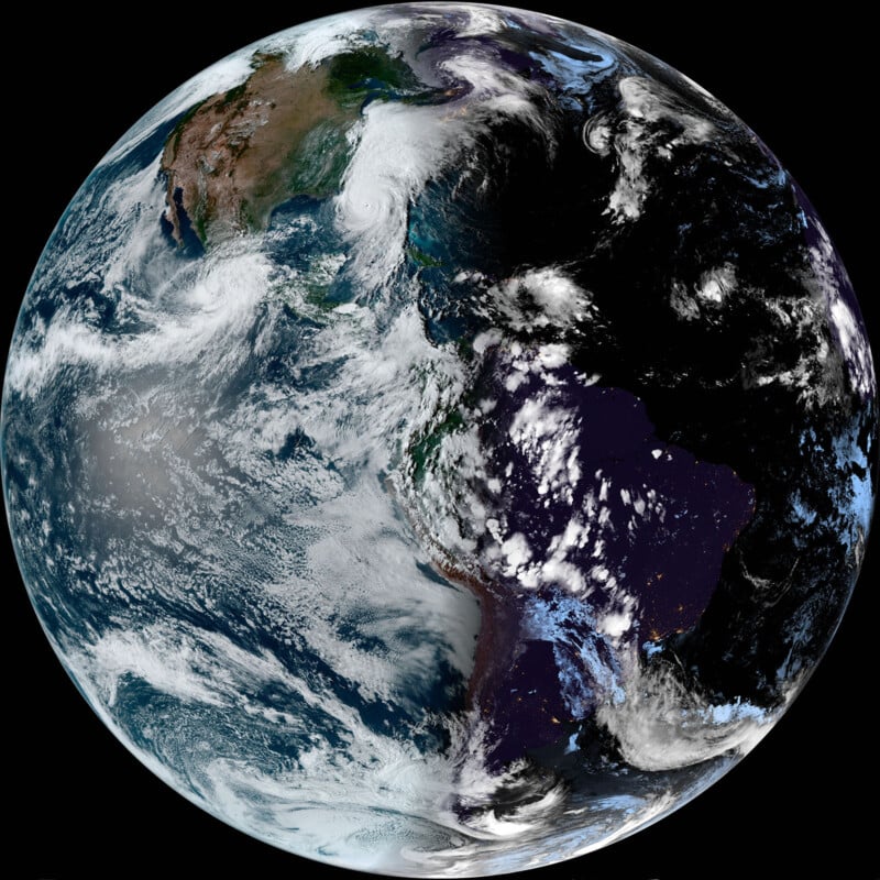
You Can Download New, Real-Time, 470 Megapixel Photos of Earth Every 10 Minutes
![]()
While browsing Reddit yesterday, I came across a gorgeous photo of Earth that had been downloaded from the NOAA’s GOES-East orbital satellite. Looking more closely, I realized the NOAA was uploading a new, 470-megapixel photo every 10 minutes.
PetaPixel covered the GOES, or Geostationary Operational Environmental Satellites, when the GOES-12 was decommissioned back in 2013 and when the GOES-16 was launched in 2016 — more on that shortly. The NOAA, or National Oceanic and Atmospheric Administration, has been busy and in 2022 launched GOES-18, the third satellite GOES–R Series and “the Western Hemisphere’s most sophisticated weather-observing and environmental-monitoring system.”
“GOES satellites orbit 22,236 miles above Earth’s equator, at speeds equal to the Earth’s rotation. This allows them to maintain their positions over specific geographic regions so they can provide continuous coverage of that area over time,” The NOAA explains.
“The first satellite in the series, GOES-R, now known as GOES-16, was launched in 2016 and is currently operational as NOAA’s GOES East satellite. GOES-S, now known as GOES-17, was launched in 2018 and now serves as an on-orbit backup. GOES-T, now GOES-18, launched in 2022 and now serves as NOAA’s operational GOES West satellite. GOES satellites are designated with a letter prior to launch. Once a GOES satellite has successfully reached geostationary orbit, it is renamed with a number. GOES-U, the final satellite in the series, is scheduled to launch in 2024.”
These satellites are constantly providing advanced imagery and atmospheric measurements as well as real-time mapping of weather and lightning activity. As a publicly funded institution, everything the GOES-R series captures is available to browse.
The GOES-East satellite is where the photo I saw on Reddit originated from and is also where the photo at the top of this story came from when I downloaded it yesterday afternoon. As stated, PetaPixel had covered it before, but it has been more than seven years and it was, admittedly, not something I was familiar with until yesterday. I certainly had no idea the photos were so detailed and updated so frequently.
The photo below is a shockingly high resolution and detailed image and that’s only the JPEG version — you can also download a TIFF that matches the 21,696 by 21,696 pixels in the JPEG but with far more visual information. You’ll have to be patient though, as the server isn’t particularly fast and that file is often in excess of a massive 375MB.

You can also watch the most recent two-hour animated loop that, like the main giant photo, is updated every 10 minutes.
If you’re interested in more than just standard views of the planet, the GOES-East image page includes multiple visual bands including dust, fire temperature, air mass, and more.
The NOAA isn’t the only organization with high-resolution orbital satellites. Last year, we featured the European Space Agency’s Meteosat Third Generation Imager-1 (MTG-I1) which shows conditions above Africa, Europe, and the Atlantic.
Image credits: NOAA