Side-by-Side Glacier Photos Show Extent of Retreat Over The Decades

The USGS has just released the 2025 images from its Repeat Photography Project, offering a striking visual record of how Glacier National Park’s landscapes, and the planet itself, have changed over more than a century.
Since 1997, the United States Geological Survey (USGS) has been capturing the story of Glacier National Park’s iconic glaciers through its Repeat Photography Project. The initiative pairs these images with historic photographs, creating a striking visual record of the park’s changing landscapes over more than a century.
Preserving the Past Through the Lens
The project began with a meticulous search of archival images from early photographers such as Morton J. Elrod, T.J. Hileman, Ted Marble, and F.E. Matthes. These photographers ventured into Glacier National Park in the early 20th century to document its glaciers for scientific study and tourism promotion.
USGS scientists retraced their steps, hiking into the same locations to capture images from the exact vantage points of the originals.
“Photographing glaciers remains a seasonal endeavor. The ideal window is between late August and October, after winter snow has melted and before autumn snowfall obscures the ice,” said L. McKeon, USGS Northern Rocky Mountain Science Center.
This narrow late-summer period provides a rare opportunity to view the glaciers clearly, allowing researchers to make precise comparisons between historic and contemporary images. Today, National Park Service staff and volunteers continue the work of capturing these repeat photographs.
Capturing Change in the Landscape
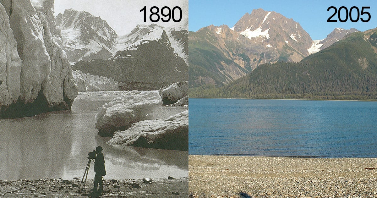
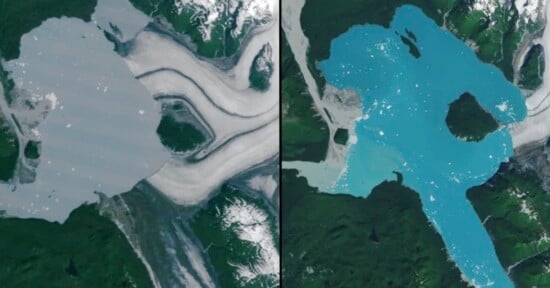
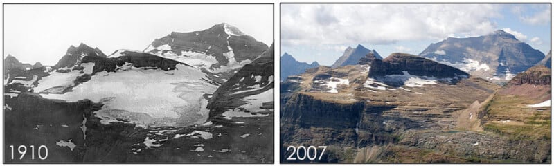
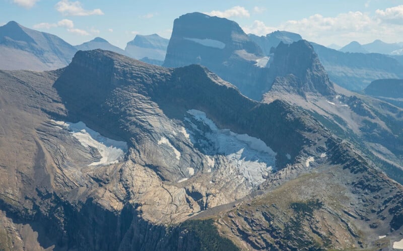
Since its inception, the Repeat Photography Project has produced around sixty repeat photograph pairs, comparing images from 1887–1943 with those taken between 1997 and 2019. The side-by-side photos offer an objective record of glacier change, documenting the retreat of ice and illustrating the effects of climate warming on Glacier National Park.
“These image pairs provide an objective visual record of landscape change, helping both scientists and the public understand the impact of climate change on Glacier National Park’s glaciers,” said McKeon.
Historic photographs were sourced from the Glacier National Park Archives, the University of Montana Archives, and the USGS Photographic Library. Researchers used Google Earth to approximate the original photo locations, then triangulated landscape features in the field to replicate the exact vantage points.
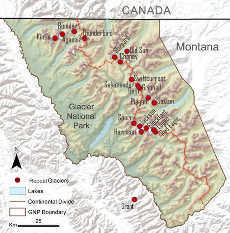
Fieldwork is often challenging, requiring multi-day hikes into backcountry areas. Grinnell Glacier, which is more accessible than most, has the most repeat photo pairs in the collection, totaling twenty-three.


Left image: Grinnell Glacier from lower Grinnell Ridge on September 27, 2016. Credit: USGS McKeon | Right image: Grinnell Glacier from Lower Grinnell Ridge on September 6, 2025. Credit: NPS Lombardi
More Than Glacier Retreat
The repeat photographs do more than document melting ice. They also reveal changes in vegetation along newly exposed glacier margins, shifts in forest composition, and signs of human activity within the park.
“The collection has inspired artistic projects, museum exhibits, educational materials, and even a selection of photographs included on a gold-plated disc orbiting the Earth,” said McKeon.
By providing a comprehensive visual history, the USGS Repeat Photography Project complements ongoing research, including glacier mass balance studies, assessments of regional glacier change, and the Benchmark Glacier Research project. Together, these efforts offer a deeper understanding of how Glacier National Park’s landscapes are evolving.
Left image: Jackson Glacier on August 31, 2021. Credit: NPS Lombardi | Right image: Jackson Glacier on August 25, 2025. Credit: NPS Lombardi

Left image: Swiftcurrent Glacier as seen from right outside the Swiftcurrent Firelookout on August 5, 2015. Credit: USGS McKeon | Right image: Swiftcurrent Glacier as seen from right outside the Swiftcurrent Firelookout on August 30, 2025. Credit: NPS Lombardi
Bearing Witness
Photographing glaciers is never straightforward. Late-summer fieldwork can be disrupted by weather, forest fire smoke, or early snowfall. Many glaciers require multi-day excursions to reach, making each repeat photograph a significant undertaking.
“These efforts not only preserve the visual history of Glacier National Park’s glaciers but also provide essential data for studying the effects of climate change on these iconic natural features,” said McKeon.
The newly released 2025 repeat photographs serve as both a scientific record and a call to reflection, reminding us of the fragility and resilience of our planet. Each image captures not just melting ice and shifting landscapes, but the passage of time and the urgent need to understand and protect our natural world. By comparing past and present, viewers are offered a rare opportunity to witness the impact of climate change firsthand, and to be inspired to act in safeguarding these iconic landscapes for generations to come.
For those interested in exploring the full collection, repeat photo pairs and other historic glacier imagery are publicly available through the USGS website.
Image credits: United States Geological Survey, Public Domain