Amazing Satellite Image Shows Mount Vesuvius Peeking Through the Clouds
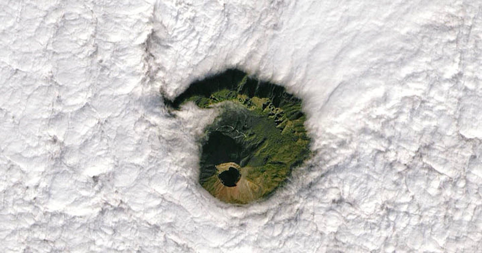
A satellite captured a remarkable image showing the summit of Mount Vesuvius peeking through a cloud blanket.
NASA’s Operational Land Imager (OLI) on Landsat 8 captured the image back in January 2022 but it was recently spotted by Live Science which describes the volcano as playing a game of peek-a-boo.
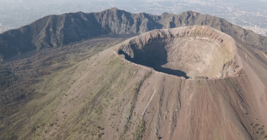
The volcano sits at the heart of the Campanian Volcanic Arc, a tectonically active region that includes Mount Etna in Sicily and the Campi Flegrei caldera near Naples. Vesuvius is unique as a composite stratovolcano, formed by layers of pyroclastic flows, lava, and volcanic debris.
The image captured by Landsat 8 reveals the volcano’s central cone, surrounded by a prominent ridge — the remains of Mount Somma, an ancient volcano that collapsed to form a caldera. Live Science compares the eerie “eye-like” appearance of Vesuvius through the cloud hole to fallstreak holes, gaps in clouds often caused by airplanes.

Roughly 800,000 people currently live on Mount Vesuvius’s slopes, and three million in total reside within the broader potential hazard zone. Therefore it is classified as one of the world’s most dangerous volcanoes. Vesuvius last erupted in 1944, destroying the village of San Sebastiano. Since then, seismic swarms and ground deformations have kept scientists on alert.
In a 2011 study published in Nature, Vesuvius was dubbed “Europe’s ticking time bomb.” Experts continue to debate the best ways to prepare for future eruptions.
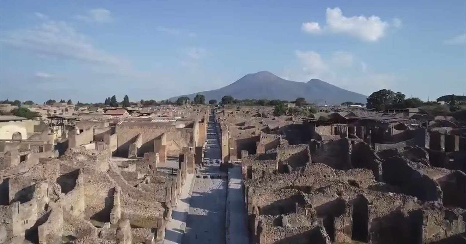
The volcano’s most infamous eruption was on August 24 and 25 in the year 79 A.D. The stratovolcano sent a towering column of ash, pumice, and toxic gases into the sky, followed by deadly pyroclastic flows that engulfed the nearby Roman cities of Pompeii, Herculaneum, and surrounding settlements.
Pompeii was buried under several meters of volcanic ash and debris, preserving buildings, streets, and even the remains of around 2,000 people, many frozen in their final moments. Herculaneum, closer to the volcano, was obliterated by superheated volcanic material, which carbonized wooden structures but preserved skeletons along the shoreline.
The eruption unfolded over two days, initially marked by pumice rain and ash fall that caused roofs to collapse. The second phase unleashed the fast-moving pyroclastic surges that sealed the cities’ fates. Pliny the Younger, an eyewitness observing from a safe distance, later documented the disaster in vivid letters, describing the “umbrella pine” shape of the eruption cloud and the chaos that followed.
The catastrophic event buried Pompeii for nearly 1,500 years until rediscovery in the late 16th century, providing one of the most detailed archaeological records of ancient Roman life.
Image credits: NASA Earth Observatory
Update 1/29: A previous version of this article stated that Vesuvius is Europe’s only active volcano. It has been amended.