Satellite Photos and AI Combine to Reveal Secret Roads Damaging Rainforests
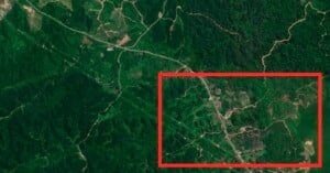
Scientists used AI to analyze satellite images and find the secret, unmapped roads that are destroying rainforests.
Scientists used AI to analyze satellite images and find the secret, unmapped roads that are destroying rainforests.
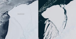
A giant iceberg five times the size of Malta has broken away from Antarctica's Brunt Ice Shelf, satellite imagery shows.

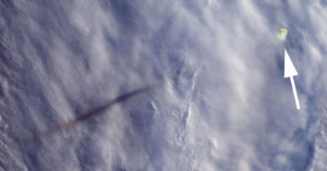
A Northrop Grumman B-2 Spirit stealth bomber has been caught flying over farm fields in the Midwest by Google Satellite cameras. It was spotted by a sharp-eyed Google Maps user.
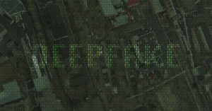
Fake, AI-generated satellite images can pose threat to nations and agencies worldwide, a team of researchers warns. These bogus images could be used to create hoaxes ranging from natural disasters to propping up other fake news, or even be used to mislead international governments into conflicts.
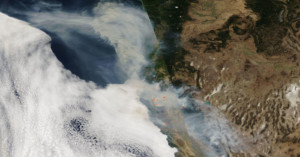
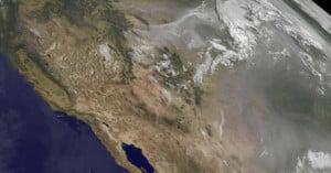
Here's an eye-opening satellite photo captured by NASA showing the wildfires and smoke "dominating" the landscape of the western United States.
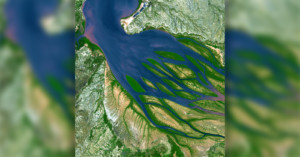
If you need a break from the lawsuits and software updates, and just want to sit in awe for a moment, NASA has got you covered. The space agency has just re-shared a stunning satellite image of a bay in Madagascar that looks just like a giant octopus.
NASA has released photos it captured of a rare ultra-powerful meteor explosion that occurred above the Bering Sea back on December 18th, 2018. The "fireball" unleashed over 10 times the energy of the atomic bomb that was dropped over Hiroshima in World War II.
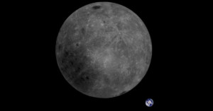
A Chinese satellite currently orbiting the moon has captured a beautiful photo showing both the far side (AKA dark side) of the Moon as well as planet Earth in the background.
Massive wildfires in the Rockies have destroyed hundreds of homes and scorched tens of thousands of acres over the …