Rare Photos Inside the United Nations Buffer Zone in Cyprus
In September 2018, I was asked to travel to Cyprus and photograph the Buffer Zone (or Green Line) in Nicosia. It was an exclusive opportunity since this area is not accessible for civilians — it’s a demilitarised zone (DMZ), patrolled by the United Nations.
The Buffer Zone in Nicosia is part of the 7 Most Endangered Programme from Europa Nostra. My visit to Cyprus has been made possible thanks to the Ministry of Foreign Affairs, United Nations, and Europa Nostra.
This article is a documentary of the current situation of the Buffer Zone / Green Line with mostly exterior shots. The historical and architectural value is very high, and I’m thrilled to share this exclusive view with you.
Walking by the Buffer Zone
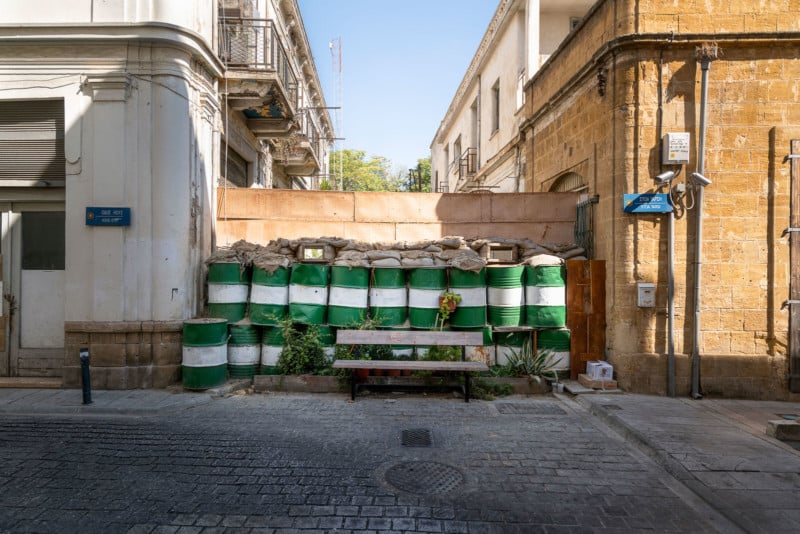
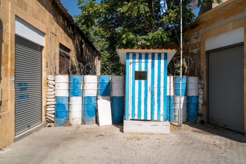
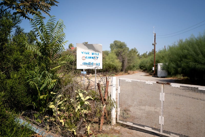
Before I was escorted by the United Nations through the Buffer Zone, I had time to walk by the Buffer Zone in the center of Nicosia. One of the first things I noticed is how weird it feels that all the roads, with a few exceptions, have been closed with barrels and/or barbed wire in an attempt to keep you from crossing over to ‘the other side’ or into the Buffer Zone.
Some of these roadblocks are even guarded by young soldiers. These posts and soldiers were not to be photographed.
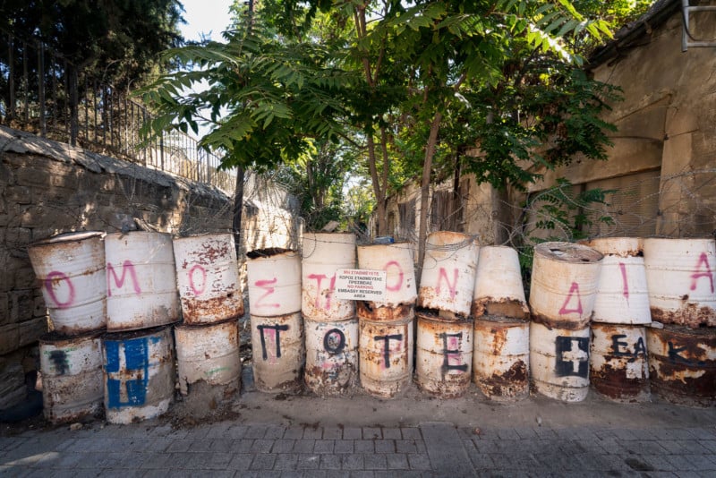
The roadblock you see on the photo above is close to Ledra Street. Ledra Street is the major shopping street in Nicosia. It is also the site of the former Ledra Street barricade, across the United Nations buffer zone. The barricade symbolized the division of Nicosia between the Greek south and Turkish north. The barricade on Ledra Street was removed in April 2008, and thus became the sixth crossing between the Southern part of Cyprus and the Northern part of Cyprus.
As a foreigner, I had to show my passport on both sides to be allowed access. By the way, the first crossing for Greek and Turkish Cypriots opened in 2003. Just imagine that you’re not able to see ‘the other part’ of your country and city for 30 years.
While in and around the city, I talked to locals from around my age. In the meantime, I had already crossed the border to the Turkish part of the island. The locals I talked to, never had. They started asking me questions how it’s like on the other side of the border. That just felt so strange. They didn’t want to cross. Because of for example principle, or even their parents not allowing them to go. Nicosia, also known as Lefkosia, is the last divided capital in Europe.
The most striking thing I experienced, is that you can see and feel that both sides have developed separately and you’re in different countries. Architecture, food, culture, people. Everything was different.
The Escort Through the Buffer Zone
The United Nations Buffer Zone in Cyprus is a demilitarised zone, patrolled by the United Nations Peacekeeping Force in Cyprus (UNFICYP), that was established in 1964 when Major-General Peter Young was the commander of a “peace force”, a predecessor of the present UNFICYP. After stationing his troops in different areas of Nicosia, the general drew a cease-fire line on a map with a green pencil, which was to become known as the “Green Line”.
The zone extended in 1974 after the cease-fire of 16 August 1974, following the Turkish invasion of Cyprus, and de facto partition of the island into the area controlled by the Republic of Cyprus (southern Cyprus save for the British Sovereign Base Areas) and the Turkish Republic of Northern Cyprus in the North.
The zone, also known as the Green Line, stretches for 180 kilometers from Paralimni in the east to Kato Pyrgos in the west, where a separate section surrounds Kokkina. The zone cuts through the center of Nicosia, separating the city into southern and northern sections. In total, it spans an area of 346 square kilometers, varying in width from less than 20 meters to more than 7 kilometers. Some areas are untouched by human interference and have remained a safe haven for flora and fauna.
I met the people from the United Nations at Ledra Palace. Once this was one of the largest and most glamorous hotels of the capital city. The hotel was designed by the German Jewish architect Benjamin Günsberg and was built between 1947-1949 by Cyprus Hotels Limited at a cost of approx. €410,000 (~$467,000). It now serves as the headquarters for Sector 2 United Nations Roulement Regiment part of UNFICYP. It’s a very important location, and I was lucky to have a peek inside.
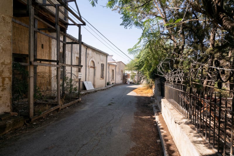
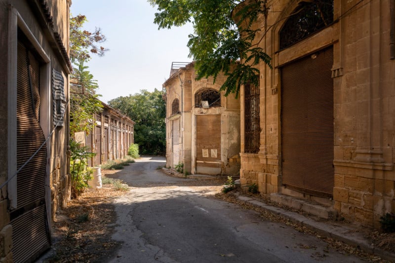
The state of the building is still very good. After that, we drove to the east part of the buffer zone where we entered through the gate you see on the right. This is where the walk through the Buffer Zone starts.
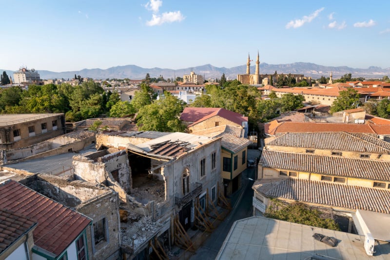
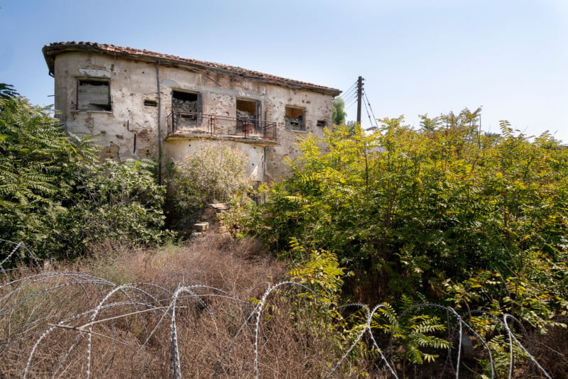
Within the Walled City of Nicosia, the capital of Cyprus, the buffer zone is a strip of land that runs along the east to west axis, forming part of the United Nations-controlled green line. This line divides the island of Cyprus and the city of Nicosia in two, keeping the two major communities – Greek Cypriots and Turkish Cypriots – apart, for more than three decades.
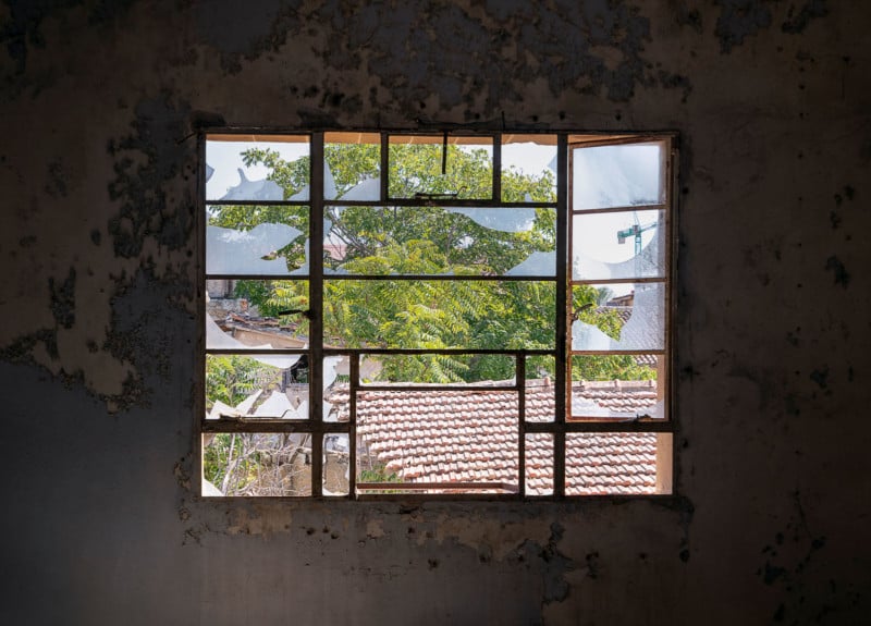
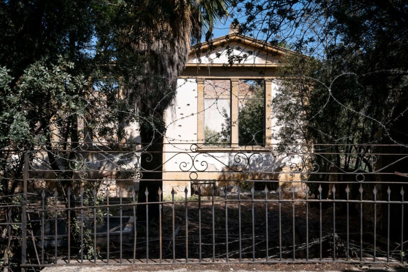
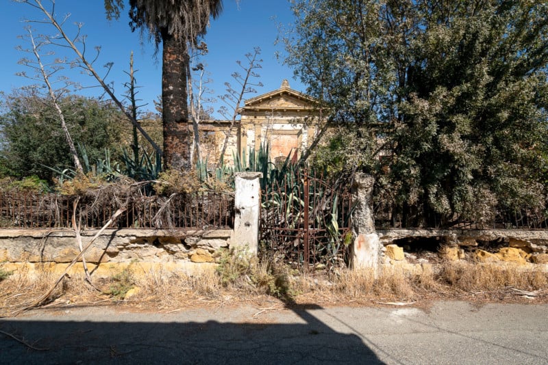
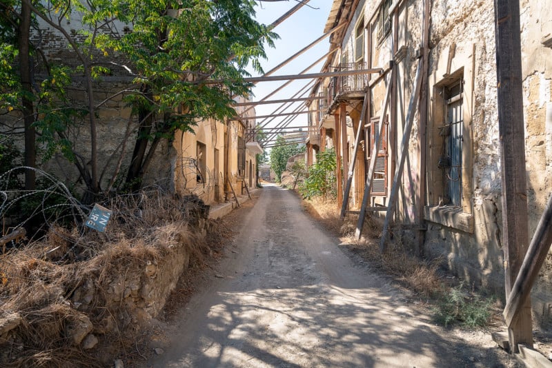
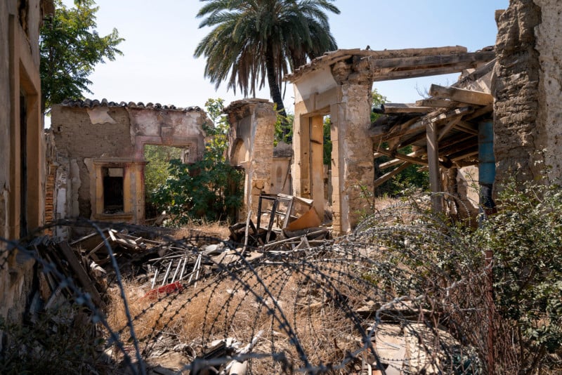
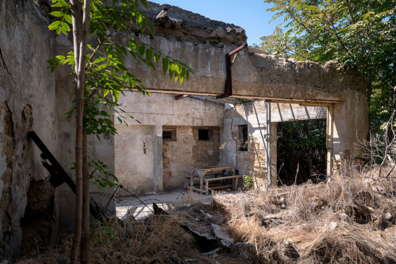
The effects of this separation have been devastating for the city of Nicosia, the last divided capital of Europe, especially for its historic center, which composes a unique core of high archaeological, architectural and environmental values. Within this highly restricted area historical buildings together with newer structures, are suffering from physical decay neglected for more than 30 years. This present situation has negative effects on the old city’s urban fabric and contributes to the degradation of the historic center as a whole, leading to its physical, economic and social decay.
The first buildings I saw and photographed were the Ayios Kassianos schools. Ayios Kassianos schools comprise a very interesting complex of two neoclassical buildings of the beginning of the 20th century and a later one which is known to be the nursery. The two schools, boys and girls, are identical in their original layout but bear later interventions. Their characteristic neoclassical elements recall the architectural style of other examples of schools within the city of Nicosia. Their importance for the area and the city as a whole leads to the urgency for their immediate support and restoration. In the same building complex as the schools, Ayios Georgios church is located.
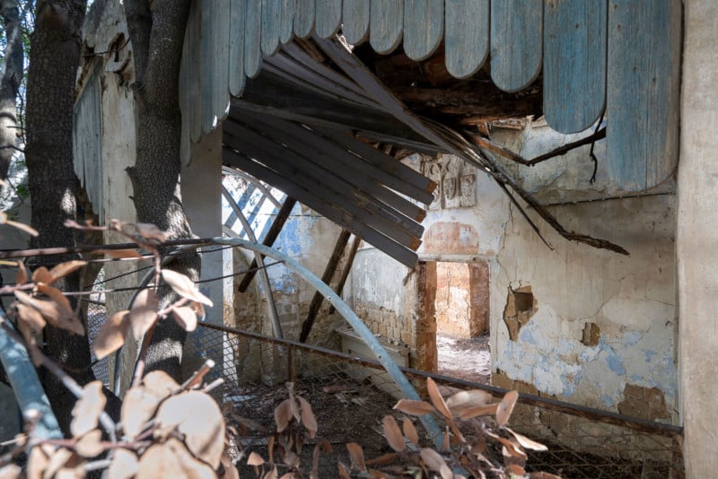
Ayios Georgios church is also a very important monument in the walled city buffer zone area. It dates back to the 17th century, built in ashlar stone, with later interventions. It is part of a building complex including the neoclassical boys and girls’ schools of Ayios Kassianos. Its’ southern wall lies on Ayios Georgios street, where the main entrance to the narthex opens. The internal walls of the narthex bear signs of bright colors and of stone decorations. It is of high importance that this church is documented and restored immediately; otherwise, one of the most important monuments of the area will be lost. Across this church, you will find ‘Annie’s House’.
Annie refused to leave her house, which is located in the Buffer Zone, after the Buffer Zone was established. UN diplomacy could not dislodge her. She continued living in her house, and UN patrols regularly escorted her on shopping trips to get groceries and such. When UN patrols hadn’t noticed any movement in her house, they entered the house and found she died. Annie’s family had broken contact, and she had no-one to arrange her funeral. Annie was 90 years old when she died, and UN soldiers paid and arranged her funeral. Her story is still alive.
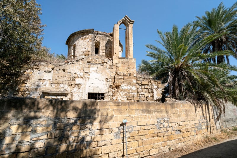
Continuing the road, I came across Ayios Iakovos church. Ayios Iakovos church is one of the most important monuments, included in the buffer zone area, dated back to the 15th- 16th c. with later interventions, such as the steeple, built in fine ashlar stones. It’s a Byzantine type of church covered with two intersected barrel vaults carrying the cupola, with eight windows. The arch of the Holy Place is semi-circular. Louis Salvator of Austria visited Nicosia in 1873 and gives a description of this church, as “… a small building with four-barrel vaults …The Iconostasis curved of wood, bears the Russian eagle…”. The church is part of a building complex, referred to as the monastery of Ayios Iakovos.
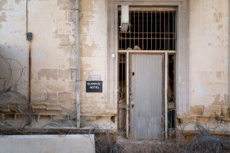
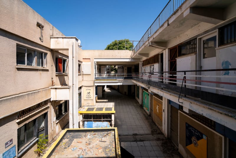
At one point, we crossed the Buffer Zone at Ledra Street. A very busy crossing, and just a day before I walked through the street and faced the big fences and gates on both sides. Today, these gates opened to cross from the east side of Ledra Street to the west side of Ledra Street. On the corner, the well-known Olympus hotel is located — one of the most important hotels of the Walled City, some decades ago.
The richness of its architectural elements, as well as the grand halls in the interior and its large rooms reveal the importance of this building and its significant role in the heart of the economic and probably the social life of the city. Built in the beginning of the 20th c., (1914–1933) in load-bearing masonry, with classical elements decorating the facades. The ground floor was built for commercial use, with simple elements of decoration while the first floor was occupied by the Olympus Hotel, with much more complicated decoration elements such as pilasters, balconies, and cornices with modillions.
Both the facades are formed according to a combination of the classical Greek ionic order with a Roman-Corinthian cornice with modillions, along with neo-baroque elements on the corner of the building. Since 1974, the building was abandoned to the ravages of time. Today, the part that faces Ledra Street, has been beautifully renovated and looks amazing.
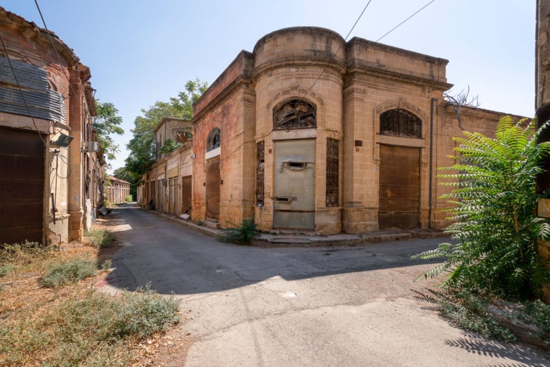
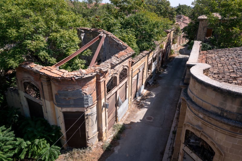
Throughout the Buffer Zone, there are several corner buildings. This is a special type of building which appears on the corners of commercial building complexes, on the crossroads, in the heart of the commercial center, in the area of Phaneromeni. There are six of these buildings in an area of 500 meters long. These buildings are identical in layout, square in shape, with rounded corner. Neoclassical architectural elements decorate the facades. On the right, you see an example of such a building. Below, you find one of my personal favorite shots of my visit. This is a corner building that’s being completely reclaimed by nature.
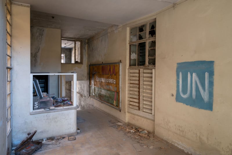
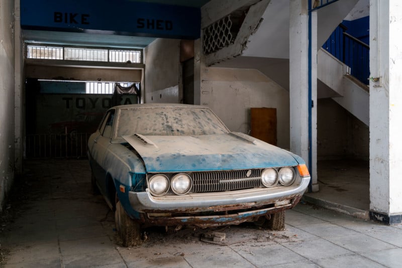
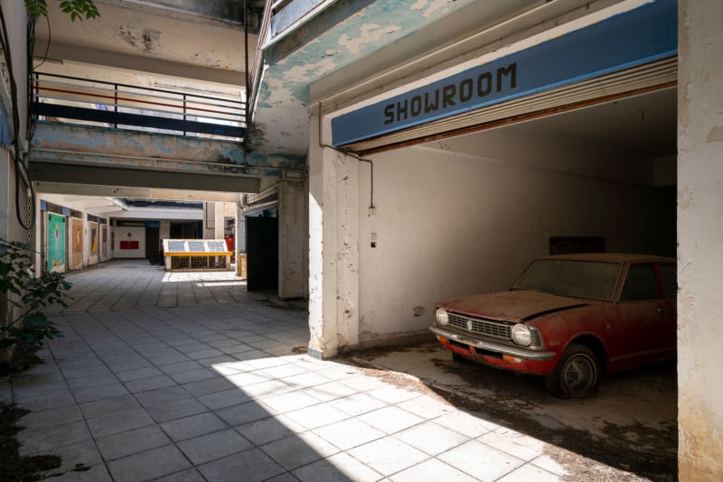
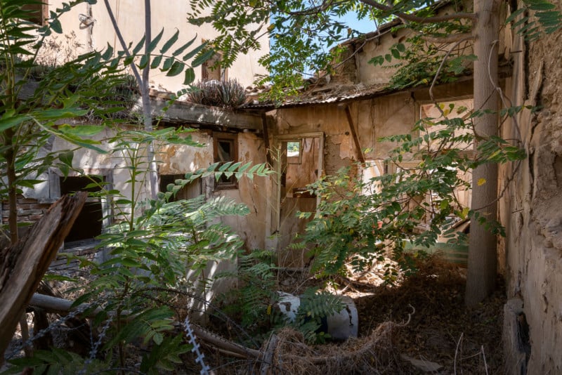
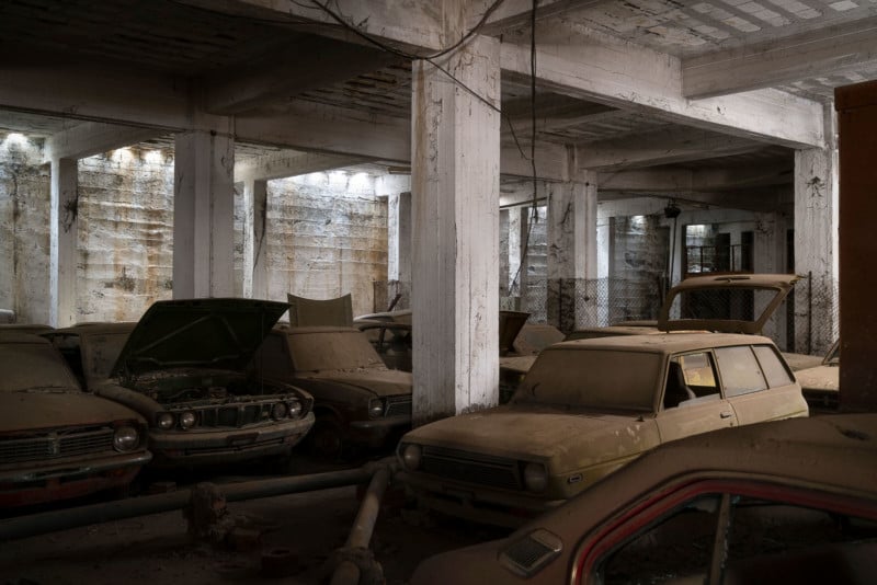
One of the buildings that I was able to enter, is called ‘Maple House’. Maple House was used as a platoon house for UN soldiers. It wasn’t a very luxurious base and has been abandoned for a number of years as part of the general force reduction. Above is a photo of the entrance to the building. On the wall is a plaque of a former gun shop that was located inside of the building. Maple House was originally a small arcade type shopping center with an apartment block. The building itself has been mostly stripped, yet it is still in good condition. One of the other shops located in this building used to be a car garage. A lot of cars have been left behind in the showroom and the cellar of the building.
The cellar of the building is filled with cars, and some of them even have as little as 40km on the clock. A small number of cars were removed from the basement by the UN and are better preserved, but most of them have been left behind. In 1974, these cars were imported through the gate at Famagusta and driven to the basement in Nicosia, a distance of around 40 kilometers. The drive-in entrance to the basement is in the Buffer Zone. Over the years the cars have been stripped of their internal fittings and smaller engine parts and, although technically ‘new’ can no longer be described as being in ‘mint condition’. Thieves have provided themselves access to this storage area, with all the risks involved, to strip the cars.
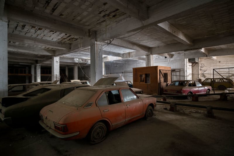
Cars that have been left behind in the showroom, a floor above the cellar, can be seen below.
Close to Maple House, you find the ‘ten-minute yard’. This is a very sensitive location because there were numerous protests about the amount of time Turkish soldiers spent in the area of this yard. It was agreed with the UN that Turkish soldiers would only be visible in the yard for ten minutes in each hour. However, to make a point the Turkish soldiers would appear at 10 minutes ‘to’ the hour and then continue to stay for 10 minutes of the next hour, thereby visible in the yard for 20 minutes. This was obviously seen as a gesture of provocation.
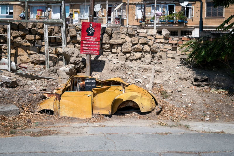
Right next to the ‘ten-minute yard’, almost attached to it, the remains of a yellow car are lying on the ground. Near the end of the fighting in 1974, this yellow car was destroyed and both the Greek and Turkish sides dispute the exact position of the CFL (Cease Fire Line). The Turkish believe that the CFL should be drawn at the south point of the car, while the Greeks believe the CFL should be drawn at the northern point of the car. The dispute was settled by the UN by painting two lines; one at the northern end and one at the southern end of the car. Thereby, the UN created a ‘Buffer Zone’ within the Buffer Zone.
The photo below gives a good indication of how close the Greek and Turkish soldiers were fighting with each other. Greek soldiers on the left and Turkish soldiers on the right. This is a photo of Spear Alley. It was here that a Greek soldier fixed a bayonet to a long pole and stabbed a sleeping Turkish soldier to death through the window on the opposite side of the road. Imagine that…
Here are some more photos of my walk through the Buffer Zone in Nicosia:
About the author: Roman Robroek is a Netherlands-based urban exploration photographer. The opinions expressed in this article are solely those of the author. You can see more of his work on his website, or by following him on Facebook, Twitter, and Instagram. This article was also published here.