This Interactive Map Shows Where You Can’t Fly Drones for Aerial Photography
Just got your hands on a drone and can’t wait to use it to shoot aerial photographs? First, make sure you only use it where it can legally fly. If you’re not sure where to look for this info, there’s a new website designed just for you.
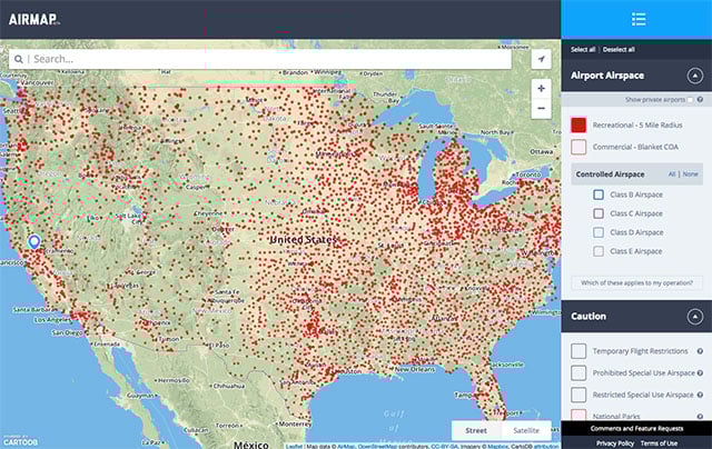
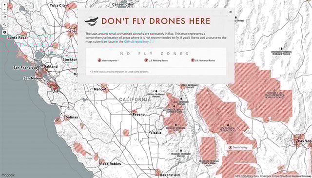
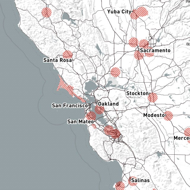
It’s called Don’t Fly Drones Here (DFDH), and is an interactive map that shows off limit areas of the US by shading them in with red.
In case you haven’t heard, unmanned drones (e.g. quadcopters and fixed-wing aircraft) are currently the focus of new airspace regulations issued by the FAA. The government is also planning to write a privacy rulebook for aerial drone imaging.
Three of the current no-fly zones are: US national parks, US military bases, and a 5-mile radius around medium-to-large-sized airports.
DFDH is an effort to present no-fly zones around the country in an easily accessible format. Here’s an embedded version of the map (you can find a full-sized one here):
The map is a work in progress, and the project is open to feedback and new data through its Github page. Also, keep in mind that this isn’t a definitive legal map/guide, so it may be beneficial to double-check the information you receive before heading out with your drone and camera.
Don’t Fly Drones Here [Mapbox via Engadget]