Curiosity Rover Snaps Another Banger Photo: A Martian Mountain at Dawn
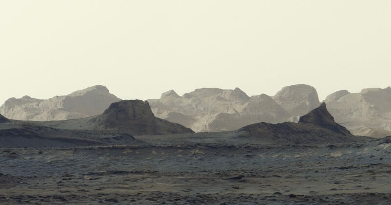
The Curiosity Rover is on a roll: NASA has released another stunning panorama captured by the extraterrestrial vehicle that shows distant cliffs shaped by wind over billions of years.
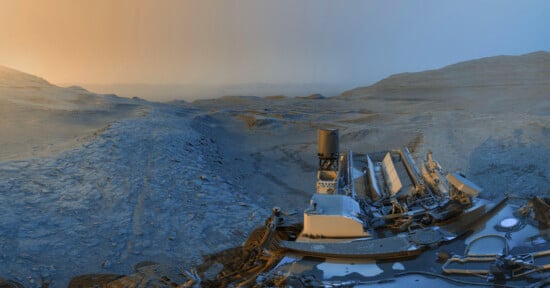
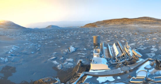
Curiosity captured the scene on August 11, its 4,982nd sol, or Martian day, using its Mastcam instrument. The six images were combined into a single panorama after being transmitted to Earth.
Taken at about 8:30 A.M. local Mars time, the image shows sunlight illuminating the rugged cliffs, with blue tones visible in the foreground. NASA processed the panorama without white balancing, preserving the appearance of the early morning scene.

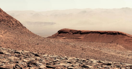
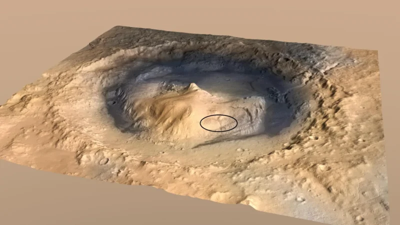
The geological formation is known as the yardang layer. It stretches about 10 miles (16 kilometers) across the northwestern portion of Mount Sharp, a mountain rising roughly three miles (five kilometers) above the floor of Gale Crater.
Curiosity landed in the crater in 2012 and has been climbing the mountain since 2014. The rover recently reached an elevation gain of about 0.6 miles (1 kilometer), the greatest height any rover has climbed on Mars.
Scientists believe the yardangs formed when wind gradually eroded a layer of hardened sediment, leaving behind ridges. The material may have originally consisted of windblown sand or volcanic ash deposited in the crater. Although the layer likely formed around three billion years ago, it appears distinct from the sequence of geological layers that make up most of Mount Sharp.
“The yardang layer looks out of place. It’s the wrong color, the layers tilt at an odd angle, and it almost appears plastered on,” says Ashwin Vasavada, Curiosity project scientist at NASA’s Jet Propulsion Laboratory in Southern California. “But that’s what makes it exciting to reach. No one is sure exactly what created this layer, but one idea is it may be ash deposited by ancient volcanic eruptions.”
Vasavada says the formation may have been added to the mountain after an interval of erosion, rather than forming as part of its original sequence of layers.
“The yardang layer doesn’t appear to be part of the continuous stack of layers that make up the layer-cake of Mount Sharp. It was added on a little later. It’s above what geologists call an unconformity: a gap in time where previous layers eroded down before new layers were deposited on top,” Vasavada tells Reuters.
Mount Sharp’s geological layers provide evidence of changing conditions on Mars over time. By examining the mountain, scientists have gathered information about ancient lakes and streams that once occupied the region when the planet was warmer and wetter. As the climate changed and surface water disappeared, salty minerals remained in some areas. Later wind erosion may have helped shape the yardangs seen in the new panorama.
The image was taken about an hour after sunrise. Vasavada says the landscape has similarities to some locations on Earth, despite differences in the planet’s atmosphere and lighting.
“This scene has a wildness that reminds me of a road trip through Monument Valley, Arizona. You can almost feel the silence and the endless open space under the sky. But as familiar as that sounds, the sky is orange and the sunrise has shades of blue. It’s like Earth, but it’s definitely Mars,” Vasavada tells Reuters.
Earlier this week, PetaPixel reported that Curiosity has already surpassed its 5,000th day on the Red Planet, celebrating it with a panorama of a sandy ridge known as “Chocolatal.”
Affiliate Disclosure PetaPixel articles may include affiliate links; we may earn a commission if you buy through one.