
Before and After Satellite Photos Show Damage Done by LA Wildfires
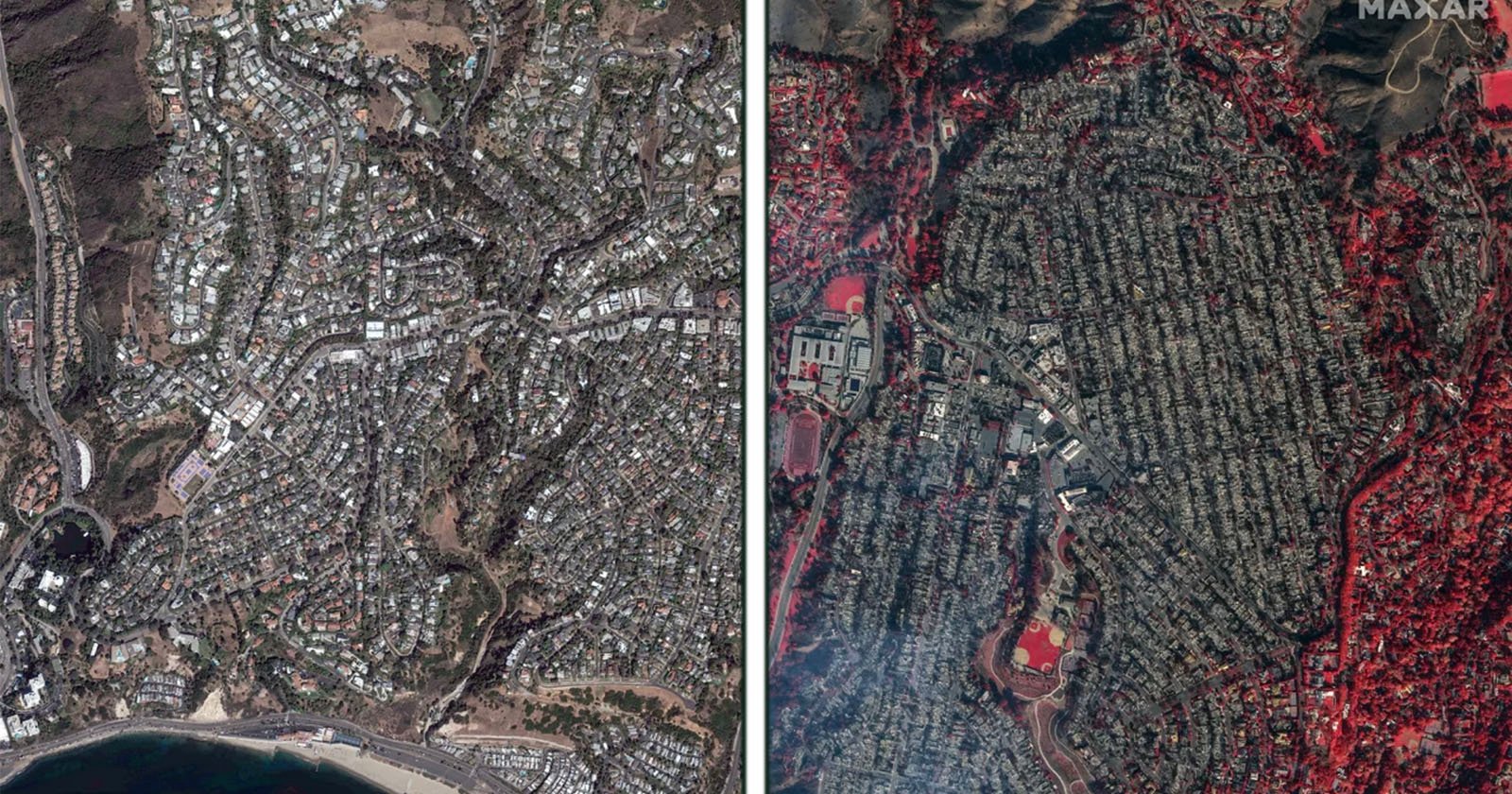
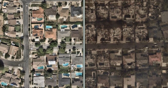
Side-by-side satellite images show a residential area before and after a wildfire. The left image depicts a dense neighborhood with greenery, while the right image shows widespread devastation, with charred land and structures.
Before and after comparison photo of the Pacific Palisades on October 20, left, and after fire damage on January 9, right. Scroll down for a slider comparison. | Maxar Technologies

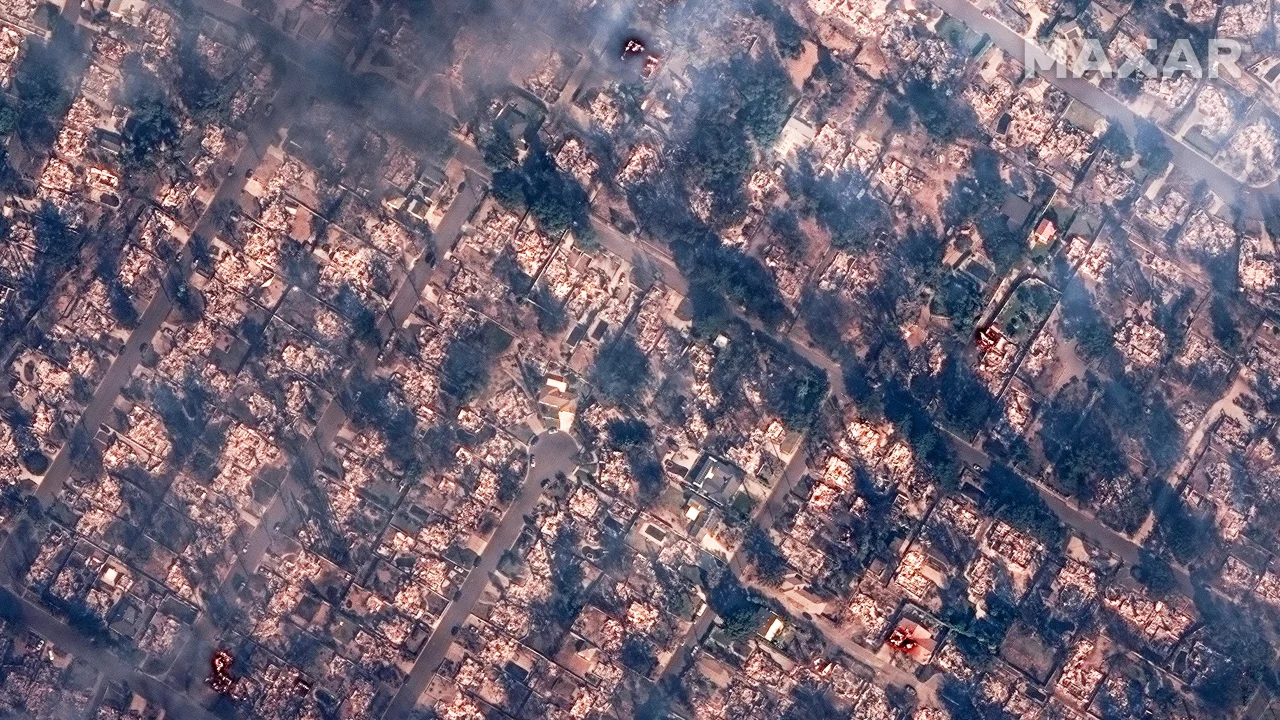
Satellite images have laid bare the terrible damage done by the Los Angeles wildfires which have devastated the city and claimed the lives of at least 24 people.

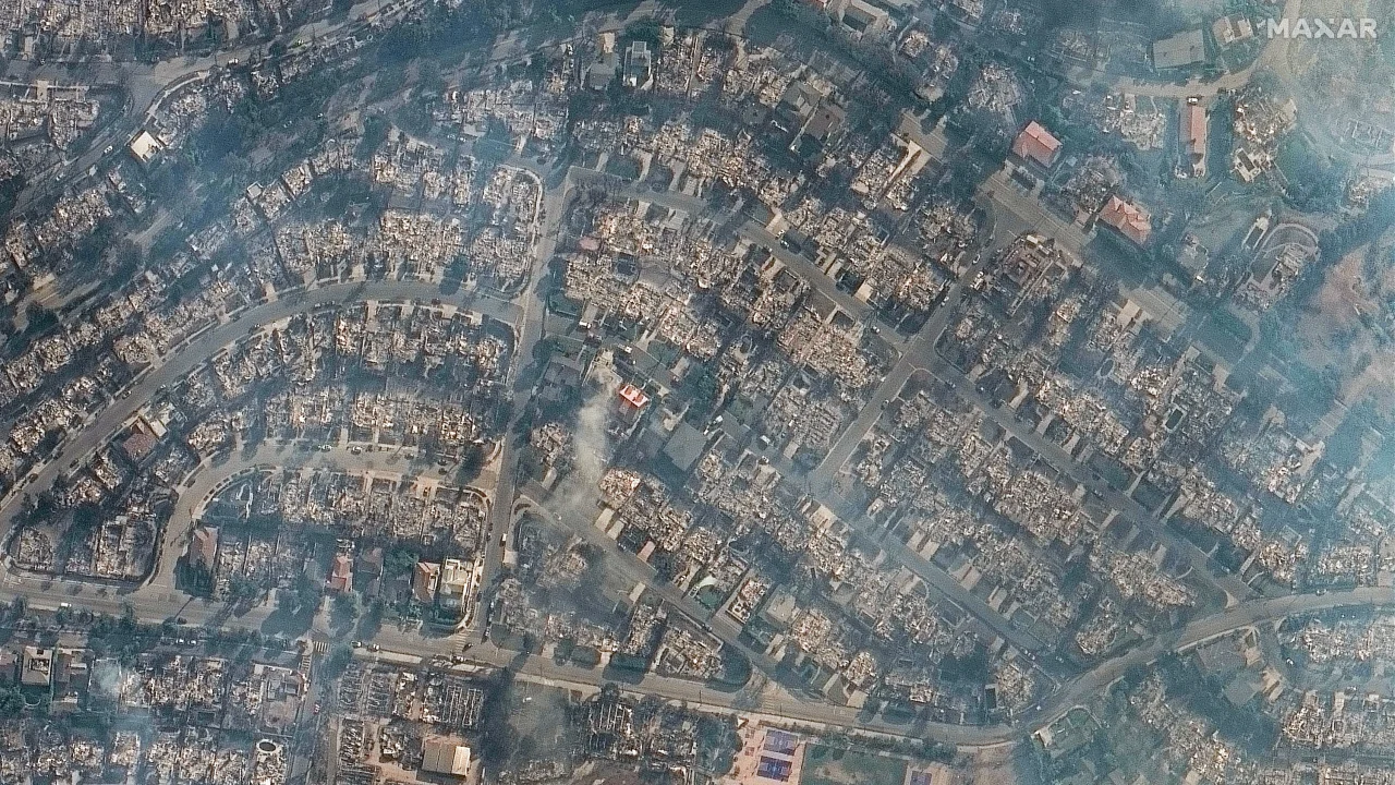
The images, such as the one below showing Pacific Palisades on October 10, 2024, and January 9, 2025, were captured by the satellites belonging to Maxar Technologies and Airbus.
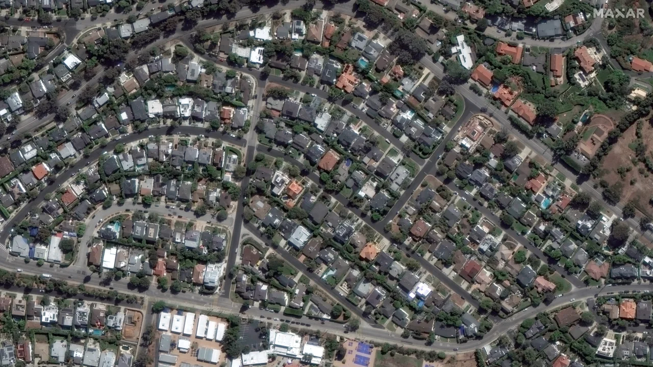
Aerial view of a residential neighborhood featuring curving streets lined with closely packed houses, each with distinct roofs. Green trees and small yards are visible throughout, with some commercial buildings at the bottom of the image.
Aerial view of a densely populated urban area with widespread fire damage. Many buildings are charred and reduced to rubble, smoke rising from the debris. Scattered undamaged houses can also be seen amid the devastation.

The Palisades fire decimated Malibu with a third of eastern Malibu described as “gone” by the mayor. “It has hit us hard,” says mayor Doug Stewart. “Malibu has lost approximately one-third of its eastern edge of the city.”

Entire neighborhoods have been erased including Big Rock and Carbon Mesa. The fire consumed Malibu so quickly that authorities struggled to warn citizens of the danger and were hampered by communication difficulties caused by the fire.

The image below shows Malibu Beach a year earlier on January 18, 2024, and then after the fires on January 9, 2025.

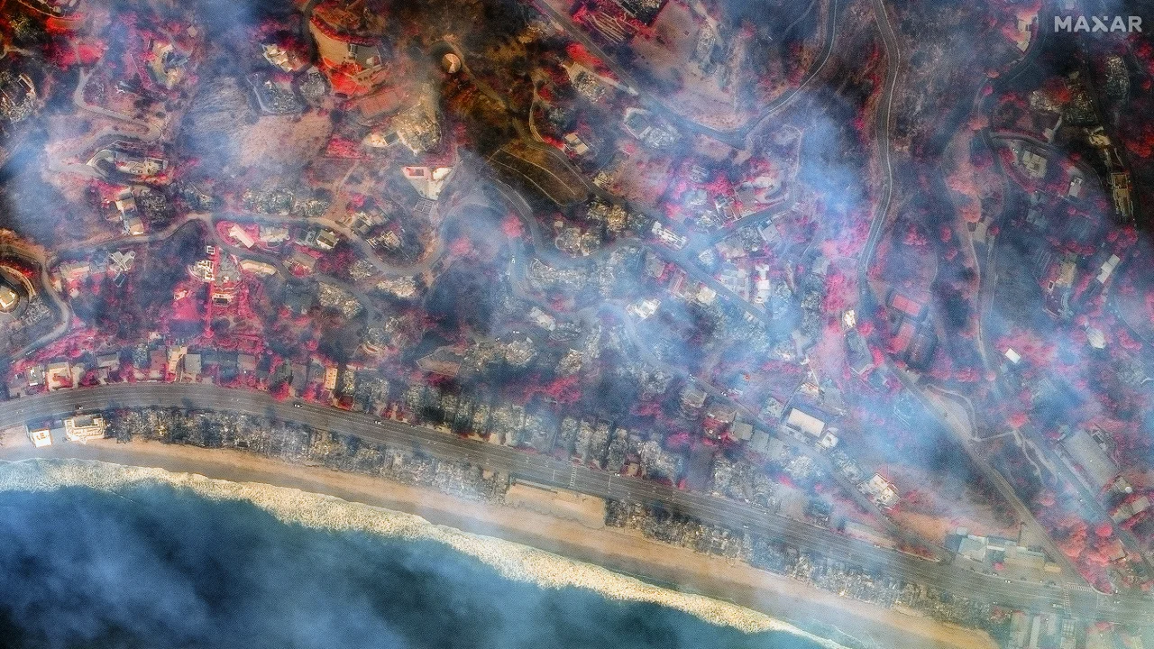
Aerial view of a coastal area with a beach at the bottom, residential houses and roads in the middle, and greenery surrounding the neighborhood. Waves from the ocean can be seen hitting the shore.
A satellite image shows a coastal area with a beach at the bottom. Smoke is visible, suggesting a wildfire. Roads and numerous structures are scattered across the landscape, affected by the fire. The image has a reddish tint, highlighting the damage.

The below image, courtesy of Pléiades Neo © Airbus DS 2025, shows the houses that surround Palisades Charter High School. Deadline describes fire damage to the school as “significant” noting that it is where Carrie was filmed. In a Facebook post by the school, it estimates that 40 percent of the buildings have been either “damaged or destroyed.”
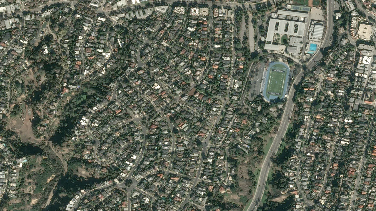

Aerial view of a densely populated suburban area with winding roads and numerous houses surrounded by trees. A sports field with a running track and buildings are visible in the upper right corner.
Aerial view of a densely populated urban area with winding roads and closely packed houses. A large sports field with a running track is visible on the right side. The landscape shows signs of smoke or haze.

The below satellite images, courtesy of Maxar Technologies, show destroyed structures in Altadena. Alatadena has been affected by the Eaton fire which has leveled rows and rows of homes.

The Eaton fire has burned 14,117 acres and Los Angeles County Sheriff Robert Luna says he knows displaced residents want to return to their neighborhoods, but warns, “we are in the third day of grid searching” in Altadena.

“It is a very grim task,” he adds, noting that every day crews are finding people’s remains.
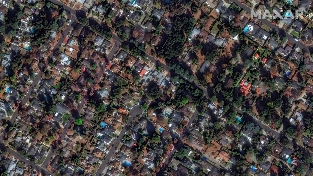

Aerial view of a densely populated residential neighborhood with winding roads, trees, and houses. Various building shapes and sizes are visible, surrounded by greenery, creating a mosaic-like pattern in an urban setting.
A satellite image shows a dense neighborhood, with many buildings appearing to be damaged or burned. Smoke is visible throughout the area, suggesting a recent fire. Roads crisscross between the structures, and patches of greenery are present.

The final picture, below, shows the Pacific Palisades on October 20, 2024, and on January 9, 2025. Taken by Maxar Technologies, it shows the vast area where the largest fire has burned.
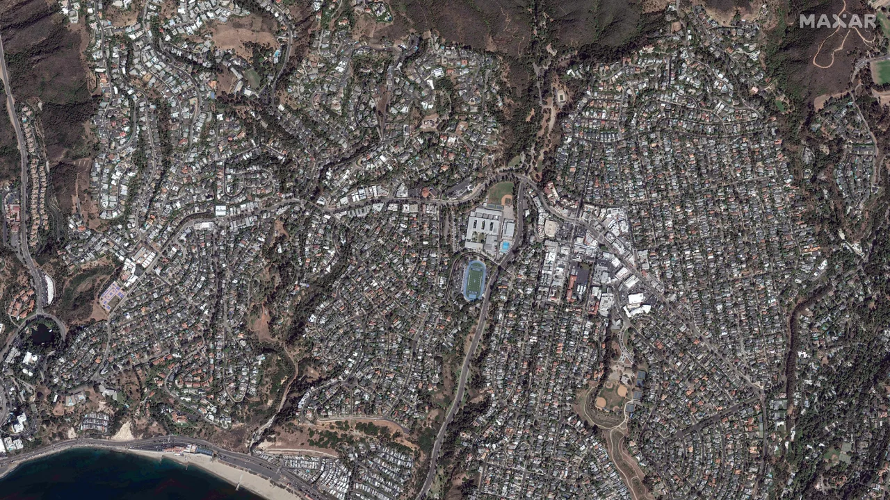

  Aerial view of a densely populated area with winding roads and numerous homes, surrounded by hills and a coastline. A sports stadium and large building complex are visible centrally. The landscape includes patches of greenery throughout.
  Aerial view of a densely populated area affected by a wildfire, with smoke visible on the left. The vegetation is highlighted in red, and urban structures like roads and buildings are seen amidst the landscape.

Earlier today, PetaPixel reported on a rare bright spot: firefighters going the extra mile by saving family photo albums from a burning house in the Pacific Palisades.


Image creditsHeader image courtesy of Maxar Technologies.

Discussion