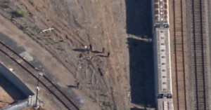
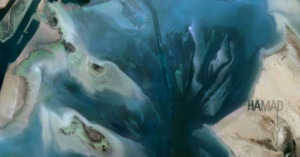
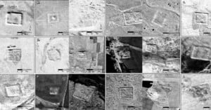
Google’s Earth Day Doodle Shows Effects of Climate Change Over Time
In celebration of Earth Day, Google's April 22 Doodle uses timelapse satellite imagery to show the real-life effects of a warming planet.
A hiker who had been missing in the mountains of Southern California was found after a Twitter user pinpointed his location from the last photo the hiker sent to a friend, which was shared by authorities on social media.
This past weekend, Canon was planning to launch its 5D Mark III-based CE-SAT 1B satellite camera into orbit, but it was not meant to be. The satellite was supposed to go as part of Rocket Lab's aptly named mission "Pics or It Didn’t Happen," but the Electron vehicle experienced "an anomaly" and all 7 micro-satellites onboard—including Canon's—were destroyed.
1 terapixel equals 1 million megapixels, or 1 trillion pixels. And San Francisco-based satellite startup Planet plans to capture 50 of these terapixels each day starting later this year. Specifically, they plan to capture one 50 terapixel image of our entire planet every single day.
NASA just gave satellite imagery nerds a very big present: along with a bunch of other scientific data, the space agency just made 2.95 million images of Earth changing surface available to the public at no cost.
Airports are a common source of creative and interesting imagery. From time-lapses of the comings and goings to composites that pack hours worth of departures into a single image, the sheer scope and complexity of airports fascinates many creatives.
One such creative is Art Director Lauren O'Neill, whose photo series/Tumblog Holding Pattern reveals the intricacies of airports from above using Google Earth satellite imagery.
If you're more into satellite photography than basketball, then March probably had you following along with an entirely different tournament than most of the US: NASA's Tournament Earth 2014. Instead of pitting teams against each other, this tournament packed a bracket full of satellite imagery until a clear winner emerged.
Google has agreed to replace a Google Maps satellite image of a Richmond, California railroad yard that may show the body of a murdered teenager.
There are a couple of different types of imaging satellites currently orbiting our planet. On one end of the spectrum are specialized satellites that gather very high-resolution imagery in which you can identify objects as small as 3 feet across. On the other are the lower resolution satellites that beam down photos of larger areas.
California company Planet Labs wants to fill the space in-between, by providing an affordable middle-of-the-road option for companies interested in using it. To that effect, they're planning on launching 28 tiny, mid-resolution satellites called "Doves" into space before the year is out.
Don’t want people using photos of your private island without permission? Watermark it! Billionaire …
Here’s a Picasa gallery showing Google satellite imagery of various locations in Japan …