Hawaii’s Kilauea Volcano Erupts, Moment Caught on Camera
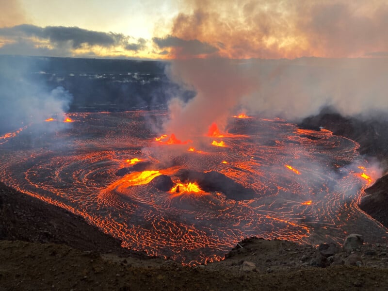
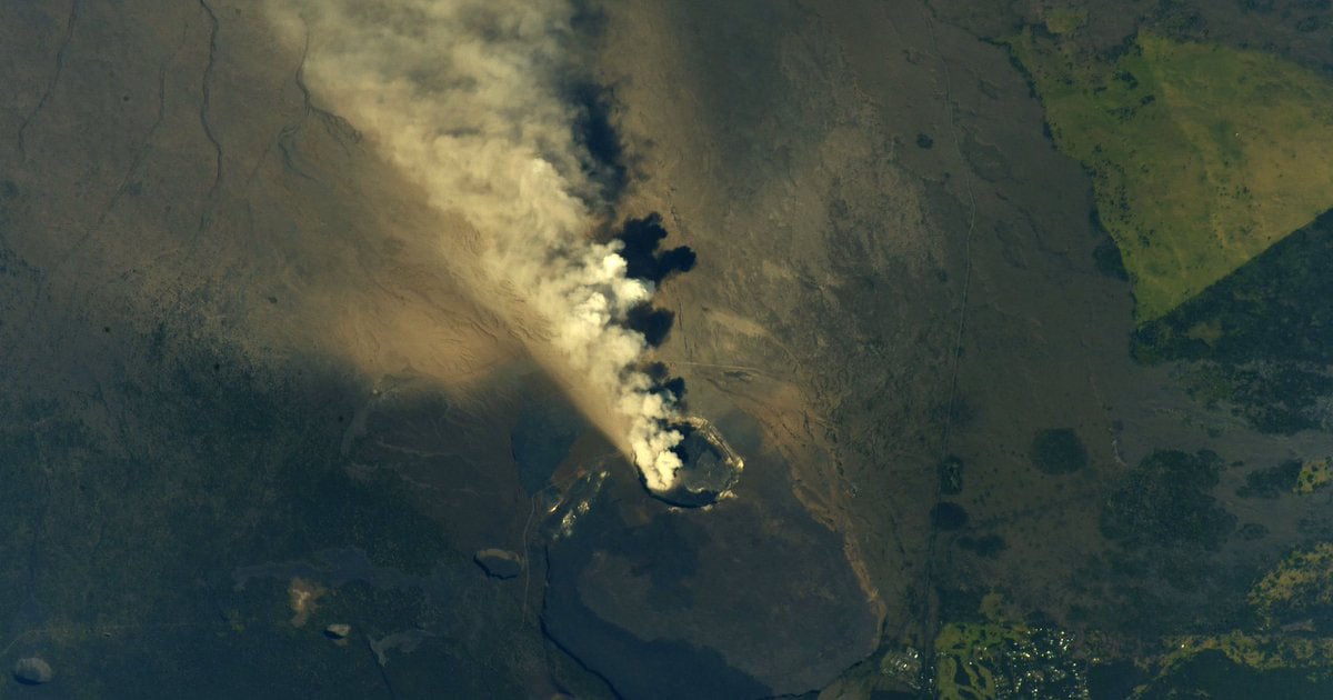
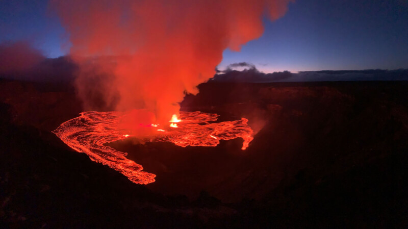
Hawaii’s famous Kīlauea began erupting again on Wednesday morning, delivering a fiery spectacle after a few months of inactivity. The initial eruption was caught on camera, showcasing Kīlauea’s incredible power.
Unlike the recent volcanic eruption in Iceland, the show at Kīlauea is occurring in a heavily restricted area that is closed to the public. However, officials are monitoring the situation and capturing photos and videos of the event, including when the eruption began.
Eruptions at Kīlauea are common. The volcano erupted earlier this year, following a lengthy 16-month eruption that began in September 2021.
The United States Geological Survey (USGS) has issued a “code red” alert through its USGS Hawaiian Volcano Observatory, stating that “high levels of volcanic gas are the primary hazard of concern.” The dangerous gases can travel downwind, affecting population areas.
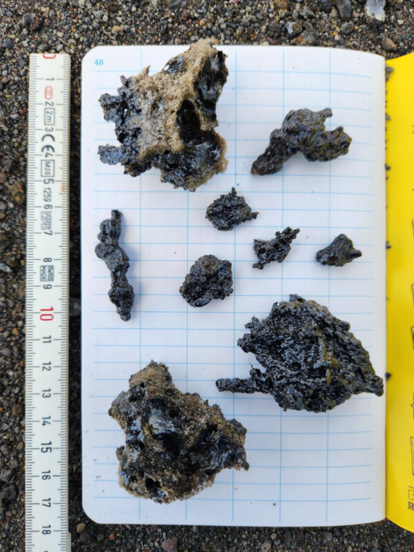
Additional hazards include volcanic glass fragments and volcanic particles. “Strong winds may waft lighter particles to greater distances. Residents should minimize exposure to these volcanic particles, which can cause skin and eye irritation,” the USGS warns.
Nearby volcano Mauna Loa, a popular hiking location, is experiencing trail closures due to hazards from the recent eruption.
Kīlauea is a hotbed of volcanic activity and one of Earth’s most active volcanoes. Since 1780, Kīlauea has been nearly continuously active, with relatively few long periods of inactivity. A particularly devastating eruption in 2018 lasted months and ultimately destroyed 700 homes.
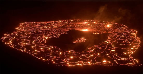
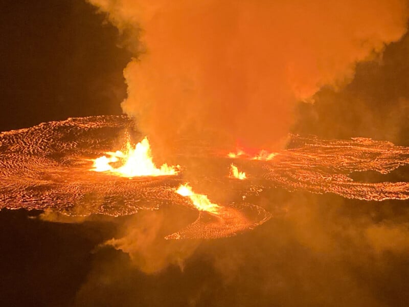
Video recorded by #HVO geologists of the new #Kilauea eruption. This clip is from the west rim of the crater at approximately 6 a.m. HST. Telephoto view shows multiple active vent sources and lava flooding the crater floor. pic.twitter.com/5pq6CUbOQb
— USGS Volcanoes🌋 (@USGSVolcanoes) June 7, 2023
Currently, the USGS isn’t warning Hawaiians about lava flows like those that destroyed homes in 2018, but that doesn’t mean there aren’t significant hazards resulting from the current eruption. Beyond the dangerous gas and particles threatening human health and agricultural crops, there’s ongoing crater wall instability around the Kīlauea caldera.
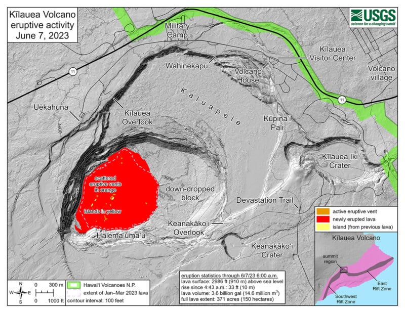
The USGS also warns of potential rockfalls and increased earthquake activity. The dangers surrounding the Kīlauea caldera rim explain why the Halema’uma’u crater area has been closed to the public since 2007.
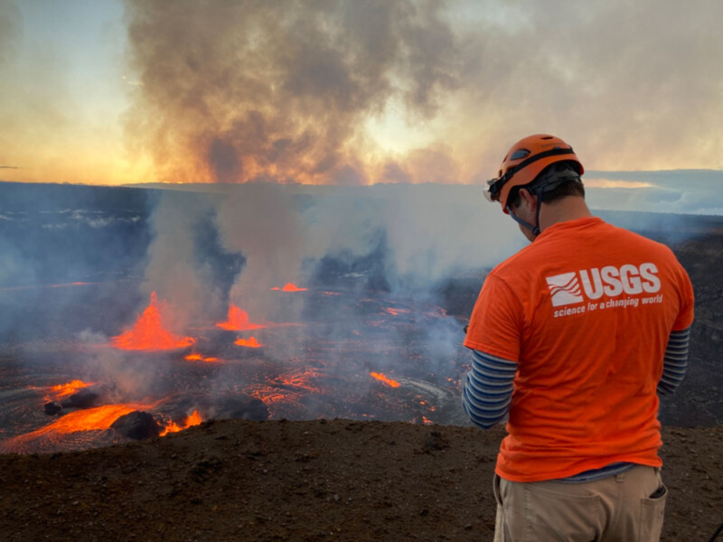
The USGS and its scientists closely monitor the eruption in Halema’uma’u at Kīlauea and are actively updating residents about changing conditions and hazards. The USGS also has a camera along the caldera’s northwest rim, providing a live stream of the eruption.
The situation at Kīlauea is rapidly evolving, but there are no indications that volcanic activity has migrated out of the heavily-monitored summit region. There are multiple minor fountains active on the Halema’uma’u crater floor. Early during the eruption, lava fountains were as high as 4-9 meters (13-30 feet), although heights have since subsided.
Despite the reduction in activity intensity, elevated levels of volcanic gas emissions remain, including high levels of sulfur dioxide.
Image credits: USGS