The Largest Sky Map Photo Ever Made Has Gotten Even Bigger
Now in its sixth year, the tenth data release from the DESI Legacy Imaging Surveys now covers half the sky and totals a petabyte of data combined from three separate telescopes.
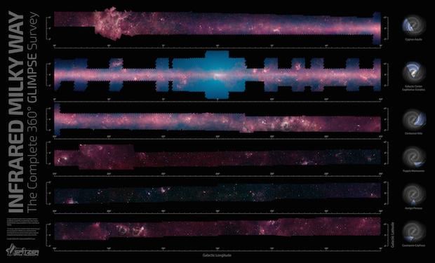
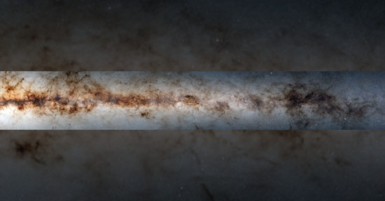
The largest star map ever made, some of which was showcased in a massive panorama of the Milky Way Galaxy earlier this year, has now grown even larger thanks to the tenth data release from the Department of Energy’s Dark Energy Spectroscopic Instrument (DESI) Legacy Imaging Survey.
As spotted by Digital Trends, the DESI Legacy Imaging Survey expands on the data included in two earlier companion surveys: the Dark Energy Camera (DECam) Legacy Survey and the Beijing-Arizona Sky Survey.
“Jointly these three surveys imaged 14,000 square degrees of the sky visible from the northern hemisphere using telescopes at NSF’s NOIRLab’s Kitt Peak National Observatory (KPNO) and Cerro Tololo Inter-American Observatory (CTIO) in Chile,” NOIRLab explains.
This new data release adds to that and bolsters the sky and wavelength coverage of already completed surveys.
“Most notably, the tenth data release focuses on integrating new imaging from DECam of the southern extragalactic sky, especially in areas away from the Milky Way’s disk, which are ideal for looking far into the cosmos,” NOIRLab says.
“This ambitious six-year effort involved three telescopes, one petabyte (1000 trillion bytes) of data, and 100 million CPU hours on one of the world’s most powerful computers at the US Department of Energy’s National Energy Research Scientific Computing Center.”
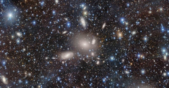
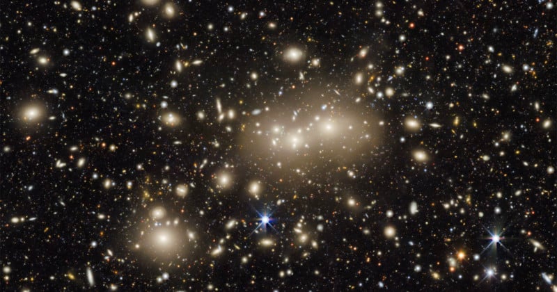
The image above is centered on what NOIRLab describes as a relatively nearby galaxy cluster called Abell 3158. The light emitted from the stars and galaxies in the photo have a redshift value of 0.059, meaning that it traveled approximately 825 million years before Earth-based telescopes saw it. It is just one small part of the DESI Legacy Imaging Surveys that has taken six years to get to this point.
Thanks to this additional data, the Legacy Surveys expands to over 20,000 square degrees, which is almost half of the total visible night sky. NOIRLab says that in addition, the new release includes images of the sky taken in an additional color filter, which is able to sample infrared light just redder than what the human eye can see, which means that the data is more useful to a wider range of scientists.
“The addition of near-infrared wavelength data to the Legacy Survey will allow us to better calculate the redshifts of distant galaxies, or the amount of time it took light from those galaxies to reach Earth,” Alfredo Zenteno, an astronomer with NSF’s NOIRLab and principal investigator of DECam eROSITA Survey (DeROSITAS), says.
“Anyone can use the survey data to explore the sky and make discoveries,” Arjun Dey, an astronomer with NSF’s NOIRLab, adds. “In my opinion it is this ease of access which has made this survey so impactful. We hope that in a few years the Legacy Surveys will have the most complete map of the entire sky, and provide a treasure trove for scientists well into the future.”
Image credits: DESI Legacy Imaging Survey/KPNO/NOIRLab/NSF/AURA; Image processing: T.A. Rector (University of Alaska Anchorage/NSF’s NOIRLab), Jen Miller, M. Zamani & D. de Martin (NSF’s NOIRLab)