Stunning Instagram Page That Posts Satellite Images Moves Toward Video
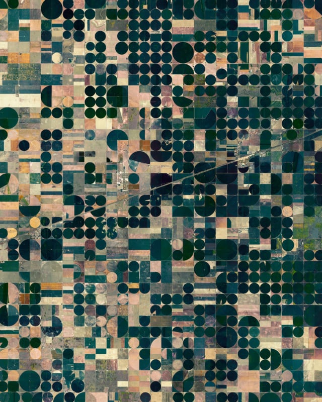
From the construction of a public park in Manhattan to the Yarlung Tsangpo River changing course on the Tibetan Plateau, the Daily Overview uses satellite imagery to create stunning images that detail how the world is changing.
The account has over 1.3 million followers on Instagram and founder Benjamin Grant tells PetaPixel the page has had to create video content to keep up with recent changes on the platform.
“This is a recent pivot in content strategy,” Grant says. “For years we’ve been doing still satellite images using source material from a number of different satellite companies we work with.
“The videos have been within the past couple of months, Instagram has really been prioritizing videos over stills. We were looking for a way of relative content while still sticking with the theme of how humans have impacted the planet.”
When scrolling through the Daily Overview’s feed there is marked shift toward video from late May this year, around the same time Instagram began testing its TikTok-like feed.
“I hope they don’t lose what made them special at the beginning which is the ability to share beautiful photography. It is I think being lost as it moves toward videos,” Grants explains in a phone call with PetaPixel.
“I have mixed feelings about it because this series is doing well for us and were attracting new followers. It feels weird that to do that they’ve had to punish people who post photos.”
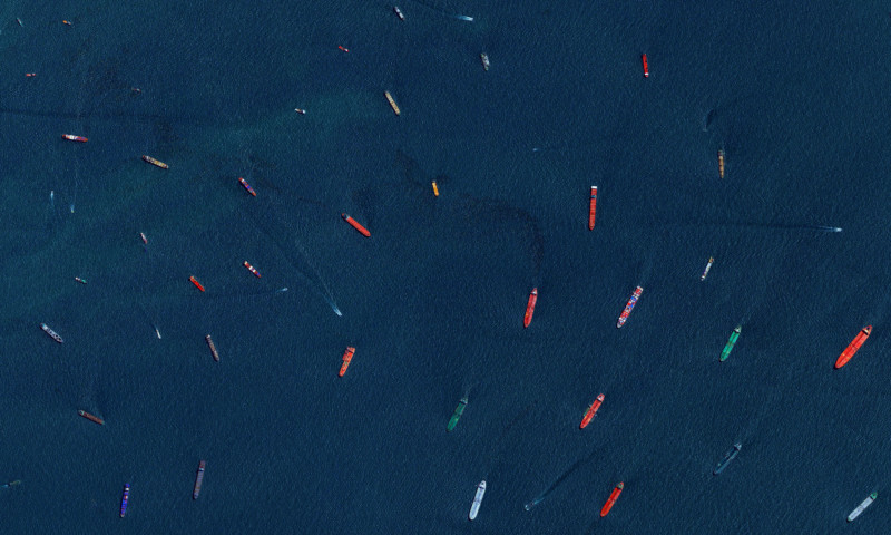
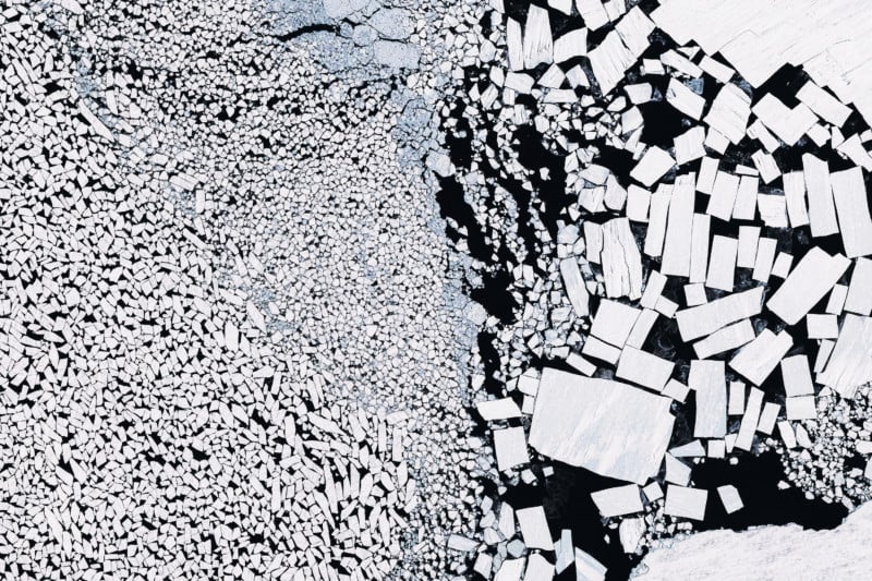
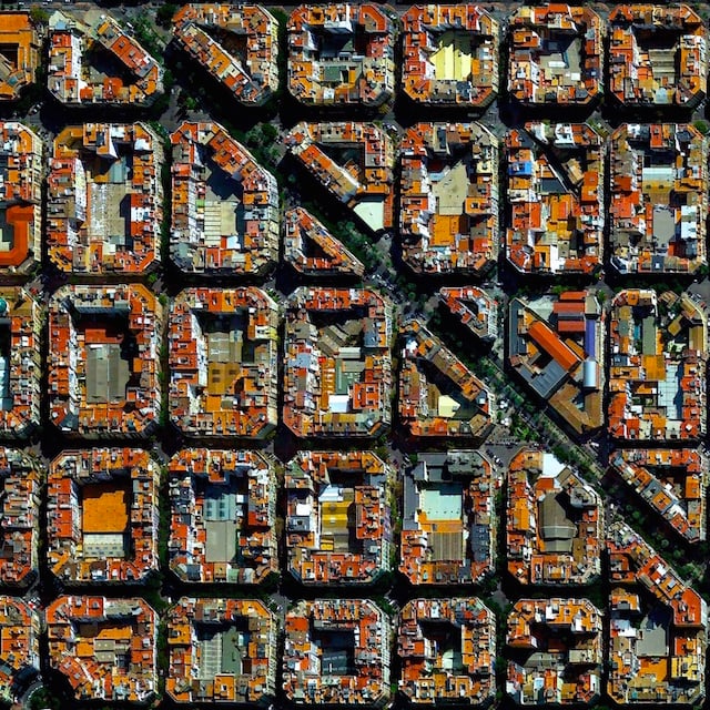
Grant has certainly posted some remarkable images since the project started almost 10 years ago. Breathtaking overhead pictures of electric cities such as Istanbul, Santiago, and Barcelona were a staple of the account until recently.
“Our pictures posts have been decreasing, but the videos really show how much change has taken place in such as short space of time,” Grant adds.
How The Images Are Created
To create the unique pictures Grant draws upon multiple resources, including Google Earth Engine Landsat data from NASA. The team have also struck a number of partnerships with satellite companies, a space that is growing.
“It’s changed a lot in the last nine years,” he explains. “In the beginning, I had to make a case for myself to get access to one company’s archives. But now I work with four different companies and an aerial imaging company. There are more brands entering the space and they’re competing with each other so we can work with all of them.”
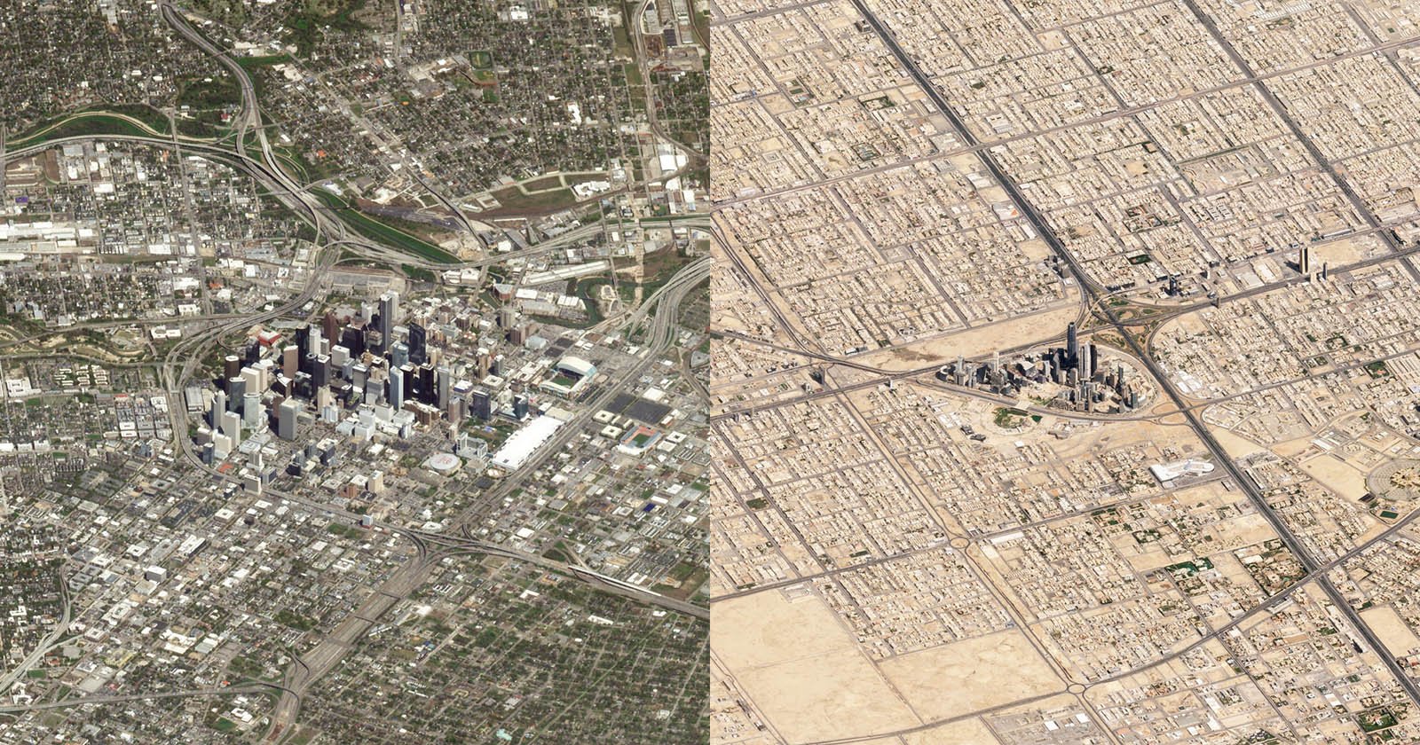
Despite being pushed into video by Instagram’s algorithm changes, Grant admits that video is the best way to understand what is happening in these places.
“You can go there and see the exposed water lines and get a sense of how the water levels look really low. But to get an idea of how much it has changed you need to look over it and it can truly provide a whole idea of what has taken place.”
To get the amazing images, Grant might use 30 to 50 tiles that have to be stitched together in Photoshop to get the high resolution. He also implements typical picture editing such as color correction and image dehazing.
“I never change an image so much that it’s not real. But just as any photographer would take their photos from a DSLR and put them in post, it’s the same kind of deal.”
Grant never expected to become an artist or photographer, especially when he was working as a consultant on brand strategy. He’s entirely self-taught as far as photography goes and believes that doing is the best form of learning.
“I think I really believed in what this perspective is able to show in the beginning. If you do something over a thousand times you really start to hone in what makes a good composition to bring out the true potential. My unique approach to this is that I viewed the data as a work of art rather than just data.”
More of the Daily Overview’s can be seen on its website and Instagram.
Image credits: All photos by The Daily Overview.