How to Use Google Earth for Extremely Detailed Location Scouting
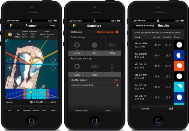
There are a lot of great location scouting tools out there. But while PhotoPills and The Photographer’s Ephemeris do an amazing job and are packed full of useful features, photographer Tony Northrup explains why he prefers to use something else that’s completely free: Google Earth.
Northrup still uses PhotoPills and TPE, but as he explains at the beginning of the video above, he knows of no mobile application that can paint a complete picture when you’re location scouting. That’s why, when he’s doing some serious scouting ahead of a trip or photo shoot, the application he prefers is Google Earth for the Mac or PC.
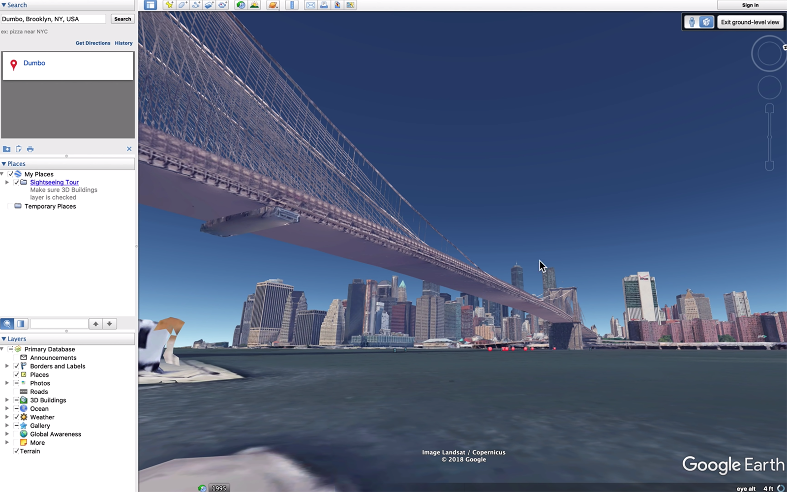
Using the app’s ground-level view (not Street View) you can navigate a location, change your “focal length” by zooming in and out, and chart the location of the sun and milky way a specific days and times. You can even see the “eye altitude” in the bottom right-hand corner. In other words: you can fine-tune your exact composition, walking around a realistic 3D rendering of the spot you’re planning to shoot.
Check out the full video for a demo of Google Earth in action as a location scouting tool, or pick up a copy for yourself here. And if you have any additional location tips of your own to share, drop them in the comments!
(via Fstoppers)