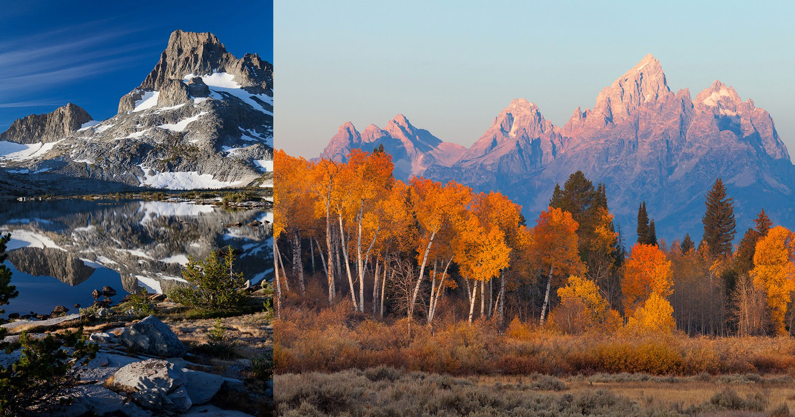
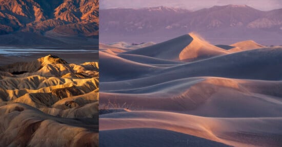
How to Do Armchair Location Scouting for Outdoor Photos
Being an accomplished photographer means developing a range of complementary skills all of which combine in an agreeable process that, hopefully, results in good photographs.
I put it to you that one of the most underrated, or at least under-appreciated skills in photography – is location scouting. The ability to seek out new locations, and to boldly go where no photographer has gone before, can be what pushes your landscape photography to the next level.
If you want to stand out from the crowd and take photographs that will catch the eye then you need to find and photograph new locations. Then you need to keep that location under your hat so that lazy bastards who won’t put in the leg work can’t ruin it for you.
The good news is that in this day and age we can put the power of technology and the Internet to use by location scouting from the comfort of the sofa.
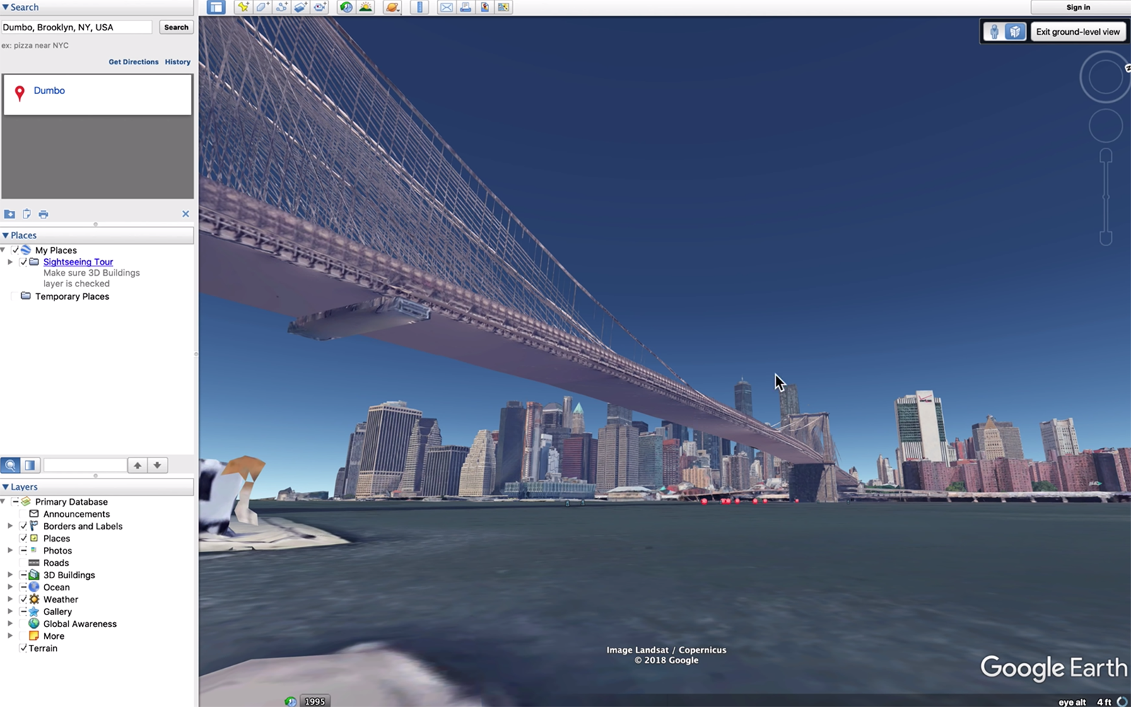
Google Earth Pro
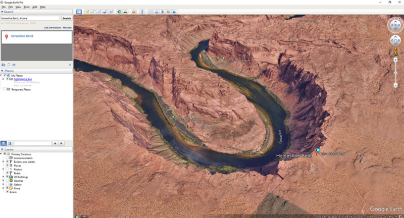
Cost and availability: Available for free from Google.
The venerable Google Earth has been around for many years now and, if I’m being honest, its interface reflects that. First released in 2005, it has gone through some changes over the years but remains a flexible way of scoping out interesting new geographic locations.
There is the familiar web version that can be used on anything with a browser, but to really put this powerful application’s tools to full use, you should download the desktop application. It’s available for Mac, Windows, and Linux and is completely free.
Its primary use is for visualizing locations with accurate height data. The app overlays satellite imagery on terrain maps to show actual relative heights in an easily understood visual way. And while the age of the satellite imagery varies, it’s less important when you’re viewing natural landscapes as opposed to cities.
Google Earth Pro makes it possible to investigate a particular location and get a sense of the kinds of angles and compositions possible at any origin point of your choosing. There’s no need to second-guess whether a composition is possible since you can place yourself there (virtually) and see for yourself.
The app can also be extended through the use of third-party layers and KML files that can be downloaded separately. For instance, you can enable a layer to show the borders of national parks and recreation areas so you can differentiate between private and public land.
You can also use Google Earth Pro in conjunction with hiking and trail walking apps to overlay your exact route on Google Earth and do pre-hike reconnaissance of the location and identify cool places to stop.
For astrophotography, Google Earth Pro enables you to simulate the location of the Milky Way and the night sky from any location you choose by scrubbing back and forwards with the day-to-night slider. The Sun’s location in the sky is accurately rendered, but the location and size of the Moon and the Milky Way are not accurately rendered and cannot be relied upon for pre-planning visibility.
Using the day-to-night slider it’s also possible to accurately see how the shadows fall in a particular location. If you’ve ever been caught out by the shadows of a hill or mountain, this is a hugely beneficial feature.
Microsoft Flight Simulator

Cost and availability: Available for $89 on PC and Xbox.
Flight simulators sure have come a long way since the genre was born back in the mid-80s. And for as long as there has been a flight simulator scene, Microsoft Flight Simulator has also been there. Incredibly, it was first released 40 years ago, way back in 1982.
Over the decades the simulator has grown in complexity and vision and so detailed and accurate are the landscape renders in the current version, that it’s now ideal for location scouting.
The game incorporates a complete model of the world and, depending on where you’re looking, properly up-to-date satellite imagery that is mapped onto accurate elevation data.
Using satellite imagery from Bing with accurate terrain mapping, it’s possible to visualize a scene with unprecedented accuracy. To get an idea of how close to reality the visuals are, check out this thread on Reddit comparing the game with real life. The detailed town and city rendering of the app also makes it ideal for urban photography scouting and planning.
When it comes to scouting locations you can either simply fly there, or enter waypoints. If you’re a photographer that uses drones, then Microsoft Flight Simulator is a terrific way to scout a location since you can fly at the same 120m ceiling. And if you shoot video too then you can pre-visualize entire sequences.
One benefit of using this game for location scouting is that it includes accurate weather data displayed in real time. So for instance, if you were thinking of going out and flying your drone at a location, you could fire up the game, fly to the location, and view the scene at 120m in close to current real-world conditions.
PhotoPills
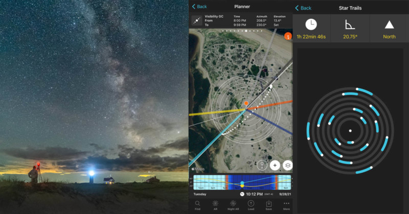
Cost and availability: Available for $10.99 on iOS and Android from PhotoPills.
There are several apps that are designed to make a photographer’s life easier, but few of them are as comprehensive as PhotoPills. The app gets its name from the idea that there are areas of a photographer’s life that need fixing and this app has the ‘pills’ to remedy them.
PhotoPills enables you to view accurate location information for everything related to the sky. Sun and moon rise and set locations, Milky Way, meteor showers, eclipses – even the international space station.
You can search visually for any location or just type in the name and view precisely where the sun is going to rise and set. And of course, you can do this for any date of your choosing past, present, and future. For technical shots when you want to photograph a celestial object such as the moon in a particular position in the night sky, such as above a lighthouse, it’s the ideal planning tool.
In terms of location scouting, the app’s ideal for simple yes/no exploration. For instance, you can work your way along a stretch of coastline, moving the origin pointer as you go, in order to find the perfect spot with the visibility you require.
The app also enables you to plan cool shots in reverse. So rather than seeing where the sun will be on a particular time and date at a particular location, you can dial in *where* you want it to be and see the corresponding time and date information.
The developers recently added a drone mode to the app which enables you to pre-visualize a shot accurately at the height you plan to fly, using your specific drone’s field of view.
The augmented reality tool is a great visual way of pre-planning any shots. So for instance, you can stand in a location during the day, hold up your phone up to the sky and see where the Milky Way will be later on during the night.
The app also includes depth of field calculator, a star trail simulator, a field-of-view calculator, a hyperlocal table, a subject distance calculator, and a timelapse planner.
Location scouting is as much about working out if there’s a shot to be had at a particular location as it is about shooting it and this app answers those questions.
Photographer’s Ephemeris
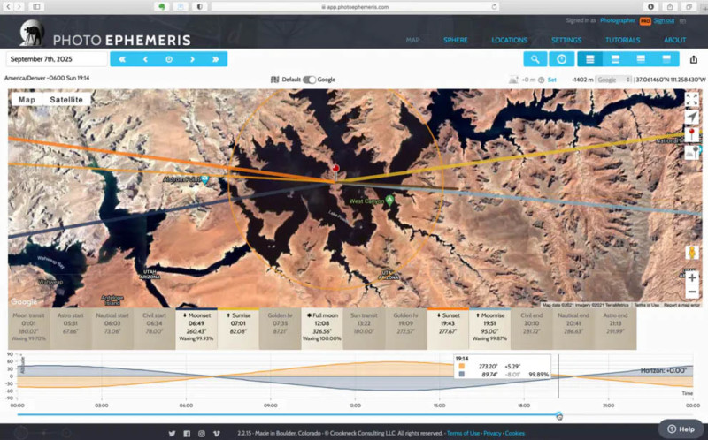
Cost and availability: Available for $14.99 on desktop and iOS from Photographer’s Ephemeris.
Before you pull the pin on a purchase of PhotoPills, you might also like to test out the Photographer’s Ephemeris. This iPhone-only app works along the same lines as PhotoPills but has a different interface and a simpler feature set that some photographers prefer.
While PhotoPills, which is a photographic toolbox, Photographer’s Ephemeris focuses purely on the light and where best to capture it. You can accurately track and predict the position and the light of the Sun, Moon, Milky Way, and other celestial objects. This makes it ideal for location scouting since it enables you to gauge the value of a particular spot for the photo you’re chasing, whether it’s a nice sunrise or a Milky Way shot.
Unlike Google Earth Pro, Photographer’s Ephemeris also accurately renders the Milky Way’s position so you can be sure of your shot before committing to visiting. And like PhotoPills, this app also includes an augmented reality feature so you can see precisely where the Sun, Moon, and Milky Way will be with the actual landscape as a backdrop.
The developers of this app have an online version that can be viewed in a web browser, but you’ll need to subscribe to the pro version ($50 per year) to see Sun, Moon, and Milky Way planning with Google Maps and 3D Terrain.
Local Flickr Groups
Cost and availability: Available for free online at Flickr.com.
There aren’t many places that someone hasn’t previously visited at some point or another, with a camera. So it’s always worth checking a site like Flickr to see if someone has been to a location previously and if so, what sort of photographs they took.
The local Flickr groups are always worth checking out if you’re visiting a location for the first time since you can get an idea of what the possibilities are. These highly regional groups have increased in popularity since SmugMug’s purchase of Flickr and they often contain a wealth of local knowledge that you can tap into.
You don’t necessarily have to go to the exact same location as those in the photographs, in fact, I’d encourage you not to, but it’s still useful to get a feel for the location and perhaps spy out some other spots that you can point your camera at.
AllTrails
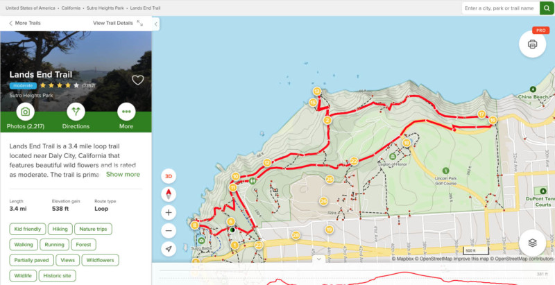
Cost and availability: Available for free (or a $30 pro subscription) on iOS, Android, and Web from AllTrails.
My final pick is another app and while this one isn’t made specifically for photographers, it’s still extremely useful.
AllTrails is a hiking app that includes a massive database of hikes and walks all over the world. After all, most landscape shoots begin and end with a hike and so there’s an obvious benefit to trail apps like this.
Apart from directing you along a particular hike, the app includes photographs taken by other people who’ve visited this location. Simply search for the location you want to visit, view the track on AllTrails and you’ll see photographs taken at various waypoints along the trail.
You can view the trails in the app or on the website but both have a photos tab where you can view a gallery of images shot by other people who did that particular walk. There’s also a Pro version of AllTrails which enables you to download maps and see air quality and weather details, but the excellent basic version is free.
And if you pony up for the, really quite reasonable, $30 per year for the Pro version to get the downloadable maps – then you can export these trails as GPS files and import them into Google Earth Pro for more advanced photo planning.
The Shot List
Above and beyond the options I’ve just listed, I also maintain an entry in my Apple Notes app for locations that I might like to check out. I get inspired by TV shows and YouTube videos and have gotten into the habit of adding locations to my list so that I don’t instantly forget about them after the show’s over.
Quite often location scouting is impromptu and accidental, rather than planned and so when I’m driving somewhere and I see a cool-looking spot, I add a GPS pointer to the note so I can easily find it again. And whenever I’m on a train, traveling through the countryside, or in a plane flying above it, I mark interesting-looking locations so I can locate them again.
I find my shot list useful for getting out of a photographic rut. It also helps me to resist the urge to return to the same locations again and again.
However you go about your location scouting, it’s an important skill to develop, since it means you can score shots of cool new locations, rather than the same old tried-and-tested well-known sites. Beginning that search at home can save a lot of wasted time and effort and maximize the value of the time you do spend out in the landscape with your camera.
About the author: Andy Hutchinson is a landscape photographer, blogger, and YouTuber based in south coast NSW, Australia. You can find his website here and his YouTube channel here.