Photographing and Backpacking Through Gates of the Arctic National Park
Seeking a wilderness escape from the global pandemic, three friends embarked on a journey to one of the wildest and most scenic areas on the continent: Gates of the Arctic National Park. Two of the members, Matt Meisenheimer and Max Foster, are professional landscape photographers and spent years studying the park for compelling mountains and rivers to photograph. This is their story.
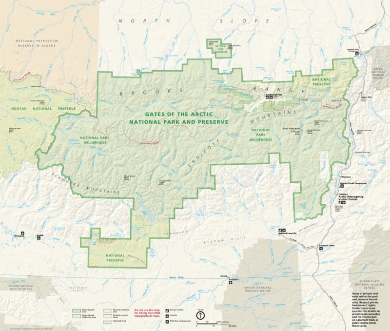
Gates of the Arctic National Park is located in northern Alaska, beyond the Arctic Circle. It is the least visited national park yet the second largest in the United States park system. Only 10,000 people visit the park each year and many of those visits are day trips via bush plane. For those who put the effort in, Gates of the Arctic features incredible mountain and arctic landscapes with abundant wildlife and wilderness solitude.
Access is challenging, though. There are no roads or trails in the park; it is pure wilderness. To visit and truly experience the place, backpacking or rafting is required.
After digitally scouting, studying maps, finding accessible areas, and reading trip reports, the group settled on late August to make their journey. Since the park is above the Arctic Circle, fall comes early. In late August, the tundra comes alive with vibrant reds, oranges, and yellows as winter approaches. Since the group planned the trip during the 2020 pandemic, their entire schedule was canceled and rebooked several times. But after months of preparation, they successfully embarked on the Alaskan adventure.
The 11-day trip included four bush plane flights, 50-plus miles of hiking, and 25 miles of pack rafting.
Trip Summary
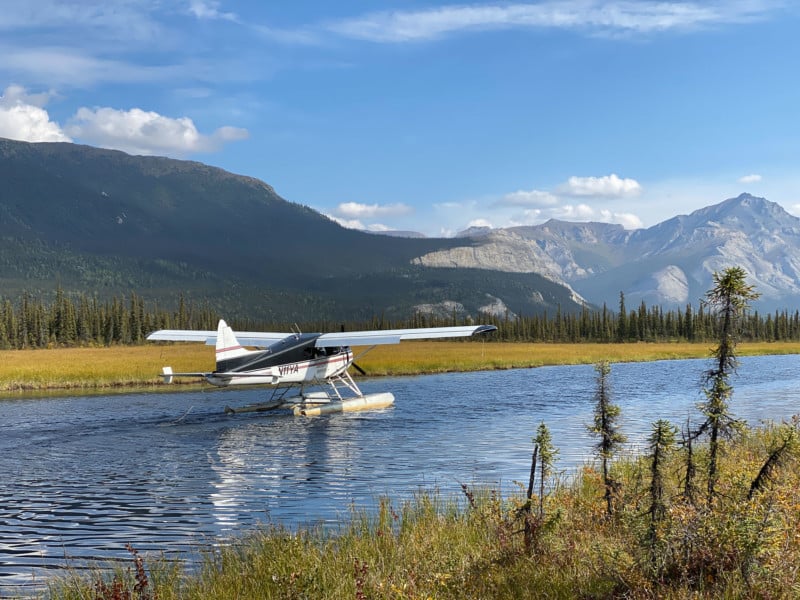
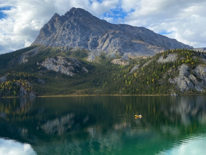
Access is difficult in the Gates and the biggest challenge is finding a suitable drop-off and pick-up point for trips. The group took bush planes from Bettles, Alaska, a very small town north of Fairbanks and they chose to be dropped off at Circle Lake, a small body of water near the Alatna River.
Due to the small size of the lake, the group could not be picked up from the same location since the plane could not gain speed quickly enough for a takeoff. That necessitated a pickup at Takahula Lake and a 25-mile pack raft trip down the Alatna River.
![]()
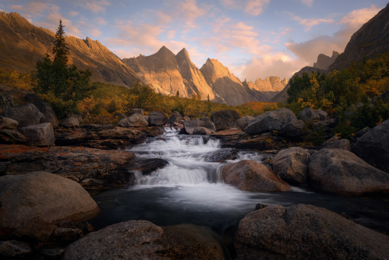
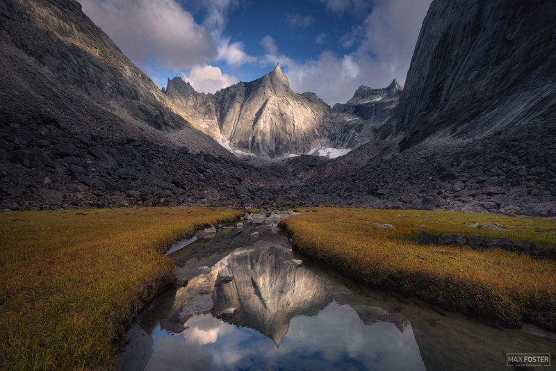
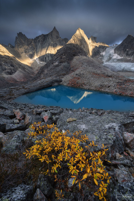
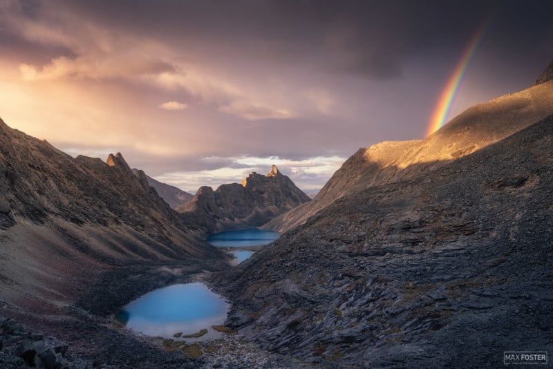
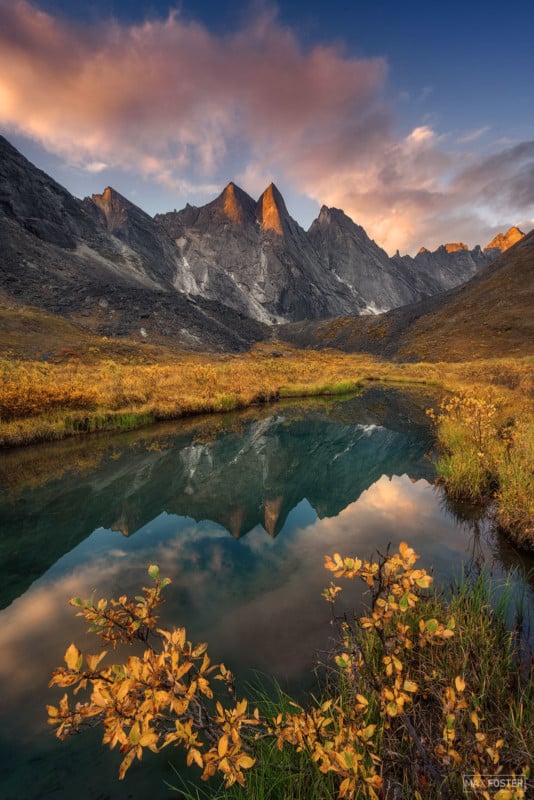
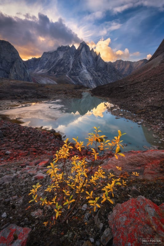
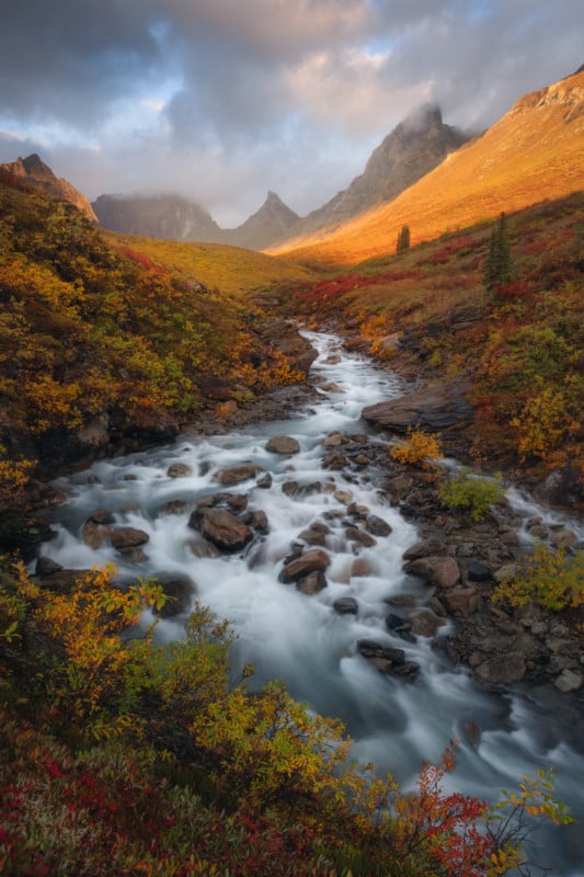
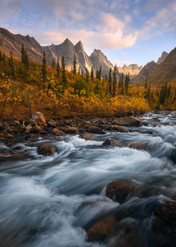
With 11 total days, most of the time was dedicated to backpacking into the valley of Arrigetch Creek and surrounding areas. Arrigetch means “fingers of the outstretched hand” in Iñupiaq and that name is very fitting considering the jagged and sheer vertical walls of the peaks. The group focused their energy on capturing these magnificent peaks in the best light possible and were blown away by the wild beauty of the far north.
In Their Own Words
We spent an incredible 11 days in the Arrigetch Peaks region and were treated to fantastic weather and light. We got extremely lucky, as this region experiences harsh weather year-round. We had mild temperatures with lows in the 30s and highs in the 50s. We were prepared for single-digit temperatures, but never had to face them. One other benefit to the far north is that it stays light late into the night. We never needed headlamps due to the perpetual twilight.
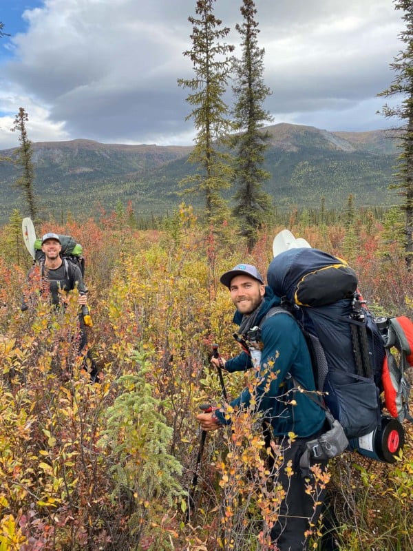
Since there are no trails in Gates of the Arctic, we spent our backpacking days creating our own paths. We did find a game trail here and there, but bushwhacking was the primary mode of travel. Our most difficult hiking occurred on the first and last day in the lower elevations of the tundra. We were forced to hike over what are called “tussocks,” which look like something out of a Dr. Seuss book. They are balls of tundra that are unstable and elevated over what is usually a wet area. They make for nightmarish hiking because you sink into them every step, oftentimes losing your balance completely and stepping into a nearby hole (that’s also usually filled with water). On our last day, we ran into a combination of tussocks and thick birch brush in an expansive wetland. We covered one mile in about three hours that day, to give you some idea of the slow going when the terrain is tough.
The majority of our trip was spent in the alpine where hiking was much easier. We scrambled over scree fields and hiked on the hard tundra, where vegetation was minimal. The hiking was still difficult, though, due to the elevation gain, stream crossings, and very slippery and unstable boulder fields.
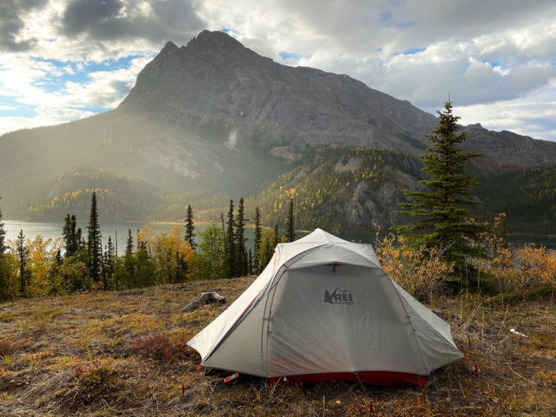
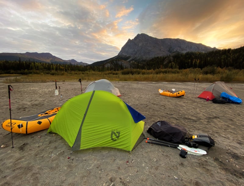
Once in the alpine, we established four different camps from which we based our photography excursions from. This allowed us to travel light and return to camp after shooting sessions. With peak fall colors, we were rewarded with magnificent colorful views. The peaks in the Arrigetch are some of the sheerest and most jagged in existence, and we were constantly in awe of our surroundings.
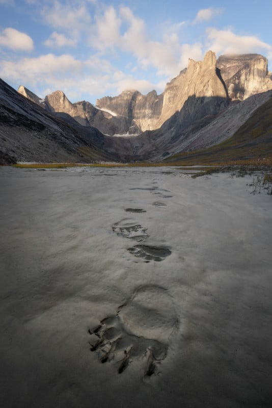
The park does have a healthy grizzly population, so safe bear practices were necessary. The park also alerted us that there was a curious bear in the general area we were headed into, so we were diligent. We did run into that bear twice during our trip but had no issues. Our entire group used Ursack bags to store our food properly. Ursack bags are great because they are effective and lightweight compared to a bear canister.
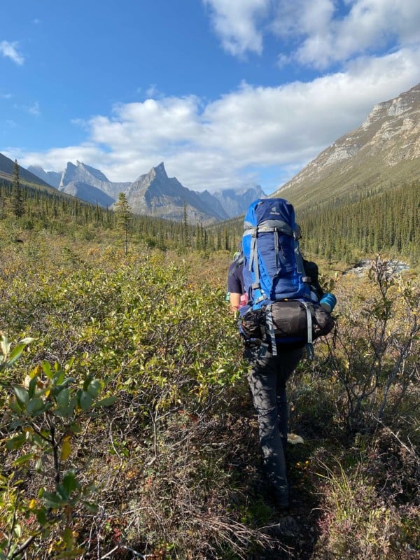
One of the most difficult aspects of a trip such as this is weight. Being in the field for 11 days means you must be self-sustainable and carry all necessary items with you. When you’re burning calories hiking, you need to eat a lot, and having enough food is extremely important. So, carrying food for 11 days instantly puts the trip in strenuous territory.
We averaged 2.5 lbs of food per day so our food alone was around 25 pounds each. Add in camping, photography, and packrafting gear and you get heavy packs! Fully loaded with rafts was over 75 pounds, but luckily every day we ate our weight away.
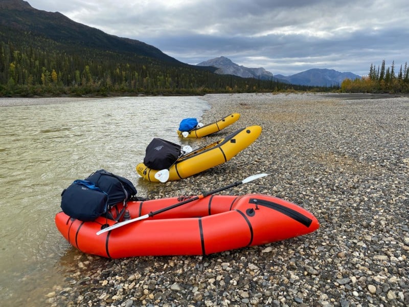
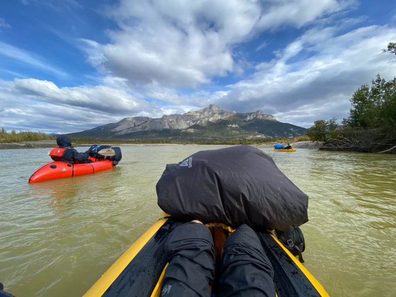
After an amazing experience in the alpine, we returned to our drop-off point on day 10 and grabbed our cached rafting gear. Caching our rafts allowed us to save some weight during the heart of our trip. On day 11, we bushwhacked to the Alatna River, inflated our rafts, prepared our gear, and put in. The Alatna is sometimes called the “Flatna” by packrafters. It is an easy paddle with no rapids. With the right wind, you can sometimes do five to six miles per hour in a raft. We had a headwind so paddling was required, but it was definitely easy water.
We rafted 25 miles and then took out right next to Takahula Lake. We spent one night camped along the Alatna River on a sand bed, and it was a beautiful evening. We had a fire on the beach and enjoyed our last moments in the park. On the final afternoon, we lazily floated on Takahula lake, resting our tired bodies. With mountains in every direction, it was an amazing way to cap off a strenuous trip.
Closing Thoughts
Overall, it was the trip of a lifetime. Traveling with friends in amazing places always makes for a great adventure. Though exhausting and challenging, the trip was highly rewarding. We were able to capture great photos of a remote and rarely seen area. Trips like these are like a reset button in today’s busy world. You can focus on your immediate surroundings without electronic distractions, work, and hectic schedules. These are the experiences that remind you how important wilderness is to the planet and soul.
About the authors: Max Foster specializes in creating unique images of our natural world, photographed in the best light and conditions possible. As an avid outdoors enthusiast, Max is passionate about adventure and is at home in the wilderness. Max’s work has been featured in numerous publications, and he has fine art print collectors worldwide.
Matt Meisenheimer’s photography revolves around finding unique compositions and exploring locations that few have seen. He enjoys merging his passion for outdoor adventure and photography. Matt is also a longtime photo guide at Backcountry Journeys.