Google Partners With the Environmental Defense Fund to Tackle Climate Change
Google is working alongside the Environmental Defense Fund (EDF) to better understand methane emissions and potential mitigations.
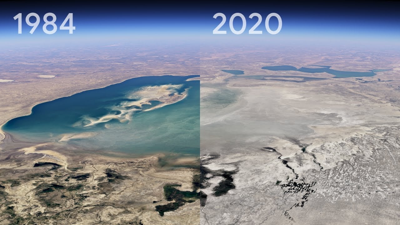
“Every year, our planet gets hotter because of greenhouse gas pollution. In fact, 2023 was the hottest year on record, and the last ten years have been the hottest years since 1850,” Google explains in a blog post. “Reducing this warming is essential to decreasing the risk of wildfires, drought and other extreme environmental events, and results in cleaner air and healthier communities.”
In view of this goal, Google and the EDF will combine their science and technology efforts to reduce methane emissions. Naturally, to reduce methane emissions, these emissions must first be adequately understood.
Methane from human sources is responsible for around 30% of global warming, and better detecting methane-producing sources across the world will help the EDF track, monitor, and ideally, reduce, methane emissions at their source.
Google’s cloud computing and artificial intelligence (AI) technology will help the EDF with this task. Google explains that the information it helps gather and analyze will also help energy companies, researchers, and lawmakers to take educated action to reduce emissions quicker and more effectively.
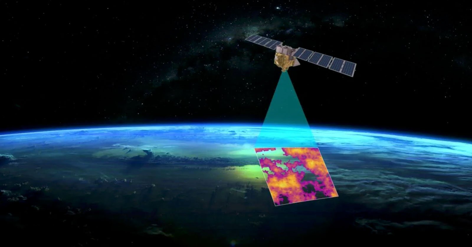
At the heart of the mission is the EDF’s new satellite, MethaneSAT, which will “map, measure, and track methane with unprecedented precision.”
MethaneSAT is scheduled to launch in March aboard a SpaceX Falcon 9 rocket. Once in orbit, the satellite will travel around the Earth 15 times a day at an altitude of more than 350 miles (563 kilometers). The satellite will measure methane levels in regions that produce the most gas and oil.

Google Cloud will power algorithms developed by EDF to monitor large and small methane-emitting sources alike, ensuring that a wide range of methane-emitting activity is accurately monitored and tracked over time. Scientists from Harvard University’s School of Engineering and Applied Science and Center for Astrophysics, alongside scientists at the Smithsonian Astrophysical Observatory, collaborated on the project.
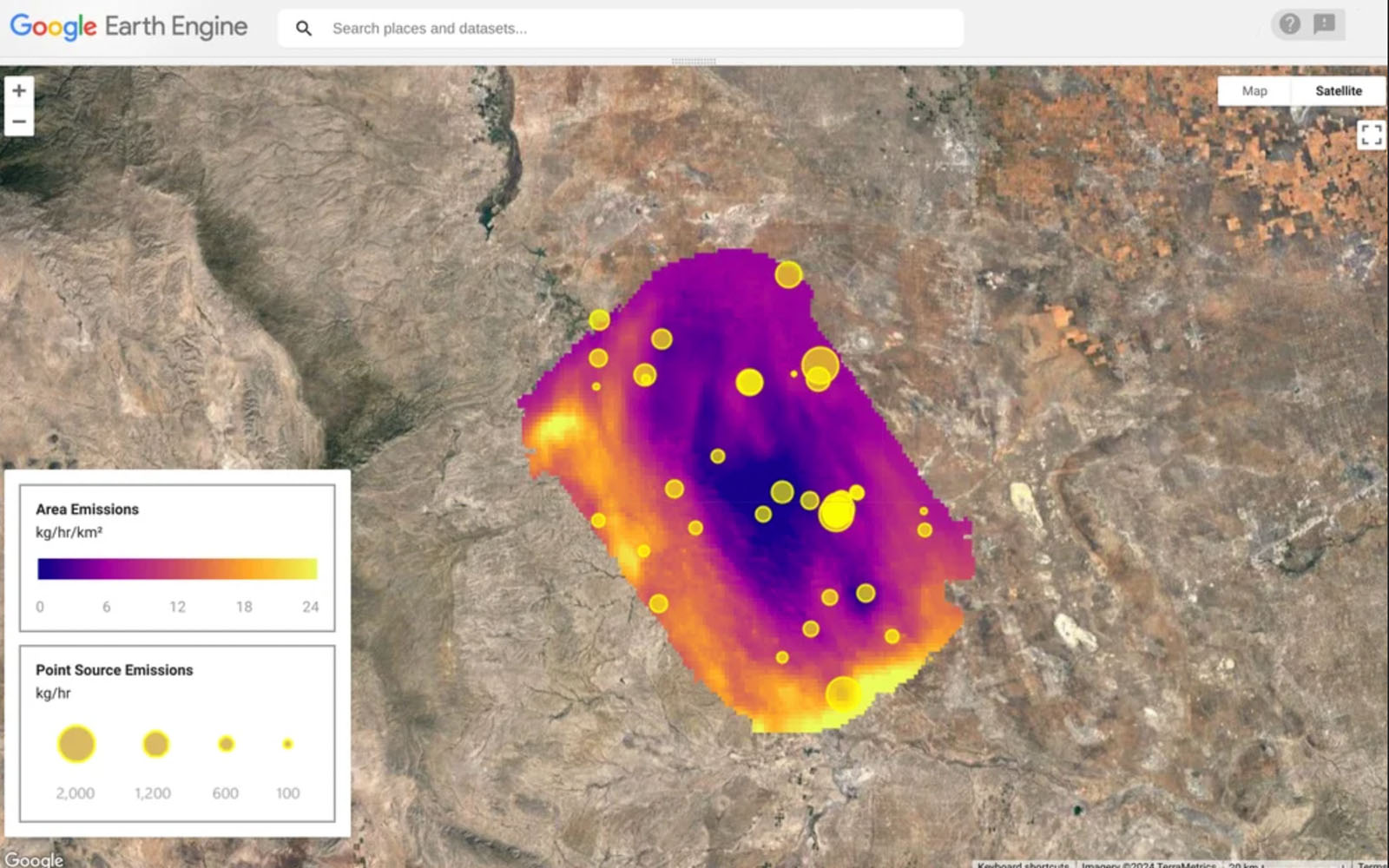
Google’s AI will also work with MethaneSAT to identify oil and gas infrastructure, including oil storage containers, in the imagery. This will work alongside EDF’s information database to locate sources of methane emissions.
“Once we have this complete infrastructure map, we can overlay the MethaneSAT data that shows where methane is coming from. When the two maps are lined up, we can see how emissions correspond to specific infrastructure and obtain a far better understanding of the types of sources that generally contribute most to methane leaks. This information is incredibly valuable to anticipate and mitigate emissions in oil and gas infrastructure that is generally most susceptible to leaks,” Google says.
“Figuring out how to address methane emissions is one of the biggest climate challenges we face today. We’re excited to share actionable information that is urgently needed to achieve real impact. This work is possible thanks to our partners at EDF.”
Image credits: Google and the Environmental Defense Fund