Declassified CIA Satellite Spy Program Reveals Lost Roman Forts
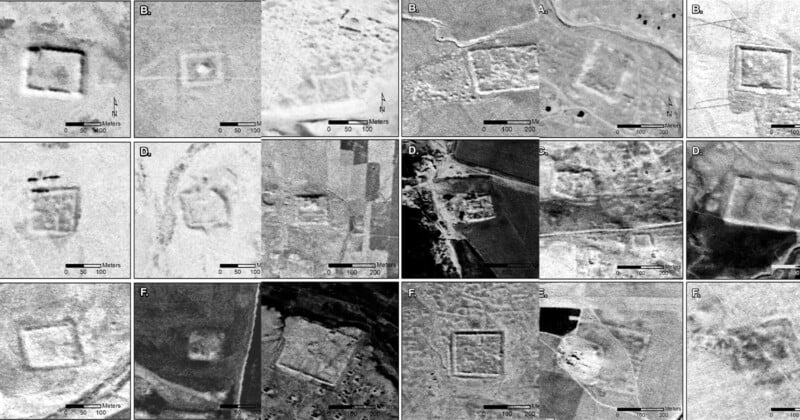
A declassified Central Intelligence Agency (CIA) satellite spy program has turned up hundreds of photos of ancient Roman forts in the Middle East — challenging a theory that is decades old.
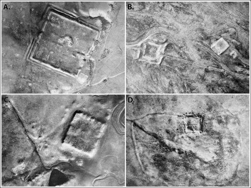
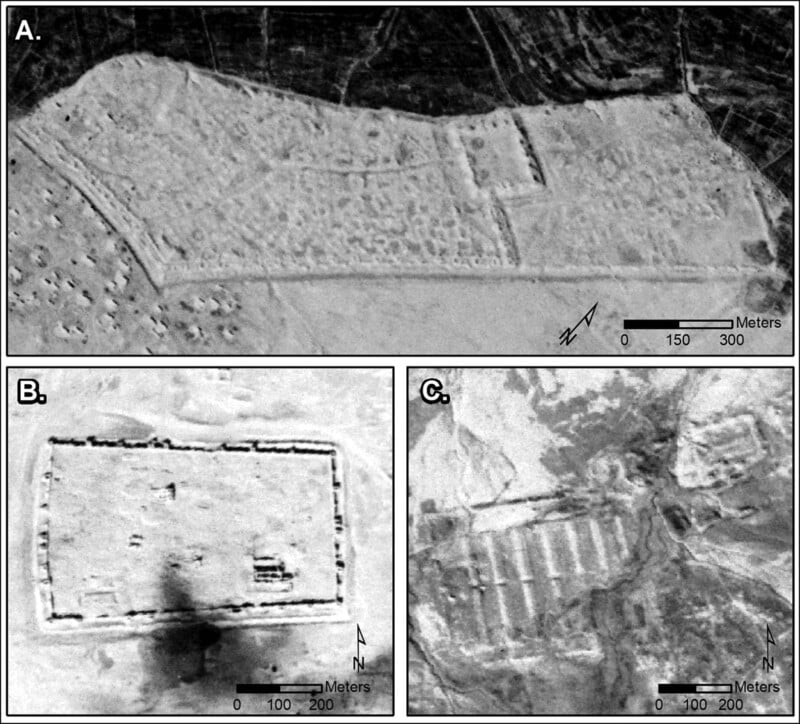
High-resolution images were analyzed in a new study that was taken by multiple satellites during two U.S. military programs: the Corona Project (1960 to 1972) and Hexagon (1971 to 1986).
Before the publication of the study in the Antiquity journal, it was believed that Roman forts in what is now Syria and Iraq were a line of defense. But this new data questions that hypothesis and suggests that the forts were actually for the safe passage of goods and people.
A 1934 study, conducted by French archaeologist Antoine Poidebard, suggested that the forts were established as a defensive line against the Parthians and the Sasanians.
However, researchers studying the newly discovered satellite imagery found that the forts did not follow a discernible north-south defensive pattern against eastern threats but were scattered throughout the region. This discovery supports the theory that these forts might have served as protectors of trade caravans, facilitating communication, and intercultural exchange.
Corona and Hexagon
The images from Corona were declassified in 1995 while Hexagon’s photos were released to the public in 2011.
Originally designed for military reconnaissance during the Cold War, these satellites provided high-resolution, stereo-perspective images, which makes them invaluable resources for archaeological research.
The landscape that the satellites captured has changed dramatically since the mid-20th century because of “urban expansion, agricultural intensification, and reservoir construction,” so say the study’s authors.
“Agriculture and urbanization have destroyed a lot of archaeological sites and features to a shocking degree,” lead study author Jesse Casana, tells CNN.
“This old imagery allows us to see things that are often either obscured or no longer extant today.”
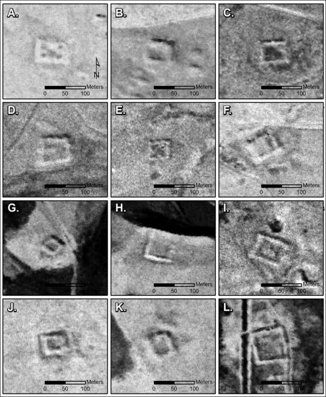
The newly-discovered Roman forts were built roughly from the second to sixth centuries CE. This period was marked by instability in the line of Roman imperial succession, border defense, and external pressures from nomadic groups.
The study may shed light on how the Romans managed their empire’s frontiers, as it suggests a balance between military defense and trade connections. The preservation of historical imagery, despite significant landscape changes over time, underscores the value of such data in understanding ancient civilizations.
Image credits: Courtesy Jesse Casana/Antiquity Publications Ltd