Photos from the First-Ever Ascent of Mt. Michel, an Ultra-Remote Volcano
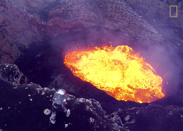
A team of National Geographic explorers led by Renan Ozturk and Emma Nicholson was able to reach the summit crater of Mount Michel — a remote stratovolcano — and confirm the existence of one of nature’s rarest phenomenons: a lava lake.
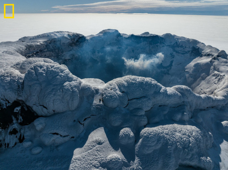
Nicholson personally stood near the rim of the crater at the top of Mount Michel and flew a drone over the mouth, confirming the lava pool below.
“Suddenly, we could see this small lava lake right deep down inside the crater,” Nicholson says in a story on National Geographic.
“It was certainly not maybe the lava lake that you’d naturally conjure to mind … but it was unmistakably lava close to the surface, feeding the gas plume we were measuring.”
Lava lakes are large volumes of molten lava that are at all times wholly or partially molten. Basically, a steady state of lava. This phenomenon is rare since lava tends to cool quickly when it reaches the surface and hardens. In order for a lava lake to exist, “the balance between heat coming up from within the vent system of the volcano must be perfectly balanced with the rate of cooling to keep the lava in its molten state,” Nicholson explains.
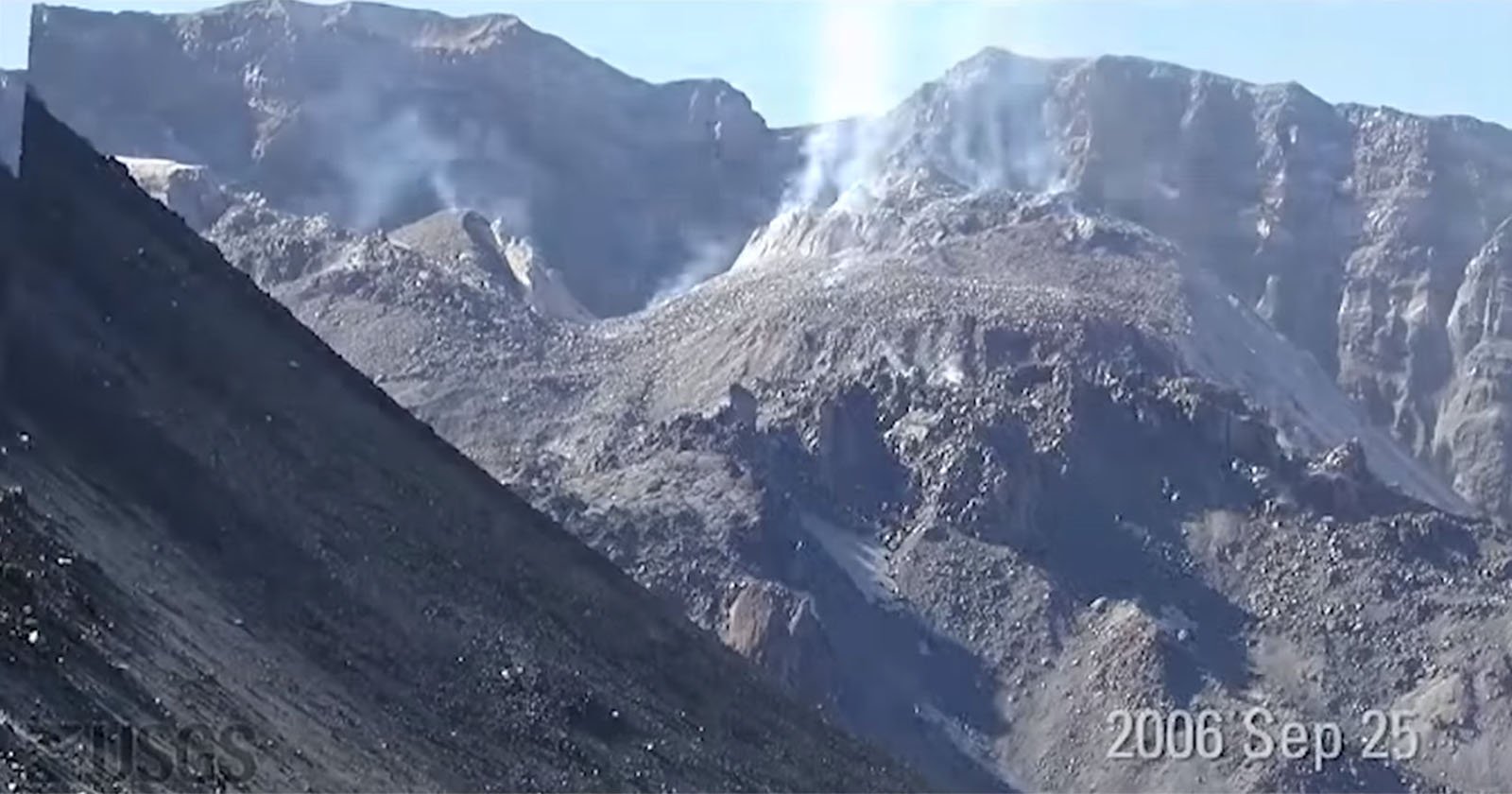
There are only eight volcanoes on Earth that are known to have a persistent pool of liquid lava: Kilauea, Masaya, Villarrica, Mount Nyiragongo, Erta Ale, Mount Erebus, Ambrym, and Mount Michel.
There has been talk about the unusual state of Mount Michel in the scientific community since the late 1900s, but in 2019 the possibility that there might be a lava lake within it was visible from high-resolution satellite imagery, though no one had actually been there to see it in person.
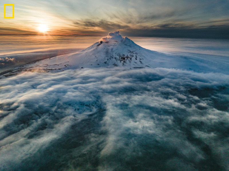
Mount Michel is particularly remote and is part of a chain in the uninhabited South Sandwich Islands about 1,000 miles north of Antarctica.
It took them months of planning and weeks of travel just to get there.
“If you stand on Saunders Island,” says Nicholson, “your closest other humans are on the International Space Station. That’s the definition of remote.”
The National Geographic expedition sailed 1,266 miles from the Falkland Islands to bring scientists and photographers to Mount Michael in order to verify the lava lake that had been indicated by satellite photos.
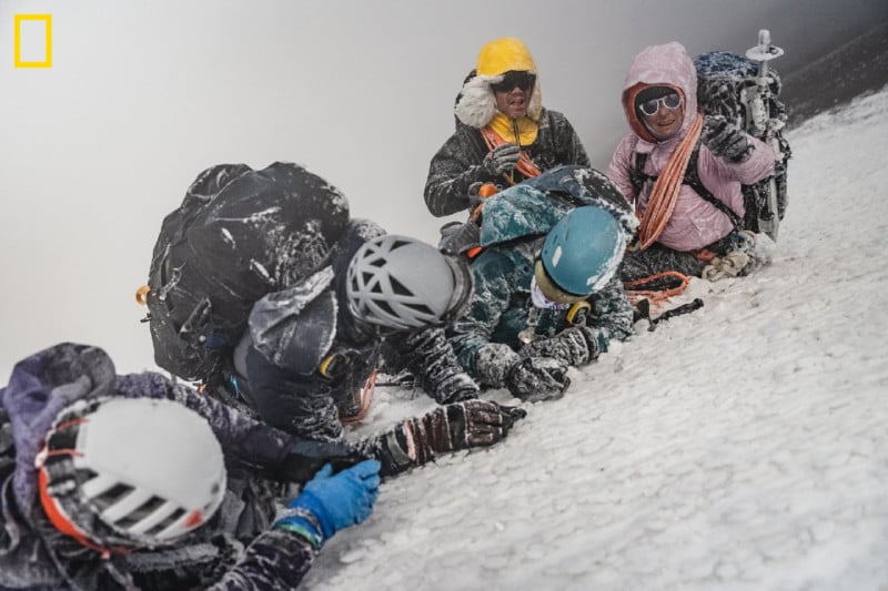
No one visits the area as it is incredibly difficult to get to, and once there, the conditions are rough even though the peak is only 2,766 above sea level. The National Geographic team reported between 45 and 60 mile per hour winds and 90% humidity in the form of a thick fog. The conditions left them with just a one or two hours where reduced winds and better visibility presented and allowed the team to operate drones, thermal cameras, a multi-gas sampling system, and other instruments that were used as part of the study.
For more on this story including a full account of the expedition and additional photos, visit: NatGeo.com.
Image credits: Photos by Renan Ozturk, National Geographic