Satellite Photographs Showing the Rapid Spread of Humans Across the Earth

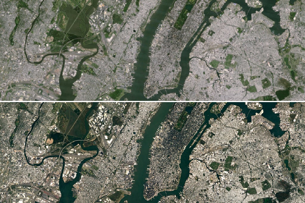
2008 marked the first time in history that more of Earth’s population lived in cities rather than in the countryside, and by 2050 nearly 70% of the world’s population will reside in large cities. A new series of satellite photographs captured decades apart by NASA’s Landsat department and the U.S. Geological Survey offers a striking look at how human cities have spread across the face of the Earth in just a few short years. The image above shows Las Vegas in 1984 and in 2011.
Tokyo, Japan — 1989/2011

Chandler, Arizona, United States — 1985/2011

Tehran, Iran — 1985/2009

Dubai, United Arab Emirates — 2000/2010

Back in March we featured a similar time-lapse video showing Las Vegas growing through satellite imagery. You can find the rest of this photo series over on CNN.
Related Articles


Discussion