Satellite Photos Show New Island Forming From Melting Glacier in Alaska
Alaska’s newest island can now be seen from space in recently released satellite photographs from NASA.
NASA released a series of images that revealed how a melting glacier created a two-square-mile island in southeastern Alaska over the summer. The island, now known as Prow Knob, was once part of a frozen landscape dominated by the Alsek Glacier.
Over the summer, as the glacier retreated and meltwater filled the area, Prow Knob was left standing on its own, surrounded by water.
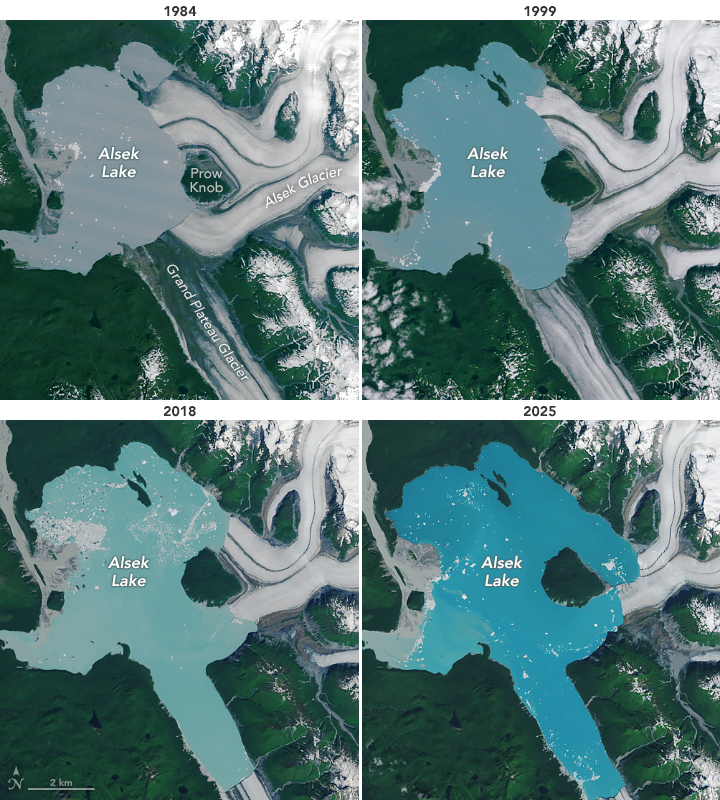
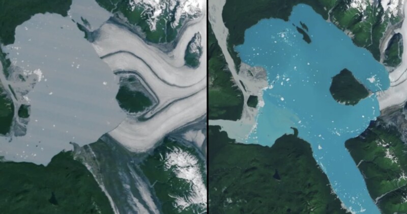
NASA’s Earth Observatory compared current images with those from the early 1980s. In the older photos, the Alsek Glacier almost completely enclosed Prow Knob, with only one side bordered by Alsek Lake. This summer, satellites captured the moment that the glacier finally pulled away, leaving Prow Knob isolated within the lake.
The change is part of a much longer trend. Over the past 40 years, aerial and satellite records have tracked the steady eastward retreat of the Alsek Glacier, along with the shrinking of another ice mass to the south, the Grand Plateau Glacier. As both ice sheets receded, meltwater filled the gap, and Alsek Lake expanded into the space once occupied by glaciers.
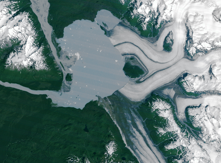
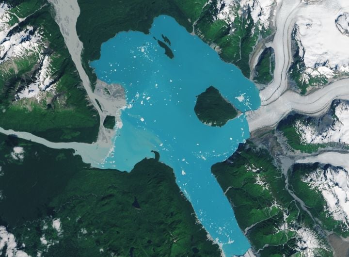
The process ended this summer when NASA’s Landsat 9 satellite captured the last section of ice separating Prow Knob from the lake sometime between July 13 and August 6. With that, the mountain became a true island, entirely enclosed by lake water.
Today, the new island sits in the middle of Alsek Lake, which is almost twice as large as it was four decades ago. The lake continues to grow as it is fed by melting glaciers.
This change is a clear example of climate change, as higher temperatures and melting glaciers alter Alaska’s landscapes. The state is warming two to three times faster than the global average, with its glaciers losing more than 66 billion tons of ice every year.
Image credits: All photos by NASA Earth Observatory. Images by Michala Garrison, using Landsat data from the U.S. Geological Survey.