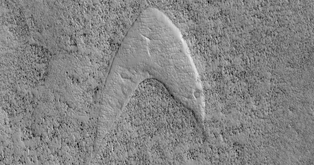
Satellite Spots ‘Star Trek’ Starfleet Logo Among Dirty Sea Ice
A photo taken by NASA’s Earth Observing-1 satellite in 2012 has resurfaced thanks to a bright white patch of sea ice that resembles the iconic Star Trek Starfleet logo.
The photo was taken hundreds of miles above Foxe Basin, a body of water north of Hudson Bay in Nunavut, Canada when there was record-low Arctic sea ice. That year, 2012, saw the lowest amount of sea ice since records began — a record that still stands to this day.
Live Science reports that the unusual snow-topped structure is facing out from a sea of dirty sea ice and is about 1.5 miles wide.
The structure resembles the arrowhead-shaped badges worn on the officer uniforms of Captain Kirk, Spock, and Jean-Luc Picard — fictional characters from the Star Trek series.

The Starfleet-styled structure is draped around a group of small, rocky islands, known as the Manning Islands and was likely “caused by snow getting trapped in rough, ridged ice that formed as it ran up against the Manning Islands,” explains Nathan Kurtz, chief scientist of the Cryospheric Sciences Laboratory at NASA Goddard Space Flight Center.
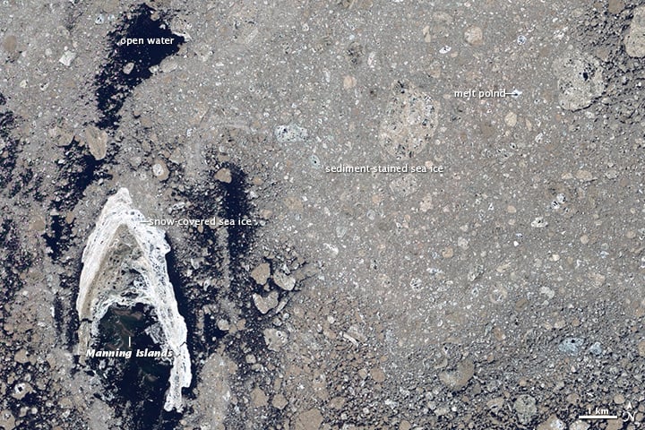
The photo was taken in the summer when the Arctic sea ice begins to melt. According to Kurtz, the picture shows “multiyear sea ice at the end stage of melting” meaning the ice dates back several years. The ice breaks down into smaller fragments which have a muddy brown color as a result of straining from sediment that is dragged up from the seafloor.
The satellite that took the image, NASA’s Earth Observing-1 (EO-1), was launched in November 2000 as part of NASA’s New Millennium Program, which aimed to develop and test advanced technologies for space missions. EO-1 was primarily a technology demonstration mission, designed to test and validate new instruments and approaches for Earth observation that could be used in future satellites. It remained operational far beyond its intended one-year mission, providing valuable data until it was decommissioned in March 2017.
The Starfleet insignia has been spotted in strange locations before, the iconic swoop has twice shown up on Mars: Once in 2019 by NASA’s Mars Reconnaissance Orbiter with William Shatner and Mark Hammill both commenting on it. And it was spotted again in January this year by the Mars Curiosity Rover and was picked up by amateur Martian astronomer Stuart Atkinson.
Image credits: NASA/EO-1