Underwater Autonomous Drones Discover ‘Ghost Ship of the Pacific’
The wreck of the “Ghost Ship of the Pacific” has been found on the Californian ocean bed with the help of underwater autonomous drones.
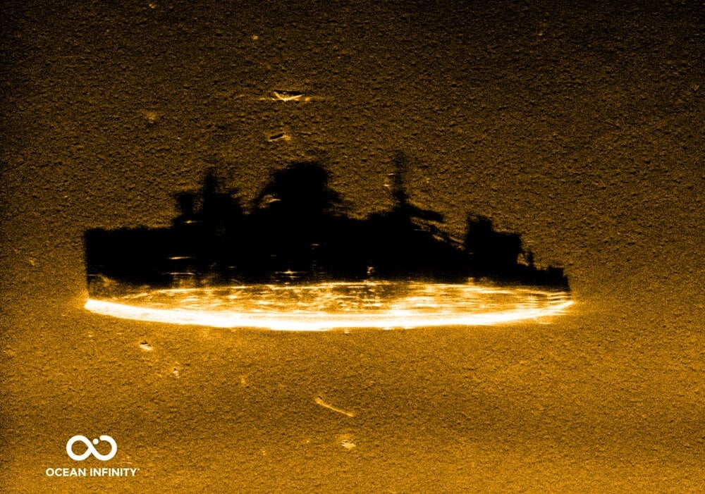
Discovered nearly 3,500 feet below the ocean’s surface using advanced robotic sonar technology, the wreck of the “Ghost Ship of the Pacific” was found off the coast of North California after being lost for 82 years.
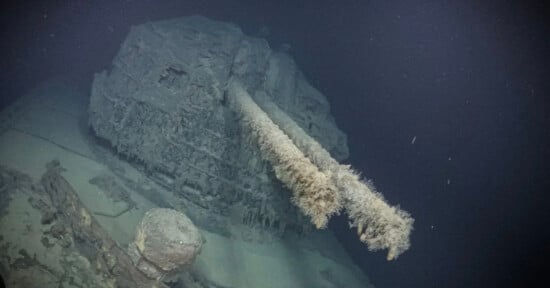
The 314-foot vessel was identified as the USS Stewart (DD-224) — the only U.S. Navy destroyer to be captured by Japanese forces during World War II.
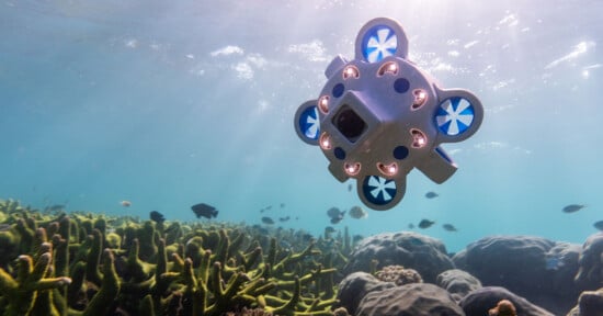
An undersea research team from Ocean Infinity, SEARCH, and the Air/Sea Heritage Foundation made the groundbreaking discovery using state-of-the-art robotic sonar technology.
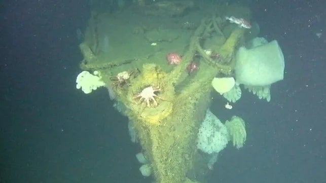
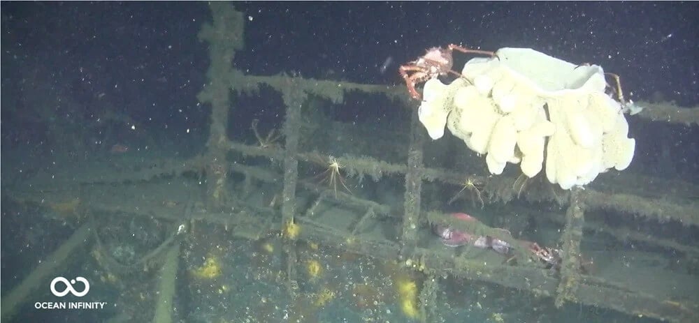
Days after the initial discovery, another team of drones captured images of the wreck, showing it resting upright and appearing “almost perfectly intact,” according to a report in The New York Times.
“This level of preservation is exceptional for a vessel of its age and makes it potentially one of the best-preserved examples of a U.S. Navy ‘four-piper’ destroyer known to exist,” Maria Brown, superintendent of both the Cordell Bank and Greater Farallones national marine sanctuaries, tells the publication.
A team of researchers from the Air Sea Heritage Foundation and Search deployed a fleet of autonomous underwater drones 70 miles off the coast of San Francisco. The drones are used to create high-resolution maps of the seafloor — a major gap in scientist’s understanding of the oceans.
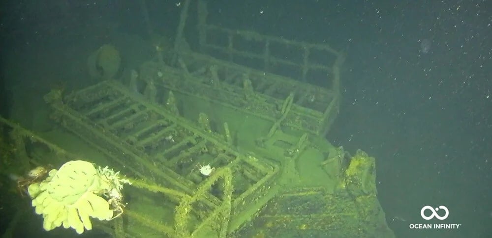
The craft scoured the sea floor, before the drones finally captured a glimpse of the historic sunken wreck. Though shrouded in decades of marine growth, the vessel is reportedly remarkably well-preserved and upright on the seafloor.
Unmanned aquatic drones have changed the game in deep-sea exploration in recent years, with the craft being linked to discoveries of ships like the Endurance, which sank during a 1915 expedition by Ernest Shackleton.
‘We’re in the midst of, I think, a radical change in Ocean discovery,” Senior Vice President, Jim Delgado, of SEARCH Inc, the leading global organization in maritime archaeology, tells The New York Times.
Image credits: All photos by Ocean Infinity.