Solving the Mystery of How and Where an Iconic Civil War Panorama Was Shot
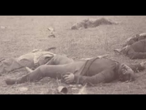
The American Civil War was one of the first significant events in American history to be photographed. While photography was still in its relative infancy as the Union and Confederacy waged violent war from 1861 until 1865, there are thousands of Civil War photographs in the Library of Congress and countless others that are unavailable online or simply lost to time.
Historians, researchers, and 19th-century photographers themselves have done a remarkable job accounting for the people and places that mattered most during the Civil War. However, even still, there are occasional mix-ups. There was no easy way to mark glass plates, and cameras certainly didn’t have the GPS technology of modern mirrorless cameras. Photographers had to keep meticulous notes, but even those most carefully kept aren’t foolproof.
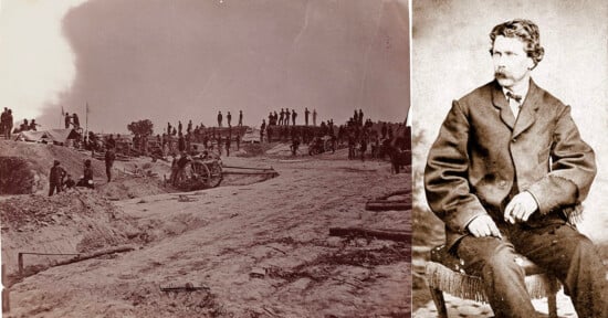
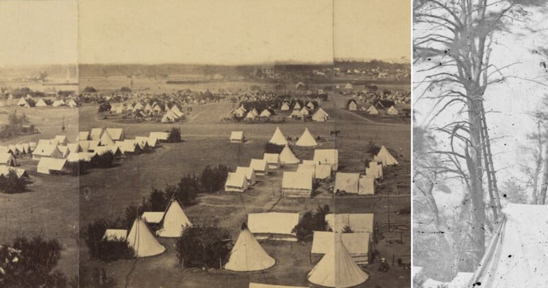
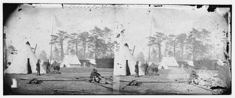
In a YouTube video found by retired photographer and longtime PetaPixel Photography Podcast host, Mike “Sharky” James, the expert Civil War historians at American Battlefield Trust looked at a particularly famous five-plate panoramic image captured at Yorktown Battlefield in Virginia. The photo shows a large encampment erected as part of the Peninsula Campaign of the Civil War in 1862. It was long thought to be shot at an entirely different battlefield, Cumberland Landing, revealing the fragility of history even when there are photographs.
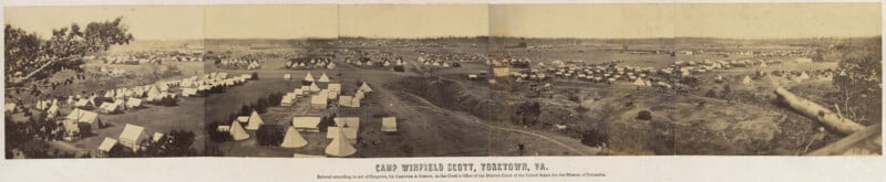
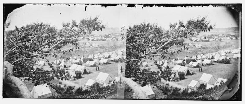
The panorama, which Civil War historian Garry Adelman says may be the largest “single” photograph captured during the Civil War, is a remarkable piece of American history. It’s also interesting because of how it was captured. The photographers, Alexander Gardner and James F. Gibson, captured the requisite plates from up in a tree — talk about commitment to getting the shot. It is a good thing they got a higher vantage, as it helps show the scale and organization of the camp.
A fellow historian sent the panorama to Adelman, explaining that it was shot at Camp Winfield Scott in Yorktown, which is what it says at the bottom of the image. However, Adelman, familiar with Civil War-era photos and documents being mislabeled, thought that couldn’t be right because Gardner’s notes explained that the photos were taken at Cumberland Landing, Virginia. The images that comprise the panorama are also listed as being shot at Cumberland Landing in the Library of Congress, which is about as trustworthy a source as there is.
So, Adelman traveled to Yorktown to tackle this photographic mystery. By piecing together distant buildings in different parts of the background and creating a virtual three-dimensional scene in his mind, Adelman worked his way through the area. As it turns out, the photographers did mislabel the photographs. They were not shot in Cumberland Landing, as long thought, but in Yorktown, some 40 miles away from McClellan’s known camp location at Cumberland Landing in New Kent, Virginia.
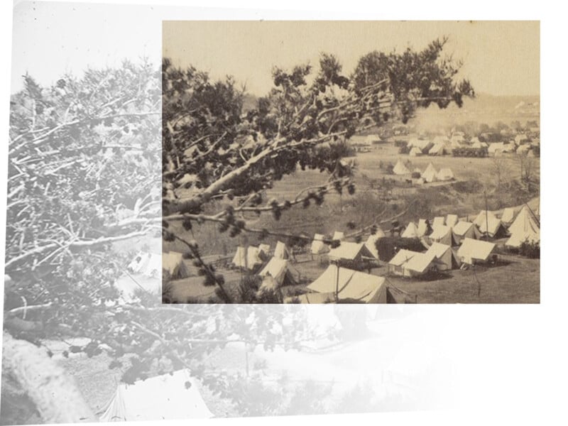
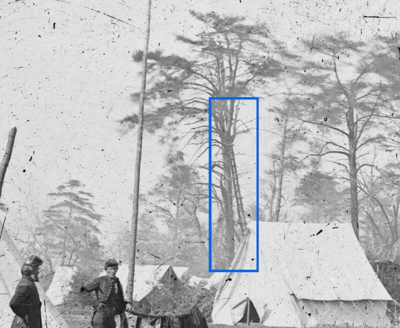
Adelman wasn’t content with determining where the panoramic photo was captured. He wanted to learn more about its fascinating tree-bound creation. Scouring archival photos of Major General George B. McClellan’s headquarters, Adelman found a very tall, rather unsafe-looking ladder in a tree at the edge of an image. This tall ladder was joined by a ramshackle platform and a pulley system that the photographers could use to send photographic plates down to the ground.
Without the dedicated work of historians and photography experts like Adelman, it would have remained an open question about precisely where the famous and beautiful panoramic photo was shot. As Adelman says, photographers during the Civil War were known to make mistakes with captions, sometimes even on purpose for whatever reason. As areas become increasingly developed, certain old buildings and landmarks get taken down or lost to time, and solving these sorts of mysteries will only become more challenging. In some cases, they will, at some point, become impossible to resolve.
Adelman continues to try to solve these historical mysteries. Just last week, he visited a battlefield location known as Minor’s Hill, where John Cummings solved a 154-year-old photo mystery about a decade ago. For history buffs, it is yet another fascinating video.