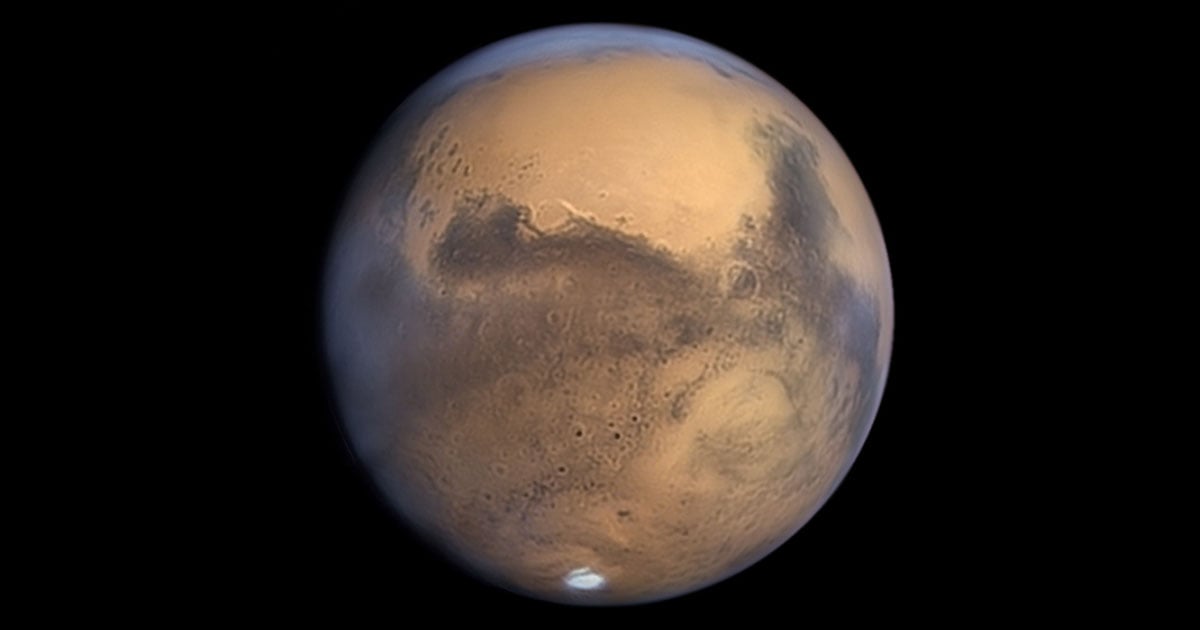
Scientists Have Created a Huge 5.7-Terapixel Global Image of Mars
A group at Caltech’s Bruce Murray Laboratory for Planetary Visualization has unveiled a 5.7-terapixel global image of Mars. The data is freely available to researchers and the public through NASA’s Planetary Data System and allows users to explore Mars in “vivid detail.”
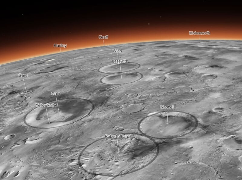
The massive mosaiced image was created at a scale of five meters per pixel and is comprised of more than 110,000 individual images captured by the Context Camera (CTX) aboard NASA’s Mars Reconnaissance Orbiter (MRO). The 5.7 trillion pixel-image covers 99.5 percent of the Martian surface between 88 degrees south and 88 degrees north. The remaining 0.5 percent was either not imaged or available in high enough quality when the mosaic was created.
“The image took six years and tens of thousands of hours of labor to build. If it were printed out at 300 dpi (the standard printing resolution), the resulting image could be used as a sunshade for the Rose Bowl and a significant chunk of the Rose Bowl’s parking lot,” explains Caltech.
“The scale of this is really unprecedented,” adds Jay Dickson, Murray Lab manager and research scientist in image processing. Dickson developed the idea for the project when he was hired to establish the Murray Lab in 2016.
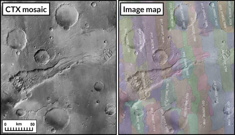
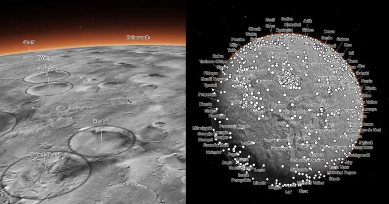
Dickson and his colleagues used an algorithm that identified features of Mars’s surface to align all the images. Overlapping images were blended “by calculating a path of least contrast” between two images and “joining them together like jigsaw puzzle pieces,” Caltech says. Dickson adds that the processing is nondestructive and doesn’t involve blurring lines. Nonetheless, a map of all image boundaries has also been realized, allowing researchers to accurately trace every pixel of the mosaic to its original parent image.
Most of the 110,000 source images were processed and stitched using this algorithm. However, about 13,000 remaining images required hand-stitching, a labor-intensive process that took three years. The problematic images were often partially obscured by dust storms and clouds on Mars, which tripped up the automatic alignment process.
While the new virtual tour of Mars is interesting enough for civilians, it is of particular utility for scientists and researchers.
“Mission data are a gift that keeps on giving. NASA’s research and analysis program allowed us to complete this huge mosaic and make it universally available. I can’t wait to see everything people do with it and the science it enables,” says Bethany Ehlmann, professor of planetary science and associate director of the Keck Institute for Space Studies.
Although scientists have access to more detailed, higher-resolution images of various locations on Mars, this is the first time that a global-scale image has been available at this level of detail. Prior global images were around 100 meters per pixel. The new image “represents a 20-fold increase in resolution in both dimensions of the Martian surface, providing 400 times more information for a given area,” says Caltech.
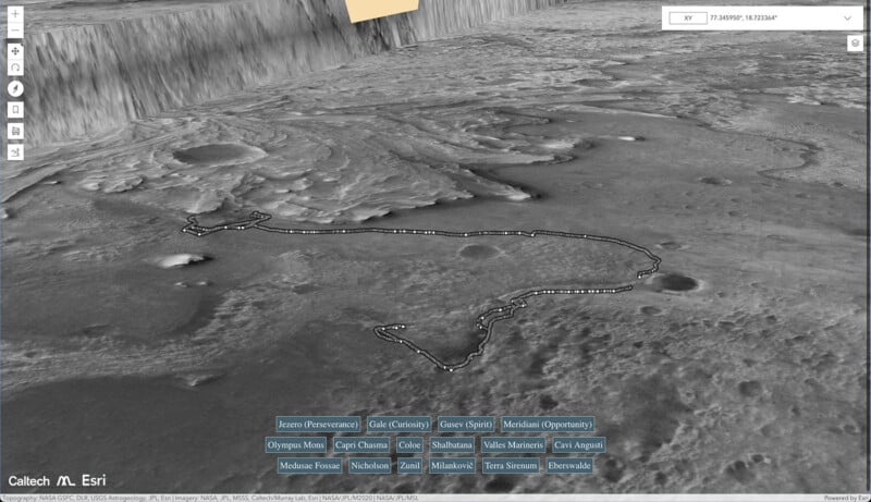
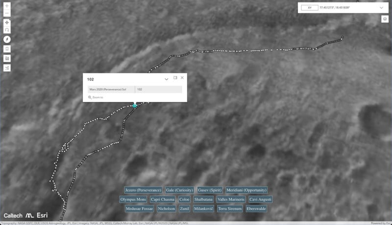
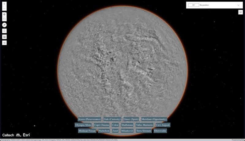
The information included in the mosaic is impressive enough, but the accessibility of the image should be emphasized. Geographic information system company Esri developed the SceneView interface that users access to view the giant image of Mars, and the result is something that anyone can use.
“I wanted something that would be accessible to everyone and without a seam. Schoolchildren can use this now. My mother, who just turned 78, can use this now. The goal is to lower the barriers for people who are interested in exploring Mars,” Dickson says.
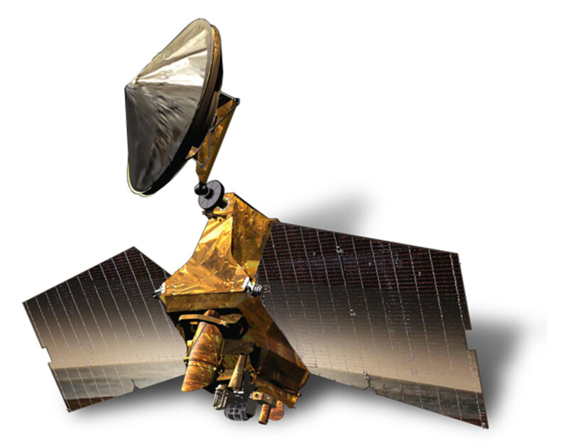
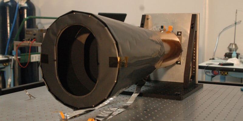
Dickson also points out that while he and his team have spent six years on this project, it’s only possible because of the two decades of work done by the MRO team. The MRO and its Context Camera were built 20 years ago and continue to do impressive work that underpins hundreds, if not thousands, of incredible research projects.
The Global CTX Mosaic of Mars is available for users to explore in extensive detail via a dedicated Caltech website.
Image creditsNASA/JPL-Caltech/MSSS