40 Years of Landsat: Time-Lapse Videos Show Changes to Earth’s Face
Yesterday marked the 40th anniversary of Landsat, the longest-running program focused on acquiring satellite photos of Earth. The Landsat satellite snaps one completely photo of the Earth’s surface every 16 days, and the petabytes of photos collected over the years have given scientists a view into how our planet’s surface has changed over time, whether by natural or human-caused means. Google is currently working to make the photos easily enjoyable by the general public by transforming them into time-lapse videos.
Deforestation of the Amazon
Growth of Las Vegas
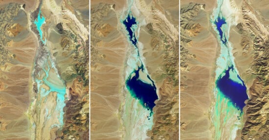
Drying of the Aral Sea
You can dive into the data yourself by visiting Google Earth Engine.
Related Articles
Discussion