Handmade Diorama Maps Created Using Thousands of Printed Photos
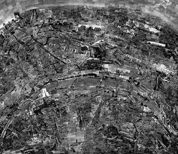
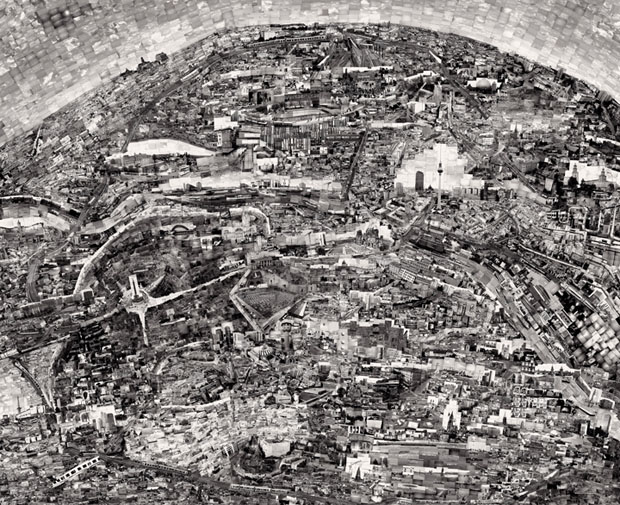
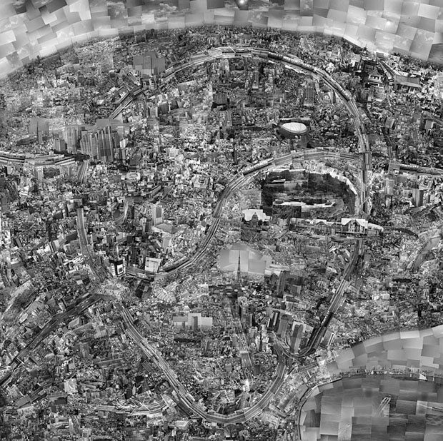
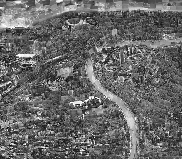
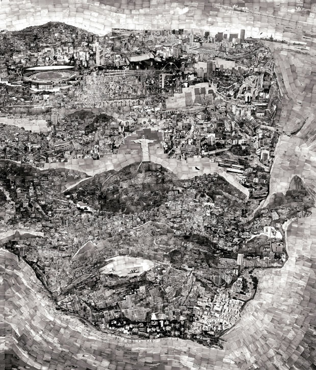
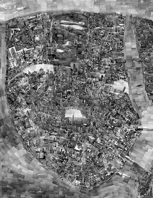
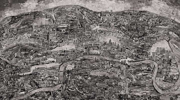
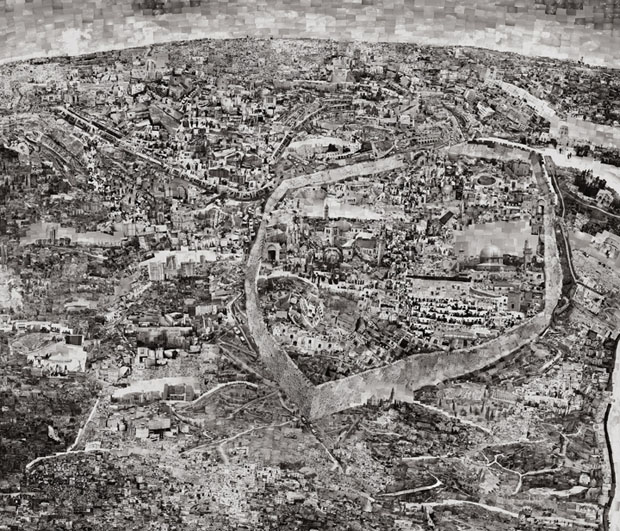
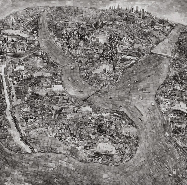
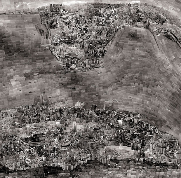
What you see above is a “map” of Paris created by collaging thousands of photographs shot in the city. It’s just one of the amazing pieces in Japanese photographer Sohei Nishino‘s Diorama Map project. The series contains maps of many of the world’s most famous cities, and all of them are photographed and collaged by hand.
Hundreds of rolls of black-and-white film and tens of thousands of photographs later, he develops and prints the film himself in a personal darkroom, brings everything into his studio, and then begins to edit them. He selects thousands of photographs that are representative of what he would like to show, and then sets to work creating a collage.
Using a sketch of the city’s layout on a giant white canvas, he spends months cutting photographs and gluing them onto the map in the locations they belong. The maps are not meant to be accurate recreations of exactly what a city looks like from above, but are instead more representative of his personal memory and experiences.
The process is tedious, but Nishino still manages to produce them at a rate of about three per year.
Here are some of the diorama maps he has created so far:
Here are a couple of time-lapse videos showing Nishino creating one of his diorama maps:
You can see more diorama maps and more of Nishino’s work over on his website.
Diorama Maps by Sohei Nishino (via POTB)
Image credits: Photographs by Sohei Nishino and used with permission