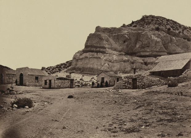
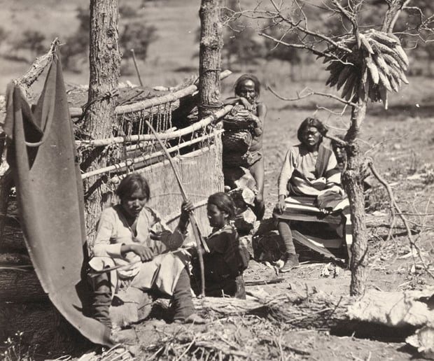
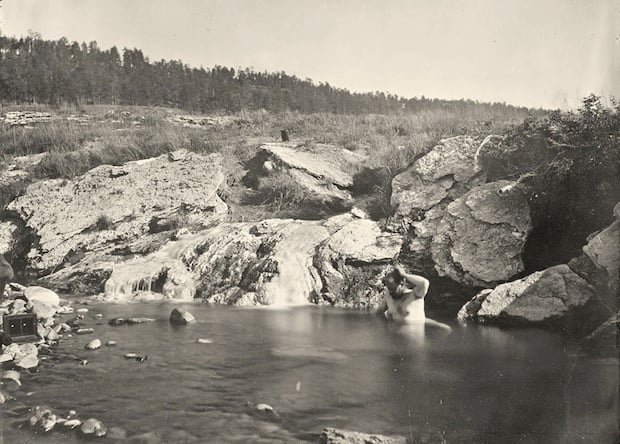
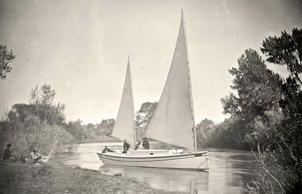
Amazing 19th Century Photographs of the American West by Timothy O’Sullivan

osullivan5

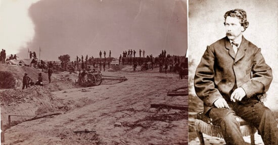
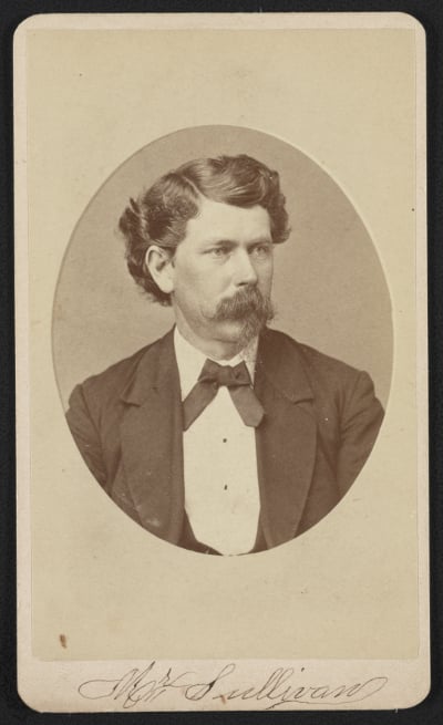
Photographer Timothy H. O’Sullivan is perhaps best known for his photos of the Civil War, which include his famous “Harvest of Death” photo. But after covering the war, O’Sullivan decided to strike out West, and when he came back, he brought with him some of the earliest photos of the (quite literally) “wild” American West.

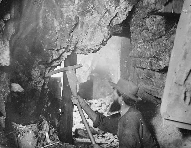
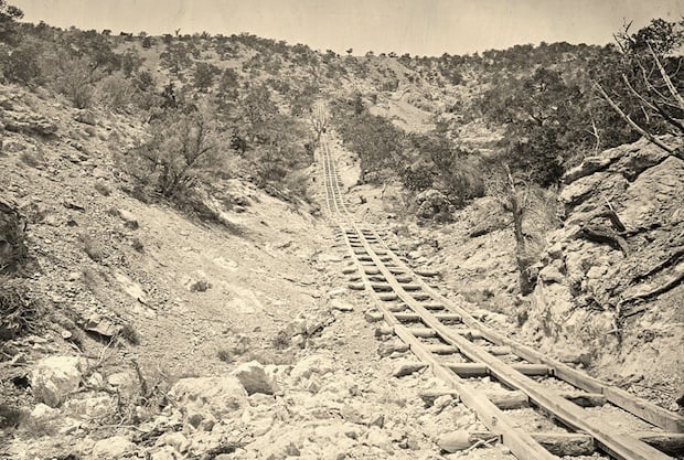
O’Sullivan’s explorations of the American West were done as part of different US Government-funded expeditions. Between 1867 and 1869, he was part of the Geological Exploration of the Fortieth Parallel led by Clarence King.

Afterwards, in 1870, he joined a survey team in Panama to survey for a canal across the isthmus, and then spent 1871 to 1874 in the southwestern United States, surveying west of the 100th meridian West under Lt. George M. Wheeler.

osullivanportrait

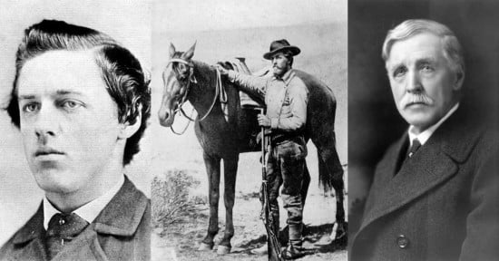
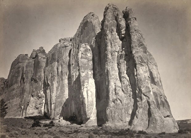
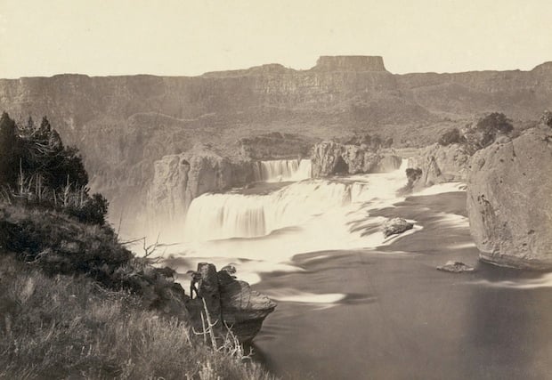
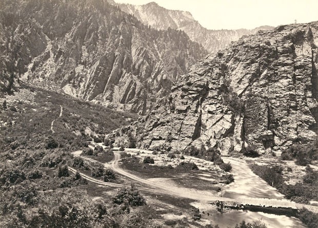
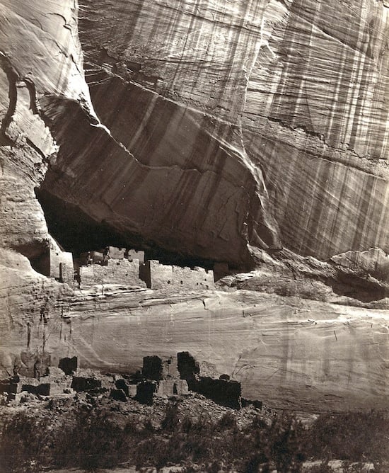
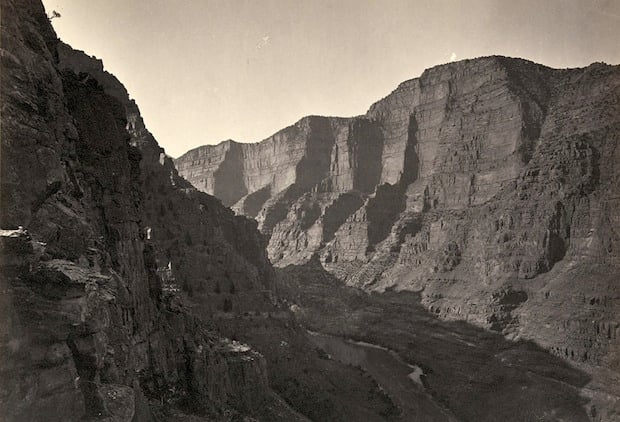
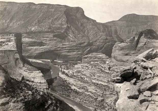
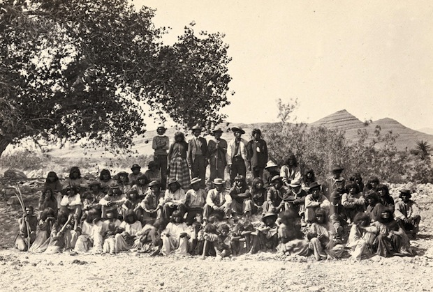
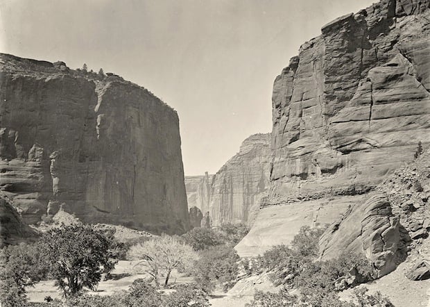
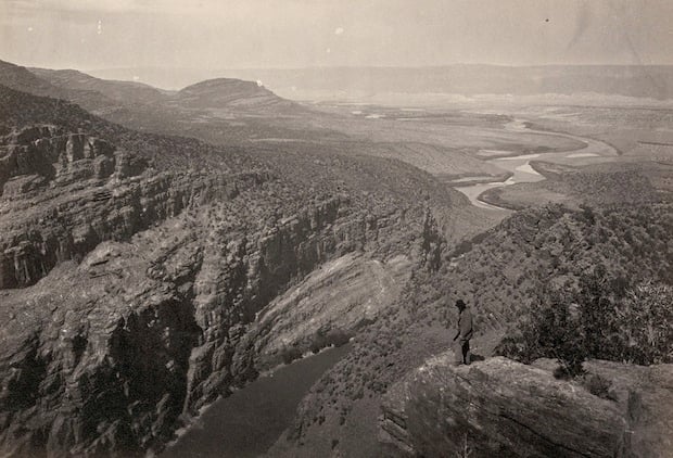
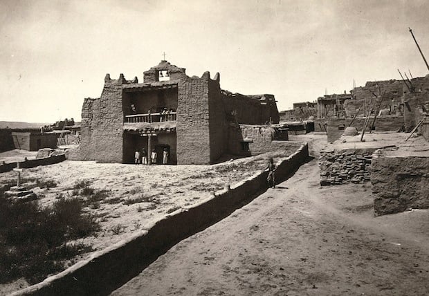
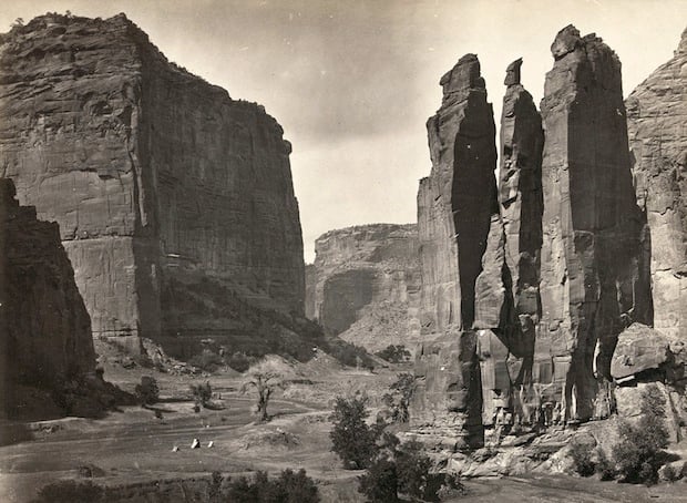
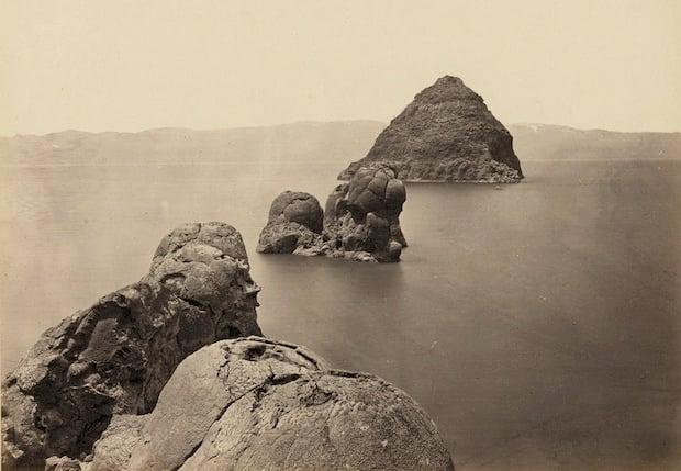
O’Sullivan was one of the first to document the prehistoric ruins and pueblo villages of the Southwest. His photographic eye beautifully captured vast landscapes and settlements, and the photos he brought back are said to have influenced the likes of Ansel Adams.

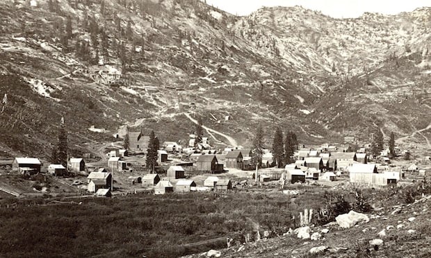
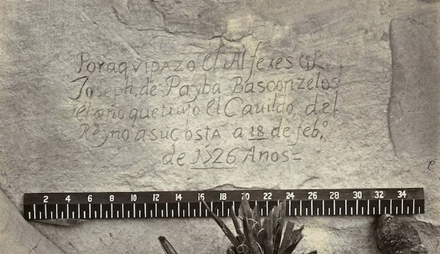
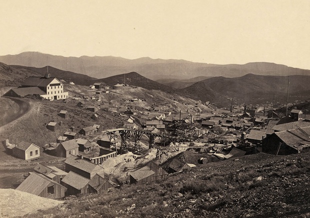
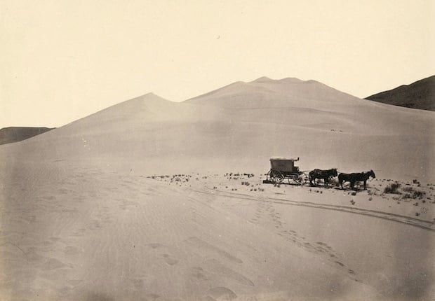
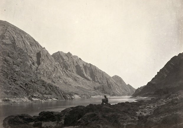
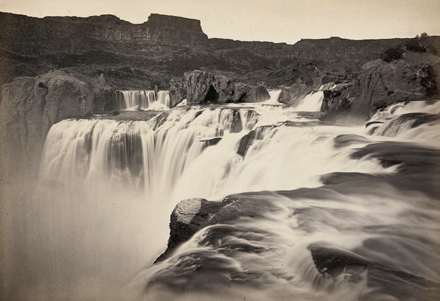
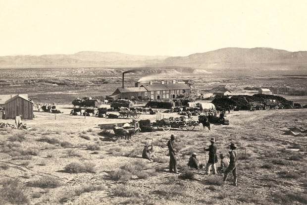
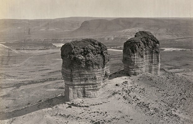
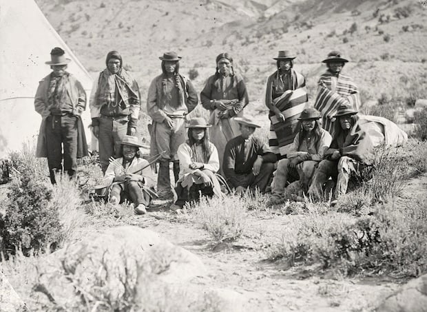
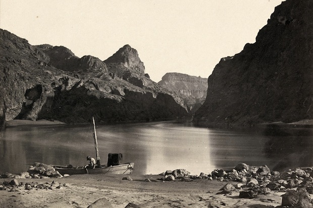
Fortunately, thanks to the Library of Congress, we have access to many of these photos. Over 1,150 images of his are found on the Library’s website (complete with captions), some 295 of which feature the American West. Here’s a small selection of those photos:

The south side of Inscription Rock (now El Morro National Monument), in New Mexico. Taken in 1873
Shoshone Falls, near present-day Twin Falls, Idaho. Taken in 1868.
Big Cottonwood Canyon, Utah. Taken in 1868.
Water Rhyolites, near Logan Springs, Nevada. Taken in 1871.
Aboriginal life among the Navajo Indians. Taken near old Fort Defiance, New Mexico, in 1873.
Man bathing in Pagosa Hot Spring, Colorado. Taken in 1874.
The "Nettie," an expedition boat on the Truckee River in western Nevada. Taken in 1867.
The “Nettie,” an expedition boat on the Truckee River in western Nevada. Taken in 1867.
View of the White House, Ancestral Pueblo Native American (Anasazi) ruins in Canyon de Chelly, Arizona. Taken in 1873.
The Canyon of Lodore in Colorado. Taken in 1872.
A close-up view of a Spanish inscription carved into the sandstone at Inscription Rock  in New Mexico in 1726. Translation:
A close-up view of a Spanish inscription carved into the sandstone at Inscription Rock in New Mexico in 1726. Translation: “By this place passed Ensign Don Joseph de Payba Basconzelos, in the year in which he held the Council of the Kingdom at his expense, on the 18th of February, in the year 1726.”
The junction of the Green and Yampah Canyons in Utah. Taken in 1872.
Native American (Paiute) men, women and children posing under a tree near Cottonwood Springs (Washoe County), Nevada. Taken in 1875.
The head of Canyon de Chelly in Arizona. Taken in 1873.
Miner working nine hundred feet underground at the Savage and the Gould and Curry mines on the Comstock Lode in Virginia City, Nevada. Taken in 1867.
A wooden balanced incline used for gold mining. Taken at the Illinois Mine in the Pahranagat Mining District in Nevada in 1871.
The mining town of Gold Hill, just south of Virginia City, Nevada. Taken in 1867.
Timothy O'Sullivan's darkroom wagon, pulled by four mules. Taken in the Carson Sink part of Nevada's Carson Desert in 1867.
Timothy O’Sullivan’s darkroom wagon, pulled by four mules. Taken in the Carson Sink part of Nevada’s Carson Desert in 1867.
Man sitting on a rocky shore beside the Colorado River in Iceberg Canyon, on the border of Mojave County, Arizona and Clark County, Nevada. Taken in 1871.
The view across Shoshone Falls, Snake River, Idaho. Taken in 1874.
Browns Park, Colorado. Taken in 1872.
Old Mission Church, Zuni Pueblo, New Mexico. Taken in 1873.
"Camp Beauty," rock towers and canyon walls in the Canyon de Chelly National Monument, Arizona. Taken in 1873.
“Camp Beauty,” rock towers and canyon walls in the Canyon de Chelly National Monument, Arizona. Taken in 1873.
The Pyramid and Domes, a line of dome-shaped tufa rocks in Pyramid Lake, Nevada. Taken in 1867.
Members of Clarence King's Fortieth Parallel Survey team, near Oreana, Nevada. Taken in 1867.
Members of Clarence King’s Fortieth Parallel Survey team, near Oreana, Nevada. Taken in 1867.
Twin buttes near Green River City, Wyoming. Taken in 1872.
Pah-Ute (Paiute) Indian group, near Cedar, Utah. Taken in 1872.
Man in a wooden boat on the edge of the Colorado River in the Black Canyon, Mojave County, Arizona. Taken in 1871.

Sadly, O’Sullivan lived a short life, dying of Tuberculosis in 1882 at the age of 42, shortly after returning from the southwest. The final years of his life were spent in Washington, D.C. as the official photographer of the U.S. Geological Survey and the Treasury Department.

To see the full breadth of his work, head over to the Library of Congress website by clicking here.

(via The Atlantic via MetaFilter)


Image credits: Photographs by Timothy O’Sullivan, courtesy of the Library of Congress

Discussion