This 3D Map Shows Where You Can Hike to in Any Given Amount of Time
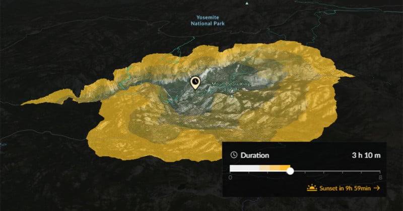
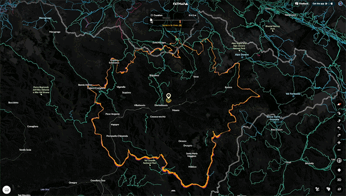
If you’re a photographer who often hikes in the great outdoors, the mapping service FATMAP has added a new feature that you may find useful. It’s called the Travel Distance layer, and it shows on a 3D map exactly where you’ll be able to hike to in any given amount of time.
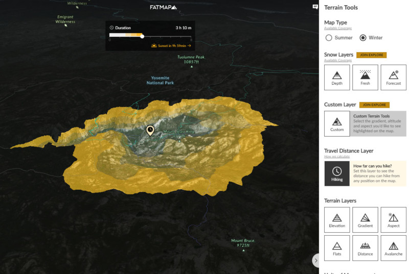
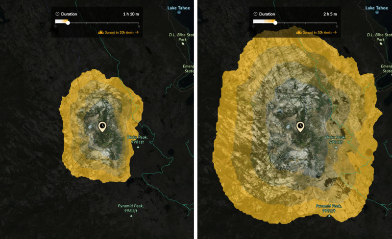
Simply access the Travel Distance Layer within the app’s Terrain Tools, choose a starting point and set a time duration, and the layer will use a color-coded area indicating everywhere you can reach within that time.
Dragging the duration slider will adjust the area in real-time.
You’ll also have a visual guide to when and where sunset or sunrise will be during your hike based on your starting location.
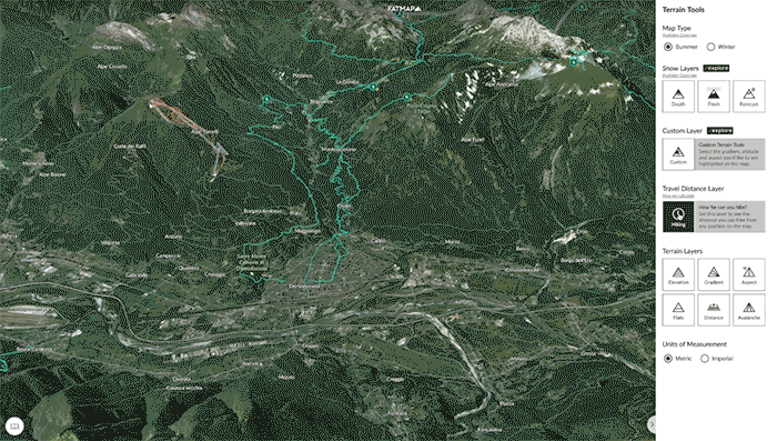
This feature is the latest to be added to FATMAP’s Web and mobile apps that can benefit photographers, joining things like snow layers, elevations, route planning, offline usage, and more.
You can start using FATMAP through your browser here or download the mobile app for iOS or Android. The app and nearly all functions are free, but subscribing to the Explore membership gets you a number of benefits (e.g. membership card, discounts, and some of the locked app features such as offline map downloads).