You Can Now Preview Google Maps Routes With AI-Powered Immersion
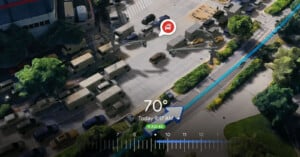
At the annual Google I/O keynote, Google announced numerous updates to Google Maps, including a new Immersive View for routes.
At the annual Google I/O keynote, Google announced numerous updates to Google Maps, including a new Immersive View for routes.
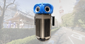
Google Street View is celebrating its 15th birthday by unveiling a brand new compact and lightweight camera system. This new camera weighs less than half of the current Google Street View cameras and is more customizable.
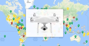
Obeying local law when flying your drone is paramount, but those laws vary from country to country – with some not allowing drones in at all. To help with planning, blogger and frequent traveler Anil Polat has created a map of the world with the laws of each country.

Remember Instagram's Photo Maps? No worries, neither did we until we found out today that, shockingly enough, Instagram has decided to kill off a feature they say "was not widely used."
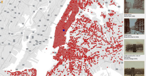
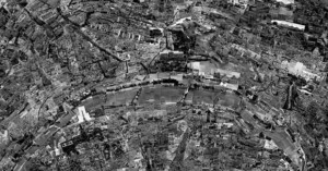
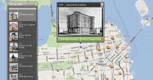
OldSF and OldNYC are two websites created by software engineer Dan Vanderkam, who gathered tens of thousands of historical photos of San Francisco and New York City and plotted them on city maps.
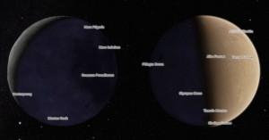
In honor of the Mars Curiosity Rover celebrating its second year on the martian surface, Google has released an incredible little resource into Google Maps. Now, you will be able to more thoroughly explore the surface of the moon and Mars than has ever been capable before. All from the confines of your seat.
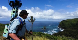
Google has had no issues expanding street view to some pretty amazing places. Thanks in large part to the company's trekker backpacks, we can now visit the Grand Canyon, explore Central Park and check out the view from the world's tallest peaks.
But the company isn't above asking others to help expand the "off-road" street view repertoire, and so Google is announcing plans to loan out those expensive Trekkers to worthy third party organizations.
What you see above is a "map" of Paris created by collaging thousands of photographs shot in the city. It's just one of the amazing pieces in Japanese photographer Sohei Nishino's Diorama Map project. The series contains maps of many of the world's most famous cities, and all of them are photographed and collaged by hand.
What are the most popular photo subjects in each location of your city? Is there any easy way of finding out? Those are questions UC Berkeley researcher Alexander Dunkel is trying to answer, and he has his sights set on Flickr as a possible solution. By combining the location geotags and context tags attached to many (or most) of the service's photos, Dunkel is able to create tag cloud-style maps of any location that reveals the tags that dominate each location.
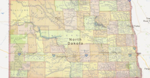
A decade ago, photographer Andrew Filer obtained the most detailed map of North Dakota he could find, and began a project of documenting the towns on it. Not just some of the towns, but every single named dot on the map. After years of dedicated work, Filer succeeded in photographing the entire state. He ended up visiting over 850 different locations and snapping 9,308 photographs.
Flickr announced today that it has partnered with Nokia to overhaul its geotagging …
Curious about where people like to take pictures in your part of the world? …
Google Street View is neat in that it allows you to step into …
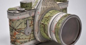
Artist Jennifer Collier uses found and recycled paper as if it were fabric to recreate common household objects, including cameras! Here are a few that were made using maps, postcards, and letters.
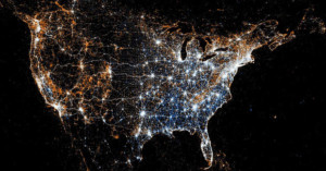
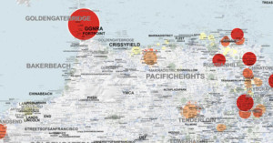
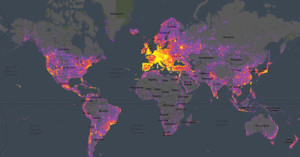
Last year map geek Eric Fischer created heat maps showing where Flickr photos are taken in large cities and comparing tourist vs. local hotspots. Now he's back again with beautiful maps showing geotagged Flickr photos and Twitter Tweets, and the maps aren't limited to cities -- there's maps for continents (see North America above) and even the whole world! The orange dots show photos, the blue ones indicate Tweets, and a white one means both were found in that location.
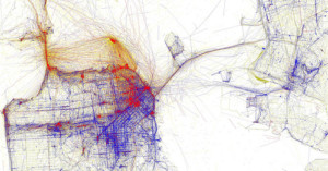
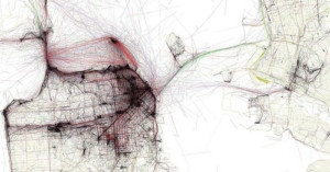
Two weeks ago we posted on the Geotaggers' World Atlas, a project by Eric Fischer that shows heat maps of where photographs are taken in big cities, created using geolocation data from Flickr and Picasa photos.
Fischer now has a new set of maps called Locals and Tourists that distinguish between photos taken by inhabitants of the city and others who are simply passing through.
Some people interpreted the Geotaggers' World Atlas maps to be maps of tourism. This set is an attempt to figure out if that is really true. Some cities (for example Las Vegas and Venice) do seem to be photographed almost entirely by tourists. Others seem to have many pictures taken in piaces that tourists don't visit.
Blue points are locals (determined by whether the person has a history of photographing in that city), red points are tourists, and yellow points indicate photos for which it cannot be determined.
San Francisco
The Geotaggers’ World Atlas is an interesting series of images by …