Geotaggers’ World Atlas: Photo Spots Reveal the Most Interesting Places on Earth
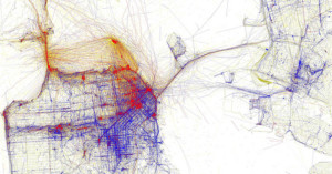
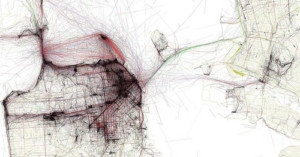
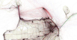
It was five years ago that we first covered Eric Fischer's Geotaggers' World Atlas project. His goal was to gain insight into the world's most interesting places and routes by gathering vast amounts of geotag data from Flickr photos.