Explore 75 Miles of Grand Canyon Trails and Roads With Google Street View
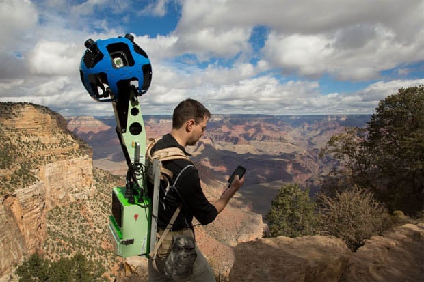
Back in October, Google took several Trekker Street View backpacks into the Grand Canyon to capture the majestic beauty of the national park for those who can’t actually go there. Several months have gone by since that point, but finally, the cubicle-bound and financially unable among us can now visit the Grand Canyon from the comfort of our own desktops.
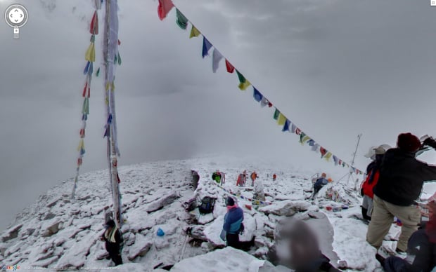
The video above offers a short introduction to the expansion that came alongside an article on Google’s Lat Long blog. Using Google Maps, you can now explore some 75 miles worth of roads and trails in and around the Grand Canyon. And, as usual, all of the pictures offer 360-degrees of visibility, so you won’t miss a thing.
The only limitation is that you’ll have to be satisfied with seeing the Grand Canyon in October, since that’s when the pictures were taken. But it looks like they picked one heck of a day; every trail, from the Bright Angel to the South Kaibab were shot under beautiful blue skies.
(via Laughing Squid)